Mount Arrowsmith
Mount Arrowsmith is the highest mountain south of Port Alberni on Vancouver Island. Its dominant rock is basalt. The mountain is contained within the Mount Arrowsmith Biosphere Region and as of September 18, 2009 is designated part of 1,300 ha (3,200 acres) hectare Mt. Arrowsmith Massif Regional Park.
| Mount Arrowsmith | |
|---|---|
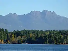 Mount Arrowsmith from Sproat Lake | |
| Highest point | |
| Elevation | 1,819 m (5,968 ft) [1] |
| Prominence | 1,429 m (4,688 ft) [1] |
| Coordinates | 49°13′25″N 124°35′40″W [1] |
| Geography | |
 Mount Arrowsmith | |
| Topo map | NTS 92F/02 |
| Climbing | |
| First ascent | John Macoun 1887 |
| Easiest route | scramble |
History
The first recorded ascent was made by botanist John Macoun in 1887. Macoun was a botanist to the Geological Survey of Canada. Mount Waddington was first seen from the peak of Mount Arrowsmith by Don and Phyllis Munday in 1925 (see also Mount Munday). The mountain was named about 1853 by Captain Richards for cartographers, Aaron Arrowsmith and his nephew John Arrowsmith.[2][3]:9
The mountain was known as "Kulth-ka-choolth", meaning "jagged face", in the Coast Salish language.[4]
Biogeoclimatic Zones
Mount Arrowsmith has three main biogeoclimatic zones. On the windward, wetter west-facing slopes the Coastal Western Hemlock zone occurs up to 1,050 m (3,440 ft), where it grades into the Mountain Hemlock zone. This forms a continuous forest up to 1,300 m (4,270 ft); above is a parkland phase which grades into the Alpine Tundra zone at 1,600 m (5,250 ft). The leeward, east-facing slopes are warmer thanks to more sunshine, and all zone boundaries are higher by 50 m (160 ft).[5]
References
- "Mount Arrowsmith". Bivouac.com. Retrieved 2006-06-05.
- Walbran, Captain John T. (1909). British Columbia coast names, 1592-1906 : to which are added a few names in adjacent United States territory, their origin and history. Ottawa: Geographic Board of Canada. ISBN 0-88894-143-9. Archived from the original on 3 March 2016. Retrieved 2 March 2016.
- Akrigg, G.P.V.; Akrigg, Helen B. (1986), British Columbia Place Names (3rd, 1997 ed.), Vancouver: UBC Press, ISBN 0-7748-0636-2
- "Mount Arrowsmith". BC Geographical Names. Retrieved 2010-02-20.
- R.N. Green and K. Klinka (1994). A Field Guide to Site Identification and Interpretation for the Vancouver Forest Region, p. 36
External links
| Wikimedia Commons has media related to Mount Arrowsmith. |