Mount Kitanglad
Mount Kitanglad is an inactive volcano[9] located in the Kitanglad Mountain Range in Bukidnon province on Mindanao island. It is the fourth highest mountain in the Philippines and has an approximate height of 2,899 metres (9,511 ft).[Note 1] It is located between Malaybalay City and the municipalities of Lantapan, Impasugong, Sumilao, and Libona. It is home to one of the Philippines' few remaining rainforests.[10]
| Mount Kitanglad | |
|---|---|
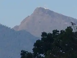
 Mt. Kitanglad viewed from Impasug-ong, Bukidnon | |
| Highest point | |
| Elevation | 2,899 m (9,511 ft) [Note 1] |
| Prominence | 350 m (1,150 ft) |
| Coordinates | 8°8′34″N 124°54′45″E |
| Geography | |
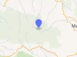
.svg.png.webp) Mount Kitanglad .svg.png.webp) Mount Kitanglad | |
| Country | Philippines |
| Region | Northern Mindanao |
| Province | Bukidnon |
| Parent range | Kitanglad Mountain Range |
| Climbing | |
| Easiest route | Intavas, La Fortuna, Impasug-ong, Bukidnon |

| |
The name "Kitanglad" was derived from a legend that there was once a great flood that submerged the native lands of Bukidnon and only the tip of the mountain, the size of a "tanglad" (lemon grass), remained visible ("kita" in Visayan). It is considered as an ancestral domain of several old cultural communities like the Bukidnons, Higaonons and Talaandigs.
Mount Kitanglad was proclaimed a protected area under the natural park category through Presidential Proclamation 896 dated October 24, 1996.[11] On November 9, 2000, Mount Kitanglad finally became a full-fledged protected area when Congress approved Republic Act 8978 also known as the "Mt. Kitanglad Range Protected Area Act of 2000."[12]
In 2009, Mount Kitanglad Range Natural Park (MKRNP) was declared as an ASEAN Heritage Park.[13]
Mount Kitanglad is recognized for its cultural and biological diversity. It is part of the ancestral domain of three major indigenous groups: the Talaandig, Higaonon, and Bukidnon peoples.[14]
Mount Kitanglad hosts over 600 rare and endemic species, including the Philippine tarsier and the Rafflesia schadenbergiana, the world's second largest flower.[14] It is a nesting place for the critically endangered Philippine eagle.[15] Other endemic species that are found here are the pygmy fruit bat Alionycteris paucidentata and two native mice, Crunomys suncoides and Limonmys bryophilus.[10]
Indigenous communities are working to have Mount Kitanglad recognized as indigenous peoples' and community conserved territories and areas to enforce indigenous customary rules on the mountain range.[16]
See also
Notes
- Elevation information varies between sources. Several sources evaluated as very reliable for this information give the elevation of Mount Kitanglad as 2,899 m.[1][2][3] Several sources evaluated as less reliable for this information list a mountain named "Mount Katanglad" (spelled with "Ka" instead of "Ki") with an elevation of 2,938 m.[4][5][6] Information gathered from the more reliable sources mentioned previously suggests that the elevation information in these sources is in error for Mount Kitanglad, and may refer to the nearby peak of Mount Dulang-dulang. Since the discovery of this error, Peakbagger (a site previously in error over the confusion between the two peaks) now has a verified page for "Mount Dulang-dulang",[7] confirming the above information for that peak. Additionally, Peakbagger now also has a page for "Mt. Kitanglad" (with the correct spelling with an "i" and the corrected elevation data)[8] explaining the mistake, though the Kitanglad page does contain a disclaimer stating its information is currently unverified.
References
- "Mt. Kitanglad (2,899+)" PinoyMountaineer.com. Retrieved 2012-03-11.
- A. Townsend Peterson; Thomas Brooks; Anita Gamauf; Juan Carlos T. Gonzalez; Neil Aldrin D. Mallari; Guy Dutson; Sarah E. Bush; Dale H. Clayton & Renato Fernandez (2008). "The Avifauna of Mt. Kitanglad, Bukidnon Province, Mindanao, Philippines" (PDF). Fieldiana Zoology. Field Museum of Natural History (114): 1–43 [2]. Archived from the original (PDF) on 2009-09-02. Retrieved 2012-03-13.
- Agnes C. Rola, Antonio T. Sumbalan & Vellorimo J. Suminguit (2004). Realities of the Watershed Management Approach: The Manupali Watershed Experience (PDF). Discussion Paper Series No. 2004-23. Philippine Institute for Development Studies. p. 4 (note 6).
- "Mount Katanglad". Peakery.com. Archived from the original on 2011-11-23. Retrieved 2012-03-13.
- "Mount Katanglad, Philippines". Peakbagger.com. Retrieved 2012-03-13.
- "PHILIPPINES MOUNTAINS : 29 Mountain Summits with Prominence of 1,500 meters or greater". Peaklist.org. Retrieved 2012-03-13.
- "Mount Dulang-dulang, Philippines" Peakagger.com. Retrieved 2014-04-25.
- "Mt. Kitanglad" Peakbagger.com. Retrieved 2013-09-29.
- PHIVOLCS' List of Inactive Volcanoes Archived 2008-05-15 at the Wayback Machine
- "The spirits, flora, fauna thrive in Mount Kitanglad". MindaNews. 2010-12-15. Retrieved 2020-06-21.
- "Proclamation No. 896, s. 1996". Official Gazette of the Republic of the Philippines. Archived from the original on 8 March 2019. Retrieved 8 March 2019.
- "R.A. No. 8978: An Act Declaring the Mt. Kitanglad Range in the Province of Bukidnon as a Protected Area and its Peripheral Areas as Buffer Zones, Providing for its Management and for Other Purposes". The Corpus Juris. 9 November 2000. Archived from the original on 2 August 2018. Retrieved 8 March 2019.
- De Vera, Ellalyn B. (2 November 2009). "Mount Kitanglad named an ASEAN Heritage Park". Manila Bulletin. Retrieved 29 April 2010.
- "Mount Kitanglad Range Natural Park". Forest Management Bureau.
- Panlilio, Cai (2013-10-07). "Tribal folk guard sacred Mount Kitanglad". Philippine Daily Inquirer. Retrieved 2020-06-21.
- "Proclamation of Mt. Kitanglad (The Philippines) as an ICCA". ICCA Consortium. 2013-09-05. Retrieved 2020-06-21.
Further reading
- Maria Easterluna Luz S. Canoy and Vellorimo J. Suminguit (2001). The Indigenous Peoples of Mt. Kitanglad Range Natural Park (PDF). 2001 Report. Social Watch-Philippines. p. 63.
External links
| Wikimedia Commons has media related to Mount Kitanglad. |
