Mountainous Shirvan economic region
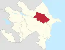
The Mountainous Shirvan economic Region is one of many economic areas in Azerbaijan. The region includes the Agsu, Ismaili, Gobustan, and the Shamakhi regional administrative districts.[1] This region consists of four cities, four districts and eight settlements consisting of 106 territorial districts, and 275 settlements. The region is located in the Southeast of the Greater Caucasus Mountain Range. The area (6,130 km²) comprises 7% of Azerbaijan. As of 2015 the population was 304,000 people, or 3.2% of Azerbaijan's total population. The population density of the economic region is 50 people/km².
Geography
Most of the area is mountainous, and it shares borders with the Aran economic region in the south, the Sheki-Zaqatala[2] in the northwest, the Guba-Khachmaz in the northeast, and the Absheron economic regions in the east.[3][4] Azerbaijan has a wide variety of flora and fauna. Within the territory of the Republic, there are around 4,100 species of vegetation.
The climate is semi-desert and a dry slope (Gobustan) mild warm climate with dry summers (Gurjivan '* Shamakhi - Maraza plateau), moderate warm climate with dry winters (the areas with 1000 - 1200 m altitudes in the North - Eastern slopes of Great Caucasus Mountains), temperate climate with equal distribution of precipitations during the year (the Northern part of Ismaili region and North - Western part of Shamakhi) and mountain tundra climate (Babadag peak zone over 3000 m altitude).[5]
Economy
Manufacturing
The region houses small manufacturing industry including carpet weaving, container producers, timber and building materials processors and agricultural machinery repair. Its agricultural industries include butter and cheese production, canneries, wine making and fruit enterprises.
From 2004 to 2008, more than 250 enterprises were started in the zone, creating close to 19,000 new jobs. Since 2009, the number of industrial enterprises has increased from 39 to 44.[6]
In 2016, under the framework of a program for providing concessional loans to entrepreneurs in Azerbaijan, 30 subjects in the zone received preferential loans totaling 262,000 manat.[7][8]
| 2010 | 2012 | 2013 | 2014 | 2015 | 2016 | |
| Number of operating enterprises | 39 | 40 | 40 | 39 | 44 | 44 |
| Industrial products (thousand azn) | 10265 | 13234 | 20382 | 18672 | 17140 | 19631 |
| Specific weight of non-public sector in industrial product | 19.3 | 40.8 | 46.6 | 51.2 | 44.2 | 40.2 |
| Average number of workers | 1564 | 1826 | 1955 | 2054 | 2002 | 2249 |
| Average salary | 195.1 | 231 | 279.6 | 297.1 | 308.9 | 319.3 |
Agriculture
Agriculture in Azerbaijan includes crop production and animal husbandry. Development priority is given to grain, cotton, vegetables, potatoes, fruits, viticulture, tobacco, livestock breeding, poultry farming and horse breeding. In 2008, crop production accounted for 63.1% of agricultural produce, while livestock production accounted for 36.9%. Between 1995 and 2008, the share of crop production increased by 4.5%, and equally, the proportion of livestock fell by 4.5%.[9]
Branches of agriculture include: viticulture, wine-making, livestock and grain production. Potatoes are grown in the mountainous regions, and cotton is grown in the plains. Beekeeping, sericulture, gardening, and growing vegetables and fruits are well developed. The area under grape cultivation is 10,324 hectares. The number of livestock reached 729,949 in 2018. Lack of fresh water is a problem.
Transport
The Baku-Tbilisi railway eases access to CIS countries. The Baku-Gazakh highway passes through the Mountainous Shirvan region and connects the capital of the country with eastern regions. Generally, the transport system both intrinsically and interregional is not well-developed in the region of Mountainous Shirvan. Reconstruction of the highways in the region is intended to achieve progress in the connection of the East and the West parts. Baku-Shamakhi part of the highway reconstructed. In accordance with the project relating to the organizing transport system, Baku-Gobustan-Shamakhi round way is renewing. Relating to the State Program on the development of the regions transport system takes into account.
The overall length of the highways in the region is 1989 kilometers long. There are both interregional and intrinsically important roads respectively, 33.1 % and 66.9 %.
There was established a regional organization in order to regulate the auto-transport system in Shamakhi district. The transport system has been improved after the establishment of the regional organization. For instance, roads were reconstructed in Agsu district and a number of new roads were established between routes such as Baku-Shamakhi-Yevlakh, Agsu-Khanbulag-Nydu, Zargova, Padar-Rahimli-Arabsarvan, Chaparli-Cafarli, Sangalan, Dilman-Xatman, Bozavand, Muganli-Ismayilli, Garamaryam-Ismayilli-Shaki, Basgal-Sulut, Sardahar-Tircan, Garaybayli-Gubakhalilli, Nasimi-Gonagkend, Shamakhi-Zarat-Kheybari, Churyurd-Qizmeydan-Piribayli, Rasadkhana-Avakhil, and Shamakhi-Chol-Goylar. In order to improve transport infrastructure in the region bridges and protective dams were established. Protective dams like Girdiman (220 meters) river and Lahic (550 meters) settlement are some of them. However, there was an established subway between Padar station and Chol-Koyler village in order to improve winery and vine-growing in the region.[10]
Communication
The communication system is launched in accordance with the up-to-date communication services in the region. During this way, financial services were provided in villages via AzerPocht Platform. Intercommunication in the post web is implemented on the base of the satellite platform. Low connection places like villages there are used satellite inventories. In accordance with the statistics, there are 56 phones for a hundred families in the region. The main parts of them are in the cities and the lower amount in the villages respectively, 82 units and 45 units.[8]
Education
Secondary schools and branches of higher education institutions (Shamakhi branch of the State Pedagogical University and the University of Odlar Yurdu), as well as cultural institutions are present. Educational facilities, as well as cultural institutions are focused in the Parea operated Pikulinski Observatory area.[11]
Biodiversity
Semi-desert plants in the Shirvan plain zone (southern plain of Shamakhi and Agsu regions) reach up to 200 meters altitude. The semi-desert plants in the valleys and large river valleys reach 400–500 meters altitude. The upper limit of a semi-desert plant is 300–400 meters. In the lowland and foothills, sparse forests and shrubs are spread in mountainous terrain. The low mountain-forest zone extends in the form of a narrow belt at the altitude of 500–900 meters. The forests are pale and pale-horned. Iberian oak, oak, and vultures are present. Chestnut and chestnut oak trees are present in Ismaili forests. Hawthorn, peanuts, hips, nuts, cranberries, and cherries grow thre. Ismaili State Reserve and parts of the Shahdag National Park are located there.
References
- "State Program on Social-Economic Development of Regions" (PDF). United nations. Retrieved 2019-04-12.
- "Economic-geographical region of Sheki-Zaqatala". Azerbaijan Geographic Society. Retrieved 2019-02-20.
- "Azerbaijan - Maps". www.azerbaijan.az. Archived from the original on 2015-06-28. Retrieved 2018-11-11.
- "Azərbaycan :: Baş səhifə". azerbaijans.com (in Azerbaijani). Retrieved 2018-11-11.
- "Mountainous Shirvan economic - geographical region-". biodiversity.az.
- "ЭКОНОМИКА РАЙОНОВ, ВХОДЯЩИХ В ГОРНО-ШИРВАНСКУЮ ЗОНУ, В ПОСЛЕДНИЕ ГОДЫ ПОЛУЧИЛА ИНТЕНСИВНОЕ РАЗВИТИЕ" (in Russian). Retrieved 2018-11-11.
- "Предприниматели в Азербайджане в 2016г получили кредиты по линии НФПП на сумму 157 млн манатов". interfax.az. Retrieved 2018-11-11.
- (www.anarsamadov.net), Anar Samadov. "Azərbaycanın regionları | Azərbaycan Respublikasının Dövlət Statistika Komitəsi". Azərbaycan Respublikasının Dövlət Statistika Komitəsi (in Azerbaijani). Retrieved 2018-11-11.
- "Acta Scientific Agriculture" (PDF). ISSN 2581-365X.
- "Mountainous Shirvan economic region" (PDF).
- http://unpan1.un.org/intradoc/groups/public/documents/untc/unpan016803.pdf
Regions of Azerbaijan | ||
|---|---|---|
| Economic regions | ||
| Other divisions | ||
The Ri-Me Philosophy of Jamgon Kongtrul the Great: A Study of the Buddhist Lineages of Tibet Delhi Escorts Service