Mueang Udon Thani District
Mueang Udon Thani District (Thai: เมืองอุดรธานี, pronounced [mɯ̄a̯ŋ ʔù.dɔ̄ːn tʰāː.nīː])) is the capital district (amphoe mueang) of Udon Thani Province, northeastern Thailand.
Mueang Udon Thani
เมืองอุดรธานี | |
|---|---|
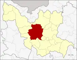 District location in Udon Thani Province | |
| Coordinates: 17°24′54″N 102°47′12″E | |
| Country | Thailand |
| Province | Udon Thani |
| Seat | Mak Khaeng |
| Area | |
| • Total | 1,094.7 km2 (422.7 sq mi) |
| Population (2013) | |
| • Total | 404,767 |
| • Density | 370/km2 (1,000/sq mi) |
| Time zone | UTC+7 (ICT) |
| Postal code | 41000 |
| Geocode | 4101 |
Geography
Neighboring districts are (from the north clockwise): Phen, Phibun Rak, Nong Han, Prachaksinlapakhom, Kumphawapi, Nong Saeng, Nong Wua So, Kut Chap, and Ban Phue of Udon Thani Province.
History
Originally named Ban Mak Khaeng (บ้านหมากแข้ง), the district was one of the original four districts of Udon Thani established during the thesaphiban administrative reforms in 1908.[1] In 1938 its name was changed from Mak Khaeng to Mueang Udon Thani.[2]
Ramasun Station
Ramasun Station, formerly Chang ('elephant') Station,[3] officially the 7th Radio Research Field Station (RRFS),[4] in Non Sung Subdistrict, was constructed by the US in 1964, just as the Vietnam War was gaining momentum. The site was run by the Army Security Agency (ASA) the Army's signals intelligence branch closely allied with the National Security Agency. Its purpose was radio communications intercept and triangulation of enemy installations. The site was dominated by a large, circular Wullenweber array. In its heyday, the station housed 1,200–1,500 US personnel, complete with sleeping quarters, a cinema, a post exchange (PX), gym, swimming pool, tennis court, arms depot, and a 300 m long tunnel that the Thai army today claims was used for electronic cable storage. It employed more than 1,400 Thais at generous wages.[3] With the US pullout of Southeast Asia in 1975, the station was handed over to the Thai 3rd Infantry Division. In 1983, it became the base of the 1st Battalion, 13th Infantry Regiment. In August 1997, it was renamed "Sunthondhammathada Camp".[5] The station reemerged in news of the US War on Terror as some believe it to be the location of a US CIA "black site" used to interrogate suspected terrorists by the United States.[5][6]
Administration
The district is divided into 21 sub-districts (tambons), which are further subdivided into 248 villages (mubans). The city (thesaban nakhon) Udon Thani covers tambon Mak Khaeng and parts of Nong Bua and Nong Khon Kwang. There are two town municipalities (thesaban mueang). Nong Samrong covers tambon Na Di and parts of Mu Mon, Ban Lueam, and Non Sung. Nam Kham covers parts of tambon Non Sung. There are five sub-district municipalities (thesaban tambon). Nikhom Songkhro covers parts of tambon Nikhom Songkhro and Khok Sa-at; Nong Bua parts of tambon Nong Bua, Nong Na Kham, Sam Phrao, and Nong Khon Kwang; Ban Chan parts of tambon Ban Chan and Nong Khon Kwang; Na Kha parts of tambon Na Kha. There are 18 tambon administrative organizations (TAO).
| No. | Name | Thai | Villages | Pop.[7] |
|---|---|---|---|---|
| 1. | Mak Khaeng | หมากแข้ง | - | 141,209 |
| 2. | Nikhom Songkhro | นิคมสงเคราะห์ | 12 | 12,692 |
| 3. | Ban Khao | บ้านขาว | 10 | 9,957 |
| 4. | Nong Bua | หนองบัว | 7 | 17,060 |
| 5. | Ban Tat | บ้านตาด | 14 | 12,224 |
| 6. | Non Sung | โนนสูง | 14 | 19,549 |
| 7. | Mu Mon | หมูม่น | 12 | 15,384 |
| 8. | Chiang Yuen | เชียงยืน | 16 | 15,580 |
| 9. | Nong Na Kham | หนองนาคำ | 18 | 21,893 |
| 10. | Kut Sa | กุดสระ | 11 | 8,414 |
| 11. | Na Di | นาดี | 8 | 6,738 |
| 12. | Ban Lueam | บ้านเลื่อม | 8 | 16,530 |
| 13. | Chiang Phin | เชียงพิณ | 8 | 10,945 |
| 14. | Sam Phrao | สามพร้าว | 10 | 17,844 |
| 15. | Nong Hai | หนองไฮ | 13 | 12,279 |
| 16. | Na Kha | นาข่า | 15 | 12,498 |
| 17. | Ban Chan | บ้านจั่น | 16 | 13,144 |
| 18. | Nong Khon Kwang | หนองขอนกว้าง | 12 | 10,517 |
| 19. | Khok Sa-at | โคกสะอาด | 10 | 7,260 |
| 20. | Na Kwang | นากว้าง | 10 | 6,874 |
| 21. | Nong Phai | หนองไผ่ | 12 | 8,458 |
Economy
Non Sung, Nong Phai, and Nong Khon Kwang Sub-districts of Mueang Udon Thani District will become sites of the Udon North potash mine if the project is approved.[8]
References
- แจ้งความกระทรวงมหาดไทย เรื่อง ให้รวมเมืองกมุทธาไส ๑ เมือง กุมภวาปี ๑ เมือง หนองหาย ๑ อำเภอ บ้านหมากแข้ง ๑ ตั้งเป็นเมืองจัตวา เรียกว่าเมืองอุดรธานีบริเวณน้ำชีให้เปลี่ยนเรียกว่าเมืองขอนแก่น บริเวณน้ำเหืองให้เปลี่ยนเรียกว่าเมืองเลย บริเวณสกลนครให้เปลี่ยน เรียกว่าเมืองสกลนคร บริเวณธาตุพนมให้เปลี่ยนเรียกว่าเมืองนครพนม ส่วนเมืองหนองคายเมืองโพนพิสัยให้คงไว้ตามเดิม (PDF). Royal Gazette (in Thai). 24 (41): 1088. 1908-01-12.
- พระราชกฤษฎีกาเปลี่ยนนามจังหวัด และอำเภอบางแห่ง พุทธศักราช ๒๔๘๑ (PDF). Royal Gazette (in Thai). 55 (0 ก): 658–666. 1938-11-14.
- "Recollections of Camp Ramasun: Life with Udon Thani GIs". The Isaan Record. 22 June 2019. Retrieved 20 May 2020.
- Lelyveld, Joseph (1974-06-26). "U.S. Military Presence Is in Asia as of Old, but Justification for It Is All New". New York Times. Retrieved 27 August 2018.
- Nanuam, Wassana (27 August 2018). "Ex-US base 'not secret prison'". Bangkok Post. Retrieved 27 August 2018.
- "Torture and secrecy in Thailand". Australian Broadcasting Corporation (ABC). 17 Mar 2018. Retrieved 27 August 2018.
- "Population statistics 2008". Department of Provincial Administration. Archived from the original on 2009-08-20.
- "Project Location". Asia Pacific Potash Corporation (APPC). Retrieved 9 October 2017.