Prachaksinlapakhom District
Prachaksinlapakhom (Thai: ประจักษ์ศิลปาคม) is a district (amphoe) in central Udon Thani Province, northeastern Thailand.
Prachaksinlapakhom
ประจักษ์ศิลปาคม | |
|---|---|
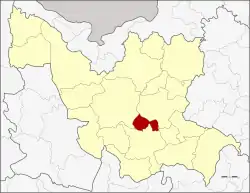 District location in Udon Thani Province | |
| Coordinates: 17°16′22″N 102°59′39″E | |
| Country | Thailand |
| Province | Udon Thani |
| Seat | Na Muang |
| Tambon | 3 |
| Muban | 41 |
| District established | 1997 |
| Area | |
| • Total | 144.8 km2 (55.9 sq mi) |
| Population (2015) | |
| • Total | 25,332 |
| • Density | 215.1/km2 (557/sq mi) |
| Time zone | UTC+7 (ICT) |
| Postal code | 41110 |
| Geocode | 4125 |
Geography
Neighboring districts are (from the north clockwise) Nong Han, Ku Kaeo, Kumphawapi, and Mueang Udon Thani.
History
The minor district (king amphoe) was established on 1 June 1997 by splitting it from Kumphawapi District. The creation became effective on 1 July 1997.[1]
On 15 May 2007, all 81 minor districts were upgraded to full districts.[2] With publication in the Royal Gazette on 24 August, the upgrade became official.[3]
Administration
Central administration
Prachaksinlapakhom is divided into three sub-districts (tambons), which are further subdivided into 41 administrative villages (mubans).
| No. | Name | Thai | Villages | Pop.[4] |
|---|---|---|---|---|
| 1. | Na Muang | นาม่วง | 14 | 10,448 |
| 2. | Huai Sam Phat | ห้วยสามพาด | 13 | 7,000 |
| 3. | Um Chan | อุ่มจาน | 14 | 7,884 |
Local administration
There are three sub-district administrative organizations (SAO) in the district:
- Na Muang (Thai: องค์การบริหารส่วนตำบลนาม่วง) consisting of sub-district Na Muang.
- Huai Sam Phat (Thai: องค์การบริหารส่วนตำบลห้วยสามพาด) consisting of sub-district Huai Sam Phat.
- Um Chan (Thai: องค์การบริหารส่วนตำบลอุ่มจาน) consisting of sub-district Um Chan.
Economy
Huai Sam Phat and Na Muang Sub-districts are among five Udon Thani sub-districts to harbour mining operations of the Udon North potash mine, although the mine has met with local resistance.[5]
References
- ประกาศกระทรวงมหาดไทย เรื่อง แบ่งเขตท้องที่อำเภอกุมภวาปี จังหวัดอุดรธานี ตั้งเป็นกิ่งอำเภอประจักษ์ศิลปาคม (PDF). Royal Gazette (in Thai). 114 (Special 51 ง): 23. June 25, 1997.
- แถลงผลการประชุม ครม. ประจำวันที่ 15 พ.ค. 2550 (in Thai). Manager Online.
- พระราชกฤษฎีกาตั้งอำเภอฆ้องชัย...และอำเภอเหล่าเสือโก้ก พ.ศ. ๒๕๕๐ (PDF). Royal Gazette (in Thai). 124 (46 ก): 14–21. August 24, 2007.
- "Population statistics 2015" (in Thai). Department of Provincial Administration. Retrieved 2016-12-06.
- Saengpassa, Chularat (2015-07-13). "Locals up in arms over potash mine". The Nation. Retrieved 9 October 2017.