Municipality of Slovenske Konjice
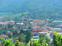
The Municipality of Slovenske Konjice (pronounced [slɔˈʋéːnskɛ kɔˈnjìːtsɛ] (![]() listen) or [- kɔˈnjíːtsɛ]; Slovene: Občina Slovenske Konjice) is a municipality in the traditional region of Styria in northeastern Slovenia. The seat of the municipality is the town of Slovenske Konjice. Slovenske Konjice became a municipality in 1994.[2]
listen) or [- kɔˈnjíːtsɛ]; Slovene: Občina Slovenske Konjice) is a municipality in the traditional region of Styria in northeastern Slovenia. The seat of the municipality is the town of Slovenske Konjice. Slovenske Konjice became a municipality in 1994.[2]

Municipality of Slovenske Konjice
Občina Slovenske Konjice | |
|---|---|
 | |
 Flag  Coat of arms | |
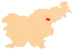
 Location of the Municipality of Slovenske Konjice in Slovenia | |
| Coordinates: 46°19′N 15°28′E | |
| Country | |
| Government | |
| • Mayor | Darko Ratajc |
| Area | |
| • Total | 97.8 km2 (37.8 sq mi) |
| Population (July 1, 2018)[1] | |
| • Total | 14,912 |
| • Density | 150/km2 (390/sq mi) |
| Time zone | UTC+01 (CET) |
| • Summer (DST) | UTC+02 (CEST) |
| Website | www |
Geography
The municipality is now included in the Savinja Statistical Region.[3] It is the administrative and cultural center of the Dravinja Valley. It spreads over 97.8 square kilometers (37.8 sq mi) and has a population of 13,600. About 100 kilometers (62 mi) from Ljubljana, Graz, or Zagreb, it is easily reachable by the A1 motorway and via the small airport Slovenske Konjice[4] near Loče.
Location
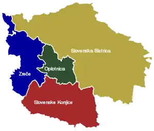
Municipality of Slovenske Konjice borders on the municipalities of Šmarje pri Jelšah and Šentjur to the south, Vojnik to the west, Zreče to the northwest, Oplotnica to the north, Slovenska Bistrica to the east, and Rogaška Slatina to the southeast.
Settlements
In addition to the municipal seat of Slovenske Konjice, the municipality also includes the following settlements:
- Bezina
- Blato
- Brdo
- Breg pri Konjicah
- Brezje pri Ločah
- Dobrava pri Konjicah
- Dobrnež
- Draža Vas
- Gabrovlje
- Gabrovnik
- Kamna Gora
- Klokočovnik
- Koble
- Kolačno
- Konjiška Vas
- Kraberk
- Ličenca
- Lipoglav
- Loče
- Mali Breg
- Mlače
- Nova Vas pri Konjicah
- Novo Tepanje
- Ostrožno pri Ločah
- Penoje
- Perovec
- Petelinjek pri Ločah
- Podob
- Podpeč ob Dravinji
- Polene
- Preloge pri Konjicah
- Prežigal
- Selski Vrh
- Škalce
- Škedenj
- Sojek
- Špitalič pri Slovenskih Konjicah
- Spodnja Pristava
- Spodnje Grušovje
- Spodnje Laže
- Spodnje Preloge
- Spodnji Jernej
- Štajerska Vas
- Stare Slemene
- Strtenik
- Suhadol
- Sveti Jernej
- Tepanje
- Tepanjski Vrh
- Tolsti Vrh
- Vešenik
- Zbelovo
- Zbelovska Gora
- Zeče
- Zgornja Pristava
- Zgornje Laže
- Žiče
References
- "Občina Slovenske Konjice". Statistični urad Republike Slovenije. Retrieved April 7, 2020.
- Vzpostavitev lokalne samouprave v Republiki Sloveniji v številkah. Ljubljana: Statistični urad Republike Slovenije. 2007. p. 119. Retrieved April 7, 2020.
- Municipality of Slovenske Konjice website
- airport
External links
 Media related to Municipality of Slovenske Konjice at Wikimedia Commons
- Municipality of Slovenske Konjice on Geopedia
- Municipality of Slovenske Konjice website