Munnsville, New York
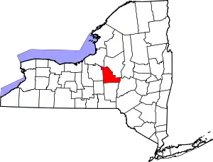
Munnsville is a village located in the Town of Stockbridge in Madison County, New York, United States. The population was 474 at the 2010 census. The village is named for an early settler, Asa Munn, and located on New York State Route 46.
Munnsville, New York | |
|---|---|
 Stockbridge Falls, June 2011 | |
 Munnsville, New York Location within the state of New York | |
| Coordinates: 42°58′36″N 75°35′18″W | |
| Country | United States |
| State | New York |
| County | Madison |
| Area | |
| • Total | 0.88 sq mi (2.27 km2) |
| • Land | 0.88 sq mi (2.27 km2) |
| • Water | 0.00 sq mi (0.00 km2) |
| Elevation | 659 ft (201 m) |
| Population (2010) | |
| • Total | 474 |
| • Estimate (2019)[2] | 463 |
| • Density | 528.54/sq mi (204.16/km2) |
| Time zone | UTC-5 (Eastern (EST)) |
| • Summer (DST) | UTC-4 (EDT) |
| ZIP code | 13409 |
| Area code(s) | 315 |
| FIPS code | 36-49220 |
| GNIS feature ID | 2391001 |
History
Asa Munn opened a mercantile business in the community around 1817.
In 1990 the village received national media attention and interviews by Connie Chung when a local dairy farmer, Delbert Ward, allegedly murdered his brother William Ward by suffocation. Delbert was found not guilty at trial. In 1992 this incident was examined in the documentary Brother's Keeper.
Munnsville became a world-renowned racing location for skateboarding because of the Madison County Gravity Festival which began in 2002. Skateboarders from all over North America and Europe descend on the town for the last weekend of July and race their skateboards at speeds up to 95 km/h.
Munnsville was the final home of poet Hayden Carruth.
The former Munnsville depot of the defunct (March 29, 1957) New York, Ontario & Western Railway is now a private residence, occupied by NYO&W historian and author John Taibi.
Munnsville is the birthplace of Bill Horr, who won silver and bronze at the Olympics.
Geography
Munnsville is located at 42°58′36″N 75°35′18″W (42.976597, -75.588236).[3]
According to the United States Census Bureau, the village has a total area of 0.9 square miles (2.3 km2), all of it land.
Demographics
| Historical population | |||
|---|---|---|---|
| Census | Pop. | %± | |
| 1870 | 313 | — | |
| 1880 | 329 | 5.1% | |
| 1920 | 377 | — | |
| 1930 | 345 | −8.5% | |
| 1940 | 357 | 3.5% | |
| 1950 | 412 | 15.4% | |
| 1960 | 391 | −5.1% | |
| 1970 | 435 | 11.3% | |
| 1980 | 499 | 14.7% | |
| 1990 | 438 | −12.2% | |
| 2000 | 437 | −0.2% | |
| 2010 | 474 | 8.5% | |
| 2019 (est.) | 463 | [2] | −2.3% |
| U.S. Decennial Census[4] | |||
As of the census[5] of 2000, there were 437 people, 166 households, and 118 families residing in the village. The population density was 506.6 people per square mile (196.2/km2). There were 176 housing units at an average density of 204.0 per square mile (79.0/km2). The racial makeup of the village was 98.40% White, 0.46% African American, 0.23% Native American, and 0.92% from two or more races. Hispanic or Latino of any race were 0.69% of the population.
There were 166 households, out of which 34.3% had children under the age of 18 living with them, 53.0% were married couples living together, 12.7% had a female householder with no husband present, and 28.9% were non-families. 22.9% of all households were made up of individuals, and 12.7% had someone living alone who was 65 years of age or older. The average household size was 2.60 and the average family size was 3.04.
In the village, the population was spread out, with 26.5% under the age of 18, 8.5% from 18 to 24, 30.2% from 25 to 44, 23.1% from 45 to 64, and 11.7% who were 65 years of age or older. The median age was 36 years. For every 100 females, there were 92.5 males. For every 100 females age 18 and over, there were 93.4 males.
The median income for a household in the village was $35,000, and the median income for a family was $36,250. Males had a median income of $35,417 versus $21,250 for females. The per capita income for the village was $16,657. About 9.7% of families and 14.8% of the population were below the poverty line, including 15.2% of those under age 18 and 16.1% of those age 65 or over.
References
- "2019 U.S. Gazetteer Files". United States Census Bureau. Retrieved July 27, 2020.
- "Population and Housing Unit Estimates". United States Census Bureau. May 24, 2020. Retrieved May 27, 2020.
- "US Gazetteer files: 2010, 2000, and 1990". United States Census Bureau. 2011-02-12. Retrieved 2011-04-23.
- "Census of Population and Housing". Census.gov. Retrieved June 4, 2015.
- "U.S. Census website". United States Census Bureau. Retrieved 2008-01-31.
