Murphy Inlet
Murphy Inlet is an ice-filled inlet about 18 nautical miles (33 km) long, with two parallel branches at the head, lying between Noville and Edwards Peninsulas on the north side of Thurston Island. Delineated from aerial photographs taken by U.S. Navy Operation Highjump in December 1946. Named by Advisory Committee on Antarctic Names (US-ACAN) for Charles J. V. Murphy, assistant to R. Admiral Byrd after Byrd Antarctic Expedition of 1928–30, and member of the wintering party of Byrd Antarctic Expedition of 1933–35.

Murphy Inlet
Location of Murphy Inlet in Antarctica
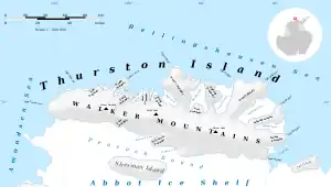
Map of Thurston Island.
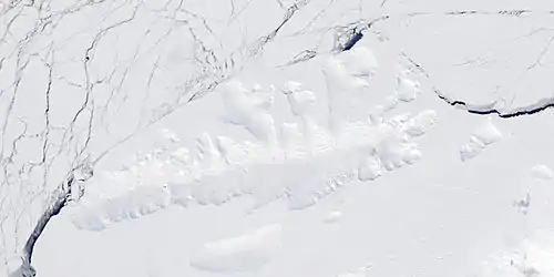
Satellite image of Thurston Island.
Maps
- Thurston Island – Jones Mountains. 1:500000 Antarctica Sketch Map. US Geological Survey, 1967.
- Antarctic Digital Database (ADD). Scale 1:250000 topographic map of Antarctica. Scientific Committee on Antarctic Research (SCAR), 1993–2016.
Further reading
• United States. Defense Mapping Agency. Hydrographic Center, Sailing Directions for Antarctica: Includes Islands South of Latitude 60°, P 210
External links
- Murphy Inlet on USGS website
- Murphy Inlet on AADC website
- Murphy Inlet on SCAR website
- Murphy Inlet on marineregions.org
References
![]() This article incorporates public domain material from the United States Geological Survey document: "Murphy Inlet". (content from the Geographic Names Information System)
This article incorporates public domain material from the United States Geological Survey document: "Murphy Inlet". (content from the Geographic Names Information System) ![]()
This article is issued from Wikipedia. The text is licensed under Creative Commons - Attribution - Sharealike. Additional terms may apply for the media files.
