Nankang District, Ganzhou
Nankang (Chinese: 南康) is a district of the city of Ganzhou in southern Jiangxi province. It was a county-level city until November 2013, when the State Council made it a district of Ganzhou.[1]
Nankang
南康区 | |
|---|---|
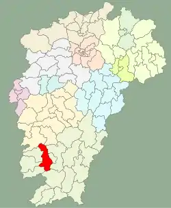 Location of Nankang (red) in Jiangxi. The map includes the towns of Tandong and Tankou, now administered by the neighboring Zhanggong District | |
| Coordinates: 25°39′43″N 114°45′54″E | |
| Country | People's Republic of China |
| Province | Jiangxi |
| Prefecture-level city | Ganzhou |
| Area | |
| • Total | 1,796 km2 (693 sq mi) |
| Population (2010) | |
| • Total | 787,636 |
| • Density | 440/km2 (1,100/sq mi) |
| Postal Code | 341400 |
Administration
Nankang has a population of 810,000. It covers an area of 1796 square kilometers. The seat of the district is at Rongjiang Town (蓉江镇).
In the present, Nankang District has 2 subdistricts, 8 towns, 11 townships and 1 ethnic township.[2]
- 2 subdistricts
- Rongjiang (蓉江街道)
- Dongshan (东山街道)
- 8 towns
|
|
- 11 townships
|
|
- 1 ethnic township
- Chitu She Ethnic Township (赤土畲族乡)
Climate
| Climate data for Nankang (1981−2010) | |||||||||||||
|---|---|---|---|---|---|---|---|---|---|---|---|---|---|
| Month | Jan | Feb | Mar | Apr | May | Jun | Jul | Aug | Sep | Oct | Nov | Dec | Year |
| Record high °C (°F) | 27.8 (82.0) |
31.7 (89.1) |
32.0 (89.6) |
34.5 (94.1) |
36.2 (97.2) |
37.7 (99.9) |
40.1 (104.2) |
40.4 (104.7) |
38.6 (101.5) |
36.6 (97.9) |
33.5 (92.3) |
28.3 (82.9) |
40.4 (104.7) |
| Average high °C (°F) | 12.6 (54.7) |
14.5 (58.1) |
18.0 (64.4) |
24.3 (75.7) |
28.5 (83.3) |
31.3 (88.3) |
34.3 (93.7) |
33.8 (92.8) |
30.4 (86.7) |
26.2 (79.2) |
20.8 (69.4) |
15.3 (59.5) |
24.2 (75.5) |
| Daily mean °C (°F) | 8.1 (46.6) |
10.3 (50.5) |
13.8 (56.8) |
19.8 (67.6) |
23.8 (74.8) |
26.8 (80.2) |
29.2 (84.6) |
28.5 (83.3) |
25.4 (77.7) |
20.8 (69.4) |
15.2 (59.4) |
9.7 (49.5) |
19.3 (66.7) |
| Average low °C (°F) | 5.1 (41.2) |
7.4 (45.3) |
10.9 (51.6) |
16.5 (61.7) |
20.5 (68.9) |
23.5 (74.3) |
25.2 (77.4) |
24.8 (76.6) |
21.9 (71.4) |
16.9 (62.4) |
11.3 (52.3) |
5.8 (42.4) |
15.8 (60.5) |
| Record low °C (°F) | −3.7 (25.3) |
−2.1 (28.2) |
−0.7 (30.7) |
4.4 (39.9) |
11.1 (52.0) |
16.3 (61.3) |
18.8 (65.8) |
20.1 (68.2) |
13.7 (56.7) |
6.0 (42.8) |
0.3 (32.5) |
−5.9 (21.4) |
−5.9 (21.4) |
| Average precipitation mm (inches) | 68.9 (2.71) |
113.5 (4.47) |
181.9 (7.16) |
184.3 (7.26) |
204.7 (8.06) |
198.4 (7.81) |
118.2 (4.65) |
135.5 (5.33) |
97.8 (3.85) |
55.8 (2.20) |
49.3 (1.94) |
40.3 (1.59) |
1,448.6 (57.03) |
| Average relative humidity (%) | 79 | 82 | 83 | 82 | 81 | 80 | 73 | 77 | 79 | 76 | 76 | 76 | 79 |
| Source: China Meteorological Data Service Center[3] | |||||||||||||
References
- 江西南康撤市设区获国务院批复. 12 November 2013. Retrieved 2 January 2014.
- "南京市-行政区划网 www.xzqh.org" (in Chinese). XZQH. Retrieved 2012-05-24.
- 中国地面气候标准值月值(1981-2010) (in Chinese). China Meteorological Data Service Center. Retrieved 20 October 2018.
External links
| Wikimedia Commons has media related to Nankang. |
| Authority control |
|
|---|
This article is issued from Wikipedia. The text is licensed under Creative Commons - Attribution - Sharealike. Additional terms may apply for the media files.