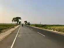
Narukullapadu
Narukullapadu is a village in Guntur district of the Indian state of Andhra Pradesh. It is located in Amaravathi mandal of Guntur revenue division.[2] Kondaveeti Vagu river flows through the village, which frequently floods causing significant damage to crops and risking lives.[4][5] The village forms a part of Andhra Pradesh Capital Region, under the jurisdiction of APCRDA.[6]
Narukullapadu | |
|---|---|
Village | |
 Narukullapadu pond | |
.svg.png.webp) Narukullapadu Location in Andhra Pradesh, India | |
| Coordinates: 16.454°N 80.377°E | |
| Country | India |
| State | Andhra Pradesh |
| District | Guntur |
| Mandal | Amaravathi |
| Government | |
| • Type | Panchayati raj |
| • Body | Narukullapadu Gram Panchayat |
| Area | |
| • Total | 941 km2 (363 sq mi) |
| Population (2011)[3] | |
| • Total | 2,335 |
| • Density | 2.5/km2 (6.4/sq mi) |
| Languages | |
| • Official | Telugu |
| Time zone | UTC+5:30 (IST) |
| PIN | 522025 |
| Area code(s) | +91–8640 |
| Vehicle registration | AP |
Geography
Malladi is situated to the south of the mandal headquarters, Amaravathi,[7] at 16.454°N 80.377°E. It is spread over an area of 941 ha (2,330 acres).[2]
Demographics
As of 2011 Census of India, Narukullapadu had a population of 2,335. The total population constitutes 1127 males and 1208 females —a sex ratio of 1023 females per 1000 males. 238 children are in the age group of 0–6 years, with child sex ratio of 1003 girls per 1000 boys. The average literacy rate stands at 59.50% with 1,287 literates.[2]
Government and politics
Narukullapadu Gram Panchayat is the local self-government of the village.[1] There are wards, each represented by an elected ward member. The present sarpanch is vacant, elected by the ward members.[8] The village is administered by the Amaravathi Mandal Parishad at the intermediate level of panchayat raj institutions.[7]
Education
As per the school information report for the academic year 2018–19, the village has a total of 2 MPP schools.[9]
See also
References
- "Gram Panchayat Identification Codes" (PDF). Saakshar Bharat Mission. National Informatics Centre. p. 95. Archived from the original (PDF) on 18 August 2017. Retrieved 7 May 2019.
- "District Census Hand Book : Guntur (Part B)" (PDF). Census of India. Directorate of Census Operations, Andhra Pradesh. 2011. pp. 14, 252. Retrieved 1 June 2019.
- "Population". Census of India. Registrar General and Census Commissioner of India. Retrieved 8 May 2019.
- "Rising Kondaveeti Vagu causes concern". The New Indian Express. 19 July 2017. Retrieved 17 May 2018.
- "Plan to save Amaravati from Kondaveeti Vagu". The Times of India. 26 September 2016. Retrieved 17 May 2018.
- "Declaration of A.P. Capital Region" (PDF). Andhra Pradesh Capital Region Development Authority. Municipal Administration and Urban Development Department, Andhra Pradesh. 30 December 2014. p. 4. Archived from the original (PDF) on 11 May 2019. Retrieved 14 May 2019.
- "District Census Handbook : Guntur (Part A)" (PDF). Census of India. Directorate of Census Operations, Andhra Pradesh. 2011. pp. 328–329. Retrieved 3 June 2019.
- Mathew, George; Sciences, Institute of Social (1995). Status of Panchayati Raj in the States of India, 1994. Concept Publishing Company. pp. 19, 78. ISBN 9788170225539. Retrieved 31 May 2019.
- "School Information". Commissionerate of School Education. Government of Andhra Pradesh. Retrieved 7 May 2019.