National Register of Historic Places listings in Conecuh County, Alabama
This is a list of the National Register of Historic Places listings in Conecuh County, Alabama.
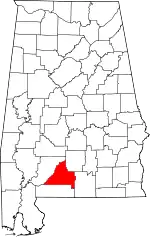
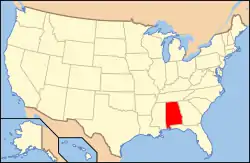
Location of Conecuh County in Alabama
This is intended to be a complete list of the properties and districts on the National Register of Historic Places in Conecuh County, Alabama, United States. Latitude and longitude coordinates are provided for many National Register properties and districts; these locations may be seen together in a Google map.[1]
There are 4 properties and districts listed on the National Register in the county.
- This National Park Service list is complete through NPS recent listings posted February 5, 2021.[2]
| [3] | Name on the Register | Image | Date listed[4] | Location | City or town | Description |
|---|---|---|---|---|---|---|
| 1 | Evergreen School | 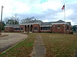 Evergreen School |
June 22, 2016 (#16000398) |
100 City School Dr. 31°26′09″N 86°57′03″W |
Evergreen | |
| 2 | Asa Johnston Farmhouse | 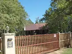 Asa Johnston Farmhouse |
May 21, 2008 (#08000455) |
County Road 29 0.6 miles northwest of its junction with County Road 6 31°17′07″N 86°52′01″W |
Johnsonville | |
| 3 | Louisville and Nashville Depot | 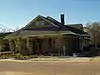 Louisville and Nashville Depot |
April 3, 1975 (#75000308) |
Southwestern end of Front St. 31°26′02″N 86°57′31″W |
Evergreen | |
| 4 | New Evergreen Commercial Historic District | 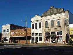 New Evergreen Commercial Historic District |
January 21, 1994 (#93001542) |
Roughly bounded by Mill, Cooper, Rural, Court, Liberty, E. Front, Cary, and Despious Sts. 31°26′03″N 86°57′17″W |
Evergreen |
See also
| Wikimedia Commons has media related to National Register of Historic Places in Conecuh County, Alabama. |
References
- The latitude and longitude information provided in this table was derived originally from the National Register Information System, which has been found to be fairly accurate for about 99% of listings. Some locations in this table may have been corrected to current GPS standards.
- "National Register of Historic Places: Weekly List Actions". National Park Service, United States Department of the Interior. Retrieved on February 5, 2021.
- Numbers represent an alphabetical ordering by significant words. Various colorings, defined here, differentiate National Historic Landmarks and historic districts from other NRHP buildings, structures, sites or objects.
- The eight-digit number below each date is the number assigned to each location in the National Register Information System database, which can be viewed by clicking the number.
Municipalities and communities of Conecuh County, Alabama, United States | ||
|---|---|---|
| City | Map of Alabama highlighting Conecuh County | |
| Towns | ||
| Unincorporated communities | ||
| Footnotes | ‡This populated place also has portions in an adjacent county or counties | |
| ||
This article is issued from Wikipedia. The text is licensed under Creative Commons - Attribution - Sharealike. Additional terms may apply for the media files.