National Register of Historic Places listings in White Pine County, Nevada
List of Registered Historic Places in White Pine County, Nevada, USA:
The locations of National Register properties and districts (at least for all showing latitude and longitude coordinates below), may be seen in an online map by clicking on "Map of all coordinates".[1]
- This National Park Service list is complete through NPS recent listings posted January 29, 2021.[2]
Current listings
| [3] | Name on the Register | Image | Date listed[4] | Location | City or town | Description |
|---|---|---|---|---|---|---|
| 1 | American Legion Hall | 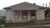 American Legion Hall |
December 1, 1994 (#94001404) |
24 Avenue J[5] 39°24′13″N 114°46′45″W |
McGill | |
| 2 | Bahsahwahbee | May 1, 2017 (#100000464) |
Address restricted |
Major's Place vicinity | ||
| 3 | Baker Ranger Station | 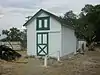 Baker Ranger Station |
October 17, 1995 (#95001224) |
Great Basin National Park 39°00′53″N 114°07′23″W |
Baker | |
| 4 | Capital Theater | _from_SSE_1.JPG.webp) Capital Theater |
August 5, 1993 (#93000692) |
464–468 Aultman St.[6] 39°14′53″N 114°53′36″W |
Ely | |
| 5 | Central Theater | _E_end_1.JPG.webp) Central Theater |
August 5, 1993 (#93000691) |
145 W. 15th St.[7] 39°15′04″N 114°52′59″W |
Ely | |
| 6 | East Ely Depot | 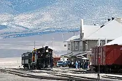 East Ely Depot |
April 12, 1984 (#84002082) |
11th St. 39°15′33″N 114°52′06″W |
Ely | |
| 7 | Ely City Hall and Fire Station | 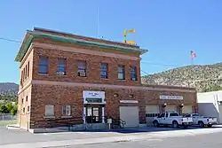 Ely City Hall and Fire Station |
February 5, 2018 (#100002071) |
501 Mill St. 39°14′49″N 114°53′41″W |
Ely | |
| 8 | Ely L. D. S. Stake Tabernacle | 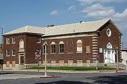 Ely L. D. S. Stake Tabernacle |
July 29, 1993 (#93000685) |
900 Aultman St. 39°14′56″N 114°53′16″W |
Ely | |
| 9 | Fort Ruby | 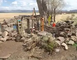 Fort Ruby |
October 15, 1966 (#66000460) |
Near Hobson on the western side of Ruby Lake 40°04′04″N 115°31′46″W |
Hobson | Site of fort for protecting Pony Express and stagecoaches. |
| 10 | Fort Schellbourne | Fort Schellbourne |
February 23, 1972 (#72000768) |
43 miles north of Ely off U.S. Route 93 on State Route 2 39°47′21″N 114°41′06″W |
Ely | |
| 11 | Johnson Lake Mine Historic District | 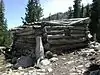 Johnson Lake Mine Historic District |
November 2, 1995 (#95001225) |
Great Basin National Park 38°56′32″N 114°17′44″W |
Baker | |
| 12 | Lehman Orchard and Aqueduct | 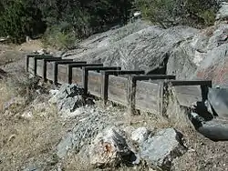 Lehman Orchard and Aqueduct |
February 25, 1975 (#75000181) |
Great Basin National Park 39°00′22″N 114°13′05″W |
Baker | |
| 13 | Lund Grade School | 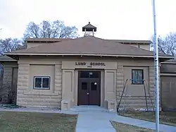 Lund Grade School |
December 7, 2018 (#100003200) |
30 W Center St. 38°51′31″N 115°00′31″W |
Lund | |
| 14 | McGill Drug Store | 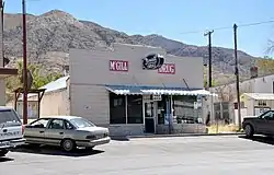 McGill Drug Store |
August 17, 1998 (#97001301) |
11 4th St. 39°24′17″N 114°46′40″W |
McGill | |
| 15 | Nevada Northern Railway East Ely Yards and Shops | Nevada Northern Railway East Ely Yards and Shops |
July 29, 1993 (#93000693) |
1100 Ave. A 39°15′36″N 114°52′07″W |
Ely | |
| 16 | Nevada Northern Railway – McGill Depot | 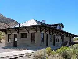 Nevada Northern Railway – McGill Depot |
February 17, 2015 (#15000010) |
1 Ave. K 39°24′13″N 114°46′29″W |
McGill | |
| 17 | Osceola (East) Ditch |  Osceola (East) Ditch |
June 6, 1996 (#96000584) |
Starting 0.5 miles east of Grouse Canyon and running approximately 18 miles southeast to Lehman Creek in Great Basin National Park 39°01′48″N 114°17′26″W |
Baker | |
| 18 | Rhodes Cabin | 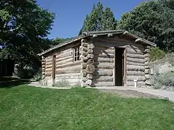 Rhodes Cabin |
February 25, 1975 (#75000180) |
Great Basin National Park 39°00′20″N 114°13′09″W |
Baker | |
| 19 | Sunshine Locality | January 30, 1978 (#78001731) |
Address Restricted |
Ely | ||
| 20 | US Post Office, Ely, Nevada | US Post Office, Ely, Nevada |
October 7, 2005 (#05001122) |
415 5th St. 39°14′50″N 114°53′35″W |
Ely | Now the Hotel Nevada's Postal Palace Convention Center[8] |
| 21 | Ward Charcoal Ovens |  Ward Charcoal Ovens |
September 28, 1971 (#71000491) |
South of Ely off U.S. Route 6 39°02′16″N 114°50′49″W |
Ely | |
| 22 | White Pine County Courthouse | 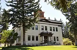 White Pine County Courthouse |
September 11, 1986 (#86001958) |
Campton St. 39°14′52″N 114°53′17″W |
Ely |
See also
| Wikimedia Commons has media related to National Register of Historic Places in White Pine County, Nevada. |
References
- The latitude and longitude information provided in this table was derived originally from the National Register Information System, which has been found to be fairly accurate for about 99% of listings. Some locations in this table may have been corrected to current GPS standards.
- "National Register of Historic Places: Weekly List Actions". National Park Service, United States Department of the Interior. Retrieved on January 29, 2021.
- Numbers represent an alphabetical ordering by significant words. Various colorings, defined here, differentiate National Historic Landmarks and historic districts from other NRHP buildings, structures, sites or objects.
- The eight-digit number below each date is the number assigned to each location in the National Register Information System database, which can be viewed by clicking the number.
- See 2014 photo, showing building facing Avenue J.
- Addresses 464, 466, and 468 can be seen on businesses occupying lower level of building in 2014 photo.
- "Central Theater". Archived 2014-09-10 at the Wayback Machine "Welcome to Ely" (White Pine County Tourism and Recreation Board). Retrieved 2014-09-08. See also 2014 photo showing theater on 15th Street.
- "Meetings". Hotel Nevada. Retrieved 2014-09-08.
This article is issued from Wikipedia. The text is licensed under Creative Commons - Attribution - Sharealike. Additional terms may apply for the media files.