National Route 700 (Costa Rica)
National Tertiary Route 700, or just Route 700 (Spanish: Ruta Nacional Terciaria 700, or Ruta 700) is a National Road Route of Costa Rica, located in the Alajuela province. [1]
| ||||
|---|---|---|---|---|
| Ruta Nacional Terciaria 700 | ||||
| ||||
| Route information | ||||
| Maintained by the MOPT | ||||
| Length | 3.37 km (2.09 mi) | |||
| Major junctions | ||||
| West end | ||||
| East end | ||||
| Location | ||||
| Provinces | Alajuela | |||
| Highway system | ||||
National Road Network of Costa Rica
| ||||

Description
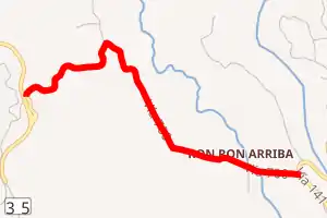
In Alajuela province the route covers San Carlos canton (Quesada district).
Junction list
The route is entirely in Quesada district.
| km | mi | Destinations | Notes |
|---|---|---|---|
| 0 | 0 | Segment in construction. | |
| 3.37 | 2.09 |
History
Route created in 2020 over an existing road between Route 141 and the in construction south segment of Route 35.[1]
References
- "GeoPortal". Ministerio de Obras Públicas y Transporte de Costa Rica. Retrieved 4 Sep 2020.
This article is issued from Wikipedia. The text is licensed under Creative Commons - Attribution - Sharealike. Additional terms may apply for the media files.