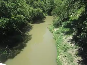
Navasota River
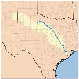
The Navasota River is a river in east Texas, United States. It is about 125 miles (201 km) long, beginning near Mount Calm [2] and flowing south into the Brazos River at a point where Brazos, Grimes, and Washington counties converge.[3]
| Navasota River | |
|---|---|
 | |
 Brazos River Watershed | |
| Location | |
| Country | United States |
| State | Texas |
| Physical characteristics | |
| Source confluence | |
| • location | 3.5 miles NNW of Mount Calm, Hill County, Texas |
| • coordinates | 31°48′24″N 96°52′00″W[1] |
| • elevation | 196 m (643 ft) |
| Mouth | at its confluence with the Brazos River. |
• location | where Brazos County, Texas, Grimes County, Texas, and Washington County, Texas converge. |
• coordinates | 30°19′54″N 96°09′15″W[1] |
• elevation | 44 m (144 ft) |
| Length | 201 km (125 mi) |
| Discharge | |
| • location | Washington-on-the-Brazos, Texas |
| • minimum | 0.76 m3/s (27 cu ft/s) |
| • maximum | 2,390 m3/s (84,000 cu ft/s) |
Name
The river has been known by several names. The indigenous people called it the Nabasoto, Domingo Terán de los Ríos called it San Cypriano, Fray Isidro Félix de Espinosa called it the San Buenaventura, and in 1727, Pedro de Rivera y Villalón named it the Navasota.[2]
Lakes
The Navasota River is dammed to form several lakes, including Lake Mexia, Springfield Lake, Joe Echols Lake, Lake Groesbeck, Lake Limestone, Martin Lake, and Lake Fort Parker in Fort Parker State Park.[2]
See also
Notes
- U.S. Geological Survey Geographic Names Information System: Navasota River
- NAVASOTA RIVER, from Hand Book of Texas Online
- Merriam-Webster's Geographical Dictionary, Third Edition, p. 794
References
- Merriam-Webster's Geographical Dictionary, Third Edition. Springfield, Massachusetts: Merriam-Webster Incorporated, 1997.
This article is issued from Wikipedia. The text is licensed under Creative Commons - Attribution - Sharealike. Additional terms may apply for the media files.