Nebraska Highway 65
Nebraska Highway 65 is a highway in southeastern Nebraska. It is a north–south highway with a length of 15.25 miles (24.54 km). The southern terminus of Nebraska Highway 65 is at the Kansas border south of Pawnee City. The northern terminus is in Table Rock at an intersection with Nebraska Highway 4.
| ||||
|---|---|---|---|---|
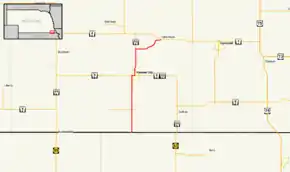 Nebraska Highway 65 highlighted in red | ||||
| Route information | ||||
| Maintained by NDOT | ||||
| Length | 15.23 mi[1] (24.51 km) | |||
| Existed | 1933[2]–present | |||
| Major junctions | ||||
| South end | Bailey-Pawnee Road at Kansas border south of Pawnee City | |||
| North end | ||||
| Location | ||||
| Counties | Pawnee | |||
| Highway system | ||||
| ||||

Route description
Nebraska Highway 65 begins at the Kansas border. The road continues into Kansas as Bailey-Pawnee Road. Highway 65 goes north from the border on a gravel road. The highway becomes paved as it approaches Pawnee City. It then meets Nebraska Highway 8 at the western city limits of Pawnee City and they run concurrently going east until an intersection with Nebraska Highway 50. Highway 65 then turns north with Highway 50 and they run concurrently for 3 miles (4.8 km). They then separate and Highway 65 goes east, then northeast and ends in Table Rock at an intersection with Nebraska Highway 4.[1][3]
Major intersections
The entire route is in Pawnee County.
| Location | mi[1] | km | Destinations | Notes | |
|---|---|---|---|---|---|
| | 0.00 | 0.00 | Bailey-Pawnee Road south | Kansas state line; route begins on a gravel road | |
| | 3.04 | 4.89 | |||
| | 7.04 | 11.33 | Pavement begins | ||
| Pawnee City | 7.53 | 12.12 | South end of NE 8 overlap | ||
| 7.90 | 12.71 | North end of NE 8 overlap; south end of NE 50 overlap | |||
| | 11.42 | 18.38 | North end of NE 50 overlap | ||
| Table Rock | 15.23 | 24.51 | Northern terminus | ||
1.000 mi = 1.609 km; 1.000 km = 0.621 mi
| |||||
References
- "Nebraska Highway Reference Log Book" (PDF). Nebraska Department of Roads. 2015. p. 165. Retrieved January 7, 2017.
- "The Nebraska Highways Page: Highways 61 to 100". Archived from the original on 2006-12-07. Retrieved 2008-02-28.
- Google (2010-11-01). "overview of Nebraska Highway 65" (Map). Google Maps. Google. Retrieved 2010-11-01.