Nebraska Highway 69
Nebraska Highway 69 is a highway in southeastern Nebraska. Its southern terminus is at an intersection with U.S. Highway 34 east of Waco. Its northern terminus is at an intersection with U.S. Highway 81 and Nebraska Highway 92 in Shelby.
| ||||
|---|---|---|---|---|
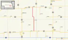 Nebraska Highway 69 highlighted in red | ||||
| Route information | ||||
| Maintained by NDOT | ||||
| Length | 20.87 mi[1] (33.59 km) | |||
| Existed | January 1, 1975[2]–present | |||
| Major junctions | ||||
| South end | ||||
| North end | ||||
| Location | ||||
| Counties | York, Polk | |||
| Highway system | ||||
| ||||

Route description
Nebraska Highway 69 begins at US 34 east of Waco and heads in a northbound direction through farmland. It passes through Gresham before continuing northward. It makes a slight turn to the west just north of Gresham before turning northward again. The highway continues into Shelby where it terminates at an intersection with US 81 and NE 92.[1][3]
Major intersections
| County | Location | mi[1] | km | Destinations | Notes |
|---|---|---|---|---|---|
| York | Waco | 0.00 | 0.00 | Southern terminus | |
| Polk | Shelby | 20.87 | 33.59 | Northern terminus | |
| 1.000 mi = 1.609 km; 1.000 km = 0.621 mi | |||||
References
- "Nebraska Highway Reference Log Book" (PDF). Nebraska Department of Roads. 2015. p. 172. Retrieved January 7, 2017.
- "New Numbers for Highway Segments". The Beatrice Daily Sun. Beatrice, Nebraska. November 18, 1974. p. 1. Retrieved December 18, 2019 – via Newspapers.com.

- Google (2010-11-01). "overview of Nebraska Highway 69" (Map). Google Maps. Google. Retrieved 2010-11-01.
External links
This article is issued from Wikipedia. The text is licensed under Creative Commons - Attribution - Sharealike. Additional terms may apply for the media files.