Nebraska Highway 92
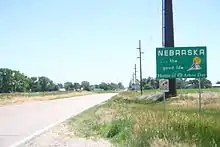
Nebraska Highway 92 is a highway that enters the state from Nebraska's western border at the Wyoming state line west of Lyman, Nebraska, to the state's eastern border on the South Omaha Veterans Memorial Bridge over the Missouri River in Omaha, where it enters Iowa. Nebraska Highway 92 passes, follows, or runs through a number of the state's principal attractions, including Scotts Bluff National Monument, the Oregon Trail, Chimney Rock National Historic Site, Ash Hollow State Historical Park, Lake McConaughy, the Nebraska Sand Hills, and the City of Omaha. Nebraska Highway 92 is the longest state route in the state at a total of 489.1 miles (787.1 km), and is part of a continuous 886-mile (1,426 km) four-state "Highway 92" which begins in Torrington, Wyoming, goes through Nebraska and Iowa and ends in La Moille, Illinois. It is the only Nebraska Highway to run from the west border to the east border of Nebraska; along the way it crosses the Platte River or its tributary North Platte River a total of five times.
| ||||
|---|---|---|---|---|
 Nebraska Highway 92 highlighted in red | ||||
| Route information | ||||
| Maintained by NDOT | ||||
| Length | 489.46 mi[1] (787.71 km) | |||
| Major junctions | ||||
| West end | ||||
| East end | ||||
| Location | ||||
| Counties | Scotts Bluff, Morrill, Garden, Keith, Arthur, McPherson, Logan, Custer, Sherman, Howard, Merrick, Polk, Butler, Saunders, Douglas | |||
| Highway system | ||||
| ||||

Route description
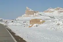
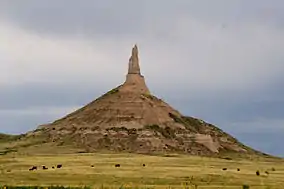
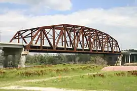
Nebraska Highway 92 begins at the Wyoming border west of Lyman and after a brief turn south, heads east passing around the north side of Scotts Bluff National Monument, crosses the North Platte River for the first of three times, and enters the town of Scottsbluff. Starting in Scottsbluff, N-92, U.S. 26, and the North Platte River form a three-way braid, crisscrossing one another several times for 91 miles (146 km) until Lewellen. At Scottsbluff, it overlaps U.S. 26 and Nebraska Highway 71, crossing the North Platte River again to its south side, to Gering, where it then turns to the east-southeast, following the route of the Oregon Trail, paralleling the North Platte River and U.S. 26 on the other side of the river. Near Chimney Rock National Historic Site, it overlaps U.S. 26 again until Bridgeport. After a brief concurrency with U.S. 385, it goes southeast until it crosses the North Platte for the third time just before Broadwater. It then again overlaps U.S. 26 a third time from there until Lewellen, where it separates to go through the resort communities along the north shore of Lake McConaughy until it meets Nebraska Highway 61.[1][2]
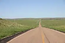
It overlaps Highway 61 and goes north into the Sand Hills and separates in Arthur. It then goes east, meeting Nebraska Highway 97 in Tryon, and encountering Nebraska Highway 2 at Merna. It then goes southeast with Highway 2 through Broken Bow and separates at Ansley. It then runs east through Loup City and meets with U.S. 281 in St. Paul.[1][2]
It runs concurrently with U.S. 281 through St. Paul, crosses the Loup River, and then separates from U.S. 281 and goes straight east, intersects U.S. 30, crosses the Platte River for the first of two times near Clarks and meets U.S. 81 west of Osceola. It is then concurrent with U.S. 81 through Osceola and Shelby, before separating east of Shelby. It then passes through Rising City and then goes straight east until it meets U.S. 77 southwest of Wahoo, Nebraska. It passes through Wahoo concurrent with U.S. 77 and goes east with U.S. 77 until they separate near Mead. After passing the south edge of Yutan, it recrosses the Platte River.[1][2]
It then encounters U.S. 275, with which it is concurrent for the rest of its distance in Nebraska. Shortly after meeting U.S. 275, it crosses the Elkhorn River and becomes a 4 lane divided expressway shortly before meeting U.S. 6 and Nebraska Highway 31. Within Omaha, it meets Interstate 80 and U.S. Route 75. The street designations for Highway 92 in Omaha, going west to east, are West Center Road, Industrial Road, L Street and Missouri Avenue.[1][2] It remains a 4 lane suburban arterial street until it enters Iowa on the South Omaha Veterans Memorial Bridge over the Missouri River.
History
Originally, Route 92 followed the route of the old Oregon Trail through Mitchell Pass in Scotts Bluff National Monument, and then through Downtown Gering. It was later rerouted on a more level route around the north side of Scotts Bluff, through the town of Scottsbluff. Between 1936 and 1973, Nebraska Highway 92 was concurrent with U.S. Highway 30A from Clarks to Omaha.
Major intersections
| County | Location | mi[1] | km | Destinations | Notes |
|---|---|---|---|---|---|
| Scotts Bluff | Lyman | 0.00 | 0.00 | Continuation into Wyoming | |
| Scottsbluff | 23.16 | 37.27 | Western end of US 26 overlap | ||
| 23.78 | 38.27 | Western end of N-71 overlap | |||
| 27.19 | 43.76 | Eastern end of US 26 overlap | |||
| | 27.76 | 44.68 | South Beltline Highway – Scottsbluff | Partial interchange; westbound exit only | |
| Gering | 29.92 | 48.15 | Interchange; eastern end of N-71 overlap | ||
| Melbeta | 36.18 | 58.23 | |||
| Morrill | Bayard | 47.23 | 76.01 | Western end of US 26 overlap | |
| Bridgeport | 59.76 | 96.17 | Eastern end of US 26 overlap; western end of US 385 overlap | ||
| 60.23 | 96.93 | Northern terminus of N-88 | |||
| | 67.89 | 109.26 | Eastern end of US 385 overlap | ||
| Broadwater | 75.91 | 122.17 | Western end of US 26 overlap | ||
| Garden | Oshkosh | 105.47 | 169.74 | Northern terminus of N-27 (middle segment) | |
| Lewellen | 118.31 | 190.40 | Eastern end of US 26 overlap | ||
| Keith | Lemoyne | 142.06 | 228.62 | Western end of N-61 overlap | |
| Arthur | Arthur | 167.51 | 269.58 | Eastern end of N-61 overlap | |
| McPherson | Tryon | 206.70 | 332.65 | Western end of N-97 overlap | |
| | 211.17 | 339.85 | Eastern end of N-97 overlap | ||
| Logan | Stapleton | 232.17 | 373.64 | Western end of US 83 overlap | |
| | 236.17 | 380.08 | Eastern end of US 83 overlap | ||
| Custer | Arnold | 252.28 | 406.01 | Western terminus of N-40 | |
| Merna | 276.45 | 444.90 | Western end of N-2 overlap | ||
| Broken Bow | 285.72 | 459.82 | Northern terminus of N-21 | ||
| 286.89 | 461.70 | Western terminus of N-70 | |||
| Ansley | 302.37 | 486.62 | Eastern end of N-2 overlap; western end of US 183 overlap | ||
| 302.77 | 487.26 | Eastern end of US 183 overlap | |||
| Sherman | Loup City | 323.07 | 519.93 | Western end of N-58 overlap | |
| 323.79 | 521.09 | Northern terminus of N-10; western terminus of R-82B | |||
| 326.04 | 524.71 | Eastern end of N-58 overlap | |||
| Howard | | 343.35 | 552.57 | ||
| | 347.10 | 558.60 | |||
| St. Paul | 352.56 | 567.39 | Western end of US 281 overlap | ||
| 354.94 | 571.22 | Eastern end of US 281 overlap | |||
| Merrick | | 364.55 | 586.69 | ||
| | 377.50 | 607.53 | Western end of N-14 overlap | ||
| | 378.51 | 609.15 | Eastern end of N-14 overlap | ||
| | 384.28 | 618.44 | One-quadrant interchange; access via unsigned L-61D | ||
| Polk | | 396.02 | 637.33 | Southern terminus of N-39 | |
| | 399.02 | 642.16 | Western end of US 81 overlap | ||
| Shelby | 408.42 | 657.29 | Northern terminus of N-69 | ||
| | 411.44 | 662.15 | Eastern end of US 81 overlap | ||
| Butler | | 414.42 | 666.94 | ||
| | 424.40 | 683.01 | Western end of N-15 overlap | ||
| | 425.92 | 685.45 | Eastern end of N-15 overlap | ||
| | 430.91 | 693.48 | |||
| Saunders | | 439.92 | 707.98 | Western end of N-79 overlap | |
| | 440.94 | 709.62 | Eastern end of N-79 overlap | ||
| | 444.45 | 715.27 | |||
| | 445.95 | 717.69 | |||
| Wahoo | 450.17 | 724.48 | Western end of US 77 overlap | ||
| 453.58 | 729.97 | Southern terminus of N-109 | |||
| Mead | 458.79 | 738.35 | Eastern end of US 77 overlap | ||
| | 459.80 | 739.98 | |||
| Platte River | 465.99 | 749.94 | Bridge | ||
| Douglas | | 469.80 | 756.07 | Western end of US 275 overlap; former US 30A east | |
| Omaha | 472.84 | 760.96 | Interchange | ||
| 479.36 | 771.46 | Millard Avenue (N-50 south) | Northern terminus of N-50 | ||
| 480.83 | 773.82 | Cloverleaf interchange with I-80 C/D lanes; I-80 exit 445; I-680 south exit 1 | |||
| 483.35 | 777.88 | Northern terminus of N-85 | |||
| 484.35 | 779.49 | 72nd Street | Interchange | ||
| 488.17 | 785.63 | Interchange | |||
| Missouri River | 489.46 | 787.71 | South Omaha Veterans Memorial Bridge; Nebraska–Iowa line | ||
| Continuation into Iowa | |||||
1.000 mi = 1.609 km; 1.000 km = 0.621 mi
| |||||
References
- "Nebraska Highway Reference Log Book" (PDF). Nebraska Department of Roads. 2015. pp. 247–253. Retrieved January 7, 2017.
- Google (2010-11-10). "overview of Nebraska Highway 92" (Map). Google Maps. Google. Retrieved 2010-11-10.