Neuville-lès-Lœuilly
Neuville-lès-Lœuilly is a former commune in the Somme department in Hauts-de-France in northern France. On 1 January 2019, it was merged into the new commune Ô-de-Selle.[2]
Neuville-lès-Lœuilly | |
|---|---|
Part of Ô-de-Selle | |
_(2).JPG.webp) The church in Neuville-lès-Lœuilly | |
Location of Neuville-lès-Lœuilly 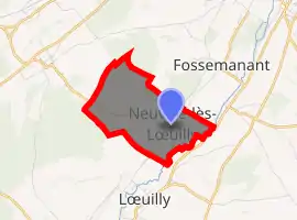
| |
 Neuville-lès-Lœuilly  Neuville-lès-Lœuilly | |
| Coordinates: 49°47′30″N 2°11′03″E | |
| Country | France |
| Region | Hauts-de-France |
| Department | Somme |
| Arrondissement | Amiens |
| Canton | Ailly-sur-Noye |
| Commune | Ô-de-Selle |
| Area 1 | 3.17 km2 (1.22 sq mi) |
| Population (2017)[1] | 127 |
| • Density | 40/km2 (100/sq mi) |
| Time zone | UTC+01:00 (CET) |
| • Summer (DST) | UTC+02:00 (CEST) |
| Postal code | 80160 |
| Elevation | 42–134 m (138–440 ft) (avg. 45 m or 148 ft) |
| 1 French Land Register data, which excludes lakes, ponds, glaciers > 1 km2 (0.386 sq mi or 247 acres) and river estuaries. | |
Geography
The commune is situated on the D61 road, some 7 miles (11 km) southwest of Amiens, on the banks of the river Selle.
Population
| Year | Pop. | ±% p.a. |
|---|---|---|
| 1962 | 75 | — |
| 1968 | 75 | +0.00% |
| 1975 | 91 | +2.80% |
| 1982 | 105 | +2.07% |
| 1990 | 104 | −0.12% |
| 1999 | 102 | −0.22% |
| 2006 | 108 | +0.82% |
| Source: EHESS[3] | ||
See also
References
- Téléchargement du fichier d'ensemble des populations légales en 2017, INSEE
- Arrêté préfectoral 7 December 2018 (in French)
- Des villages de Cassini aux communes d'aujourd'hui: Commune data sheet Neuville-lès-Lœuilly, EHESS. (in French)
| Wikimedia Commons has media related to Neuville-lès-Lœuilly. |
| Authority control |
|---|
This article is issued from Wikipedia. The text is licensed under Creative Commons - Attribution - Sharealike. Additional terms may apply for the media files.