New Mexico State Road 456
State Road 456 (NM 456) is a 58.784-mile-long (94.604 km) state highway in northeast New Mexico. NM 456's western terminus is in Folsom, New Mexico at NM 325, and the eastern terminus is at the Oklahoma state line west of Kenton, Oklahoma. At the state line, it becomes Oklahoma State Highway 325 (SH-325).
| ||||
|---|---|---|---|---|
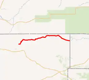
NM 456 highlighted in red | ||||
| Route information | ||||
| Maintained by NMDOT | ||||
| Length | 58.784 mi[1] (94.604 km) | |||
| Major junctions | ||||
| West end | ||||
| East end | ||||
| Location | ||||
| Counties | Union | |||
| Highway system | ||||
| ||||

Route description
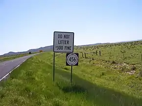
NM 456 parallels the Cimarron River for its entire length. It does not leave Union County. It is a former routing of U.S. Route 64 (US 64). Seventeen consecutive miles of it are unpaved, as per signs at each end of the unpaved stretch; their main purpose is to warn of potential impassibility in inclement weather. The stretch does have two spots of pavement, nevertheless: one about eight miles (13 km) in from the west, which is only about 100 feet (30 m) long, and one about fourteen miles (23 km) in from the west, which often confuses drivers since it is so near to the end of the advertised length (its pavement lasts about 0.5 miles (0.80 km)). The drive has some nice scenic views, including one reminiscent of Colorado's Garden of the Gods; but its remoteness is not amicable to tourists having automobile breakdowns.
Major intersections
The entire route is in Union County.
| Location | mi[2] | km | Destinations | Notes | |
|---|---|---|---|---|---|
| Folsom | 0.0 | 0.0 | Western terminus | ||
| 0.1 | 0.16 | Eastern terminus of NM 72 | |||
| | 7.6 | 12.2 | Southern terminus of NM 551 | ||
| | 30.1 | 48.4 | Northern terminus of NM 370 | ||
| | 57.9 | 93.2 | Northern terminus of NM 406 | ||
| | 58.8 | 94.6 | Continuation into Oklahoma | ||
| 1.000 mi = 1.609 km; 1.000 km = 0.621 mi | |||||
See also
 U.S. roads portal
References
- Riener, Steve. New Mexico State Highways 451-500. September 7, 2005. URL accessed 2 March 2006.
- Google (July 3, 2017). "Overview map of NM 456" (Map). Google Maps. Google. Retrieved July 3, 2017.