New Port, South Australia
New Port is a north-western suburb of Adelaide.[1]
| New Port Adelaide, South Australia | |||||||||||||||
|---|---|---|---|---|---|---|---|---|---|---|---|---|---|---|---|
 New Port | |||||||||||||||
| Coordinates | 34°50′43″S 138°29′37″E[1] | ||||||||||||||
| Population | 677 (2016 census)[2] | ||||||||||||||
| Established | 12 July 2007[3] | ||||||||||||||
| Postcode(s) | 5015[1] | ||||||||||||||
| Time zone | ACST (UTC+9:30) | ||||||||||||||
| • Summer (DST) | ACST (UTC+10:30) | ||||||||||||||
| LGA(s) | City of Port Adelaide Enfield | ||||||||||||||
| Region | Western Adelaide[1] | ||||||||||||||
| County | Adelaide[1] | ||||||||||||||
| State electorate(s) | Port Adelaide[4] | ||||||||||||||
| Federal Division(s) | Hindmarsh[5] | ||||||||||||||
| |||||||||||||||
| |||||||||||||||
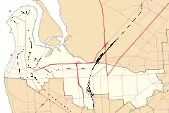
| Footnotes | LGA[1] Adjoining suburbs[1] | ||||||||||||||
It was created in 2007 from parts of the suburbs of Birkenhead, Ethelton, Glanville and Semaphore Park. The name "Newport Quays" had been requested but this was not supported by the relevant government authority. Because there is limited access to the suburb due to it being located between the Port River and the Outer Harbor railway line, the relevant Minister of the Crown considered the views of emergency service organisations before creating the new suburb. On 6 August 2009, its eastern boundary was extended in part to the centre-line of the Port River.[1][3][7]
The historic Fletcher's Slip Precinct at 230-246 Semaphore Road is listed on the South Australian Heritage Register.[8]
The 2016 Australian census which was conducted in August 2016 reports that New Port had 677 people living within its boundaries.[2]
New Port is located in the federal division of Hindmarsh, the state electoral district of Port Adelaide and the local government area of the City of Port Adelaide Enfield.[5][4]
References
- "Search results for 'New Port, SUB' with the following datasets selected - 'Suburbs and localities', 'Counties', 'Local Government Areas', 'SA Government Regions', 'Postcodes' and 'Gazetteer'". Location SA Map Viewer. Government of South Australia. Retrieved 17 July 2019.
- Australian Bureau of Statistics (27 June 2017). "New Port (State Suburb)". 2016 Census QuickStats. Retrieved 17 July 2019.

- Conlon, Patrick (12 July 2007). "GEOGRAPHICAL NAMES ACT 1991, Notice to Alter the Boundaries of Places" (PDF). The South Australian Government Gazette. Government of South Australia. p. 3043. Retrieved 17 July 2019.
- "Electoral district profiles - Port Adelaide (2018-2022 boundaries)". Electoral Commission SA. Retrieved 17 July 2019.
- "Profile of the electoral division of Hindmarsh (SA)". Australian Electoral Commission. Retrieved 17 July 2019.
- "Monthly climate statistics: Summary statistics ADELAIDE AIRPORT (nearest weather station)". Commonwealth of Australia , Bureau of Meteorology. Retrieved 15 July 2019.
- Kentish, Peter MacLaren (6 August 2009). "GEOGRAPHICAL NAMES ACT 1991, Notice to Alter the Boundaries of Places" (PDF). The South Australian Government Gazette. Government of South Australia. p. 3481. Retrieved 17 July 2019.
- "The Fletcher's Slip Precinct (including the former Fletcher's and Dunnikier Slipways Sites and Associated Structures)". South Australian Heritage Register. Department of Environment, Water and Natural Resources. Retrieved 15 August 2016.