New York State Route 80
New York State Route 80 (NY 80) is a 127.32-mile-long (204.90 km) west–east New York State Route located within Onondaga, Madison, Chenango, Otsego, Herkimer, and Montgomery counties in New York. Its western terminus is located at a junction with NY 175 in the city of Syracuse in Onondaga County, from which it actually runs in a north–south direction for 20 miles (32 km). The eastern terminus is located at a junction with NY 5 in the village of Nelliston in Montgomery County. The route is signed north–south from U.S. Route 20 (US 20) north to NY 5.
| ||||
|---|---|---|---|---|
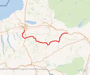
NY 80 highlighted in red | ||||
| Route information | ||||
| Maintained by NYSDOT, Madison County, the city of Syracuse, and the village of Cooperstown | ||||
| Length | 127.32 mi[1] (204.90 km) | |||
| Existed | late 1920s[2][3]–present | |||
| Major junctions | ||||
| West end | ||||
| East end | ||||
| Location | ||||
| Counties | Montgomery, Herkimer, Otsego, Chenango, Madison, Onondaga | |||
| Highway system | ||||
| ||||
Most of NY 80 between Sherburne and Cooperstown follows the routing of the Second Great Western Turnpike, a 19th-century toll road.
Route description
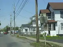
Although NY 80 follows an east–west alignment for most of its routing, two sections, located on its western and easternmost ends, are either signed as north–south (as is the case in northern Otsego County and Montgomery County) or physically oriented from north to south (such as in central Onondaga County).
Central Onondaga County
NY 80 begins at an intersection with NY 175 in southern Syracuse. The route, named Valley Drive, proceeds south through a largely residential area of Syracuse, following the path of Onondaga Creek through the area. 1 mile (1.6 km) to the south of NY 175 (and 1 mile (1.6 km) west of the interchange between Interstate 81 and Interstate 481), NY 80 intersects NY 173 (the old path of the Seneca Turnpike) near the southern city limits, which erroneously shows it as NY 80's western terminus in the 2017 route log.[4] Past NY 173, NY 80 parallels U.S. Route 11, I-81, and Onondaga Creek as all four head south out of Syracuse. At the city line, NY 80 becomes South Onondaga Road.
In Onondaga, south of Syracuse, NY 80 briefly enters the Onondaga Nation Territory, cutting across the northwestern corner of the reservation before turning to follow the western edge of the territory. NY 80 leaves to the southwest shortly after to serve South Onondaga and intersect U.S. Route 20 at Lords Corners. Past US 20, NY 80 continues south to Otisco (coming within 3 miles (5 km) of Otisco Lake), then curves southeast to the Tully hamlet of Vesper before turning fully to the east as it enters the village of Tully.
Tully to Sherburne
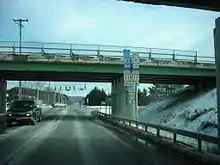
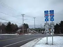
Just west of Tully, NY 80 intersects NY 11A, US 11, and NY 281 on opposite sides of an overpass carrying I-81 over NY 80. Here, all three routes, plus County Route 134 (CR 134) to the southwest, act as frontage roads for I-81 exit 14. US 11 joins NY 80 east of the interchange, following the route into Tully. US 11 heads south at the village center; NY 80, however, continues eastward, overlapping NY 91 near Fabius and NY 13 in western Madison County. Past NY 13, NY 80 continues southeast to Georgetown, where it meets NY 26. The two routes conjoin and head south into Chenango County before separating shortly after crossing the county line. Within Chenango County, NY 80 largely follows an east–west routing with a slight curve to the southeast. Incorporated municipalities 80 passes through within Chenango County include Smyrna, Sherburne, and New Berlin. East of Smyrna, NY 80 continues east, then curves to the southeast as it approaches the Otsego County line, delimited by the Unadilla River.
Former Second Great Western Turnpike
After crossing over the Chenango River and into Sherburne, NY 80 intersects NY 12 and begins to follow the old path of the Second Great Western Turnpike across Central New York. The route continues east to Columbus, where NY 80 separates from the old routing of the turnpike, at an intersection with CR 25. From Columbus NY 80 heads southeast to intersect NY 8 north of New Berlin. NY 80 turns south onto NY 8, overlapping the route to New Berlin, where the routes split at the village center. Outside of New Berlin, NY 80 heads northeast to Edmeston, where it rejoins the routing of the Second Great Western Turnpike at an intersection with CR 20. From Edmeston NY 80 heads east to intersect NY 51 in West Burlington, creating a brief, 1-mile (1.6 km) long concurrency between the two routes. Soon after NY 51 splits off NY 80 and continues north toward West Winfield.
.jpg.webp)
NY 80 heads due east from NY 51 to Otsego, where it meets NY 205. NY 205 joins NY 80 eastward into a small valley surrounding Oaks Creek, where the two routes meet NY 28. While NY 205 terminates here, NY 80 joins NY 28, following the route east across the creek and through the hamlet of Fly Creek.
To the east of Fly Creek, NY 28 and NY 80 ascend in elevation for a short distance prior to descending into a valley home to both the southern tip of Otsego Lake and the historic village of Cooperstown at its tip. Shortly after entering Cooperstown, the two routes split as NY 28 turns south at Chestnut Street, following the roadway out of the village toward Oneonta. NY 80, however, turns north onto Chestnut and continues into the heart of the village, where it intersects Main Street, a street lined with shops catering to tourists who visit the nearby National Baseball Hall of Fame. At this intersection, the Second Great Western Turnpike turned east; however, NY 80 continues north on Chestnut for another block before turning onto Lake Street and following the street out of the village.
Cooperstown to Nelliston
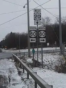
Outside of Cooperstown, NY 80 heads north along the western edge of Otsego Lake, passing by both the Fenimore Art Museum and the Farmers' Museum just north of Cooperstown, as well as the Glimmerglass Opera further up the road. Near the northern tip of the lake in Springfield, NY 80 intersects US 20 (the former Cherry Valley Turnpike) for the second time, where it becomes signed as a north-south route. The route continues northward, although the progression becomes more northeasterly as it crosses into the rural southeastern corner of Herkimer County. NY 80's stay within the county is brief, passing through the hamlet of Van Hornesville, home of the Owen D. Young Central School, established by noted American industrialist Owen D. Young. Young also founded RCA (the Radio Corporation of America). The route features no additional points of interest other than an intersection with NY 168 located at the midpoint between where NY 80 traverses the Otsego and Montgomery County lines.
Upon entering Montgomery County, NY 80 heads east to Fort Plain, a village located on the Mohawk River (here serving as the path of the Erie Canal), and becomes Main Street. At Kellogg Street, NY 80 is joined by NY 163 for two blocks to an intersection with NY 5S (Canal Street) in the heart of the village, although NY 163 is signed as ending at NY 80. Here, NY 163 ends while NY 5S and NY 80 come together on Main Street for a short overlap to Hancock Street, where NY 5S turns southeast and continues toward Canajoharie. NY 80, however, continues through and out of the village to the northeast on Main, Willett, and River Streets. Once on River, NY 80 passes under the New York State Thruway (Interstate 90) and crosses the Mohawk River before terminating at NY 5 on the opposite bank in Nelliston.
History
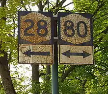
The routing of most of modern NY 80 between Sherburne and Cooperstown was originally part of the Second Great Western Turnpike, an early toll road established in 1801. The road began at the eastern bank of the Chenango River in Sherburne and proceeded east through Cooperstown to Cherry Valley,[5] where it connected to the First Great Western Turnpike and, later, the Third Great Western Turnpike. While what is now NY 80 dips south to serve New Berlin, the turnpike bypassed the settlement to the north, favoring a direct alignment between Columbus and Edmeston.[6]
When the first set of posted routes in New York were assigned in 1924, none of the former turnpike was incorporated into the system; however, a road between Cooperstown and Springfield along the western edge of Otsego Lake was designated as part of NY 28.[7] By 1926, a small segment of the ex-Second Great Western Turnpike between Edmeston and West Burlington was signed as part of NY 44.[8] The NY 80 designation was created in the late 1920s and originally assigned to a previously unnumbered roadway between U.S. Route 20 in Springfield and NY 10A in Indian Lake via Nelliston and Speculator. North of Nelliston, NY 80 followed what is now NY 10 and NY 30. From Arietta to Speculator, NY 80 overlapped NY 54 (now NY 8).[2][3]
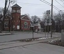
In the 1930 renumbering of state highways in New York, NY 80 was truncated to its current eastern terminus in Nelliston;[9] however, it was also extended southward and westward to NY 173 in Syracuse, replacing NY 28 from Springfield to Cooperstown[3][10] and NY 44 from New Berlin to West Burlington.[9] From Sherburne to Columbus and from West Burlington to Cooperstown, NY 80 utilized a previously unnumbered roadway that roughly followed the former alignment of the Second Great Western Turnpike. The remainder of the roadway between Syracuse and Sherburne, and from Columbus to New Berlin, was also previously unnumbered.[11] NY 80 was extended northward to its present terminus at NY 175 by 1932.[12]
The 2.5 miles (4.0 km) portion of NY 80 between Vincent Corners Road (CR 178) and the Madison County line was initially maintained by Onondaga County. On April 1, 1980, ownership and maintenance of this section of the route was transferred from the county to the state of New York as part of a highway maintenance swap between the two levels of government.[13]
Major intersections
| County | Location | mi[1] | km | Destinations | Notes |
|---|---|---|---|---|---|
| Onondaga | Syracuse | 0.00 | 0.00 | Western terminus | |
| 1.21 | 1.95 | ||||
| Onondaga | 9.67 | 15.56 | |||
| Town of Tully | 20.16 | 32.44 | Southern terminus of NY 11A; to exit 14 (I-81) | ||
| 20.18 | 32.48 | Northern terminus of NY 281; western terminus of US 11 / NY 80 overlap; to exit 14 (I-81) | |||
| Village of Tully | 20.83 | 33.52 | Eastern terminus of US 11 / NY 80 overlap | ||
| Town of Fabius | 24.36 | 39.20 | Western terminus of NY 80 / NY 91 overlap | ||
| Village of Fabius | 27.67 | 44.53 | Eastern terminus of NY 80 / NY 91 overlap | ||
| Madison | Town of Cazenovia | 34.29 | 55.18 | Northern terminus of NY 13 / NY 80 overlap | |
| Town of DeRuyter | 37.73 | 60.72 | Southern terminus of NY 13 / NY 80 overlap | ||
| Georgetown | 43.85 | 70.57 | Northern terminus of NY 26 / NY 80 overlap | ||
| Chenango | Otselic | 47.43 | 76.33 | Southern terminus of NY 26 / NY 80 overlap | |
| Village of Sherburne | 60.72 | 97.72 | |||
| Town of New Berlin | 71.61 | 115.25 | Northern terminus of NY 8 / NY 80 overlap | ||
| Village of New Berlin | 72.88 | 117.29 | Southern terminus of NY 8 / NY 80 overlap | ||
| Otsego | Burlington | 83.92 | 135.06 | Hamlet of West Burlington; western terminus of NY 51 / NY 80 overlap | |
| 84.98 | 136.76 | Eastern terminus of NY 51 / NY 80 overlap | |||
| Otsego | 91.68 | 147.54 | Western terminus of NY 80 / NY 205 overlap | ||
| 93.60 | 150.63 | Eastern terminus of NY 80 / NY 205 overlap; western terminus of NY 28 / NY 80 overlap; northern terminus of NY 205 | |||
| Cooperstown | 98.87 | 159.12 | Eastern terminus of NY 28 / NY 80 overlap | ||
| Springfield | 109.95 | 176.95 | |||
| Herkimer | Starkville | 118.21 | 190.24 | Eastern terminus of NY 168 | |
| Montgomery | Fort Plain | 126.57 | 203.69 | Western terminus of NY 80 / NY 163 overlap; signed western terminus of NY 163 | |
| 126.72 | 203.94 | Eastern terminus of NY 80 / NY 163 overlap; western terminus of NY 5S / NY 80 overlap; western terminus of NY 163 | |||
| 126.74 | 203.97 | Eastern terminus of NY 5S / NY 80 overlap | |||
| Nelliston | 127.32 | 204.90 | Eastern (northern) terminus | ||
1.000 mi = 1.609 km; 1.000 km = 0.621 mi
| |||||
References
- "2008 Traffic Volume Report for New York State" (PDF). New York State Department of Transportation. June 16, 2009. pp. 134–135. Archived from the original (PDF) on September 27, 2012. Retrieved January 31, 2010.
- Road Map of New York in Soconyland (Map). Cartography by General Drafting. Standard Oil Company of New York. 1927.
- New York in Soconyland (Map). Cartography by General Drafting. Standard Oil Company of New York. 1929.
- "Official Description of Highway Touring Routes, Bicycling Touring Routes, Scenic Byways, & Commemorative/Memorial Designations in New York State" (PDF). January 2017.
- New York State (1887). Laws of the State of New York: Passed at the Session of the Legislature Held in the Year 1801. Weed, Parsons. Retrieved December 18, 2007.
- Klein, Daniel B.; Majewski, John (February 22, 2003). "America's Toll Roads Heritage: The Achievements of Private Initiative in the 19th Century" (PDF). Retrieved November 6, 2010.
- "New York's Main Highways Designated by Numbers". The New York Times. December 21, 1924. p. XX9.
- Official Map Showing State Highways and other important roads (Map). Cartography by Rand McNally and Company. State of New York Department of Public Works. 1926.
- Dickinson, Leon A. (January 12, 1930). "New Signs for State Highways". The New York Times. p. 136.
- Road Map of New York (Map). Cartography by General Drafting. Standard Oil Company of New York. 1930.
- Automobile Legal Association (ALA) Automobile Green Book, 1930–31 and 1931–32 editions, (Scarborough Motor Guide Co., Boston, 1930 and 1931). The 1930–31 edition shows New York state routes prior to the 1930 renumbering
- Texaco Road Map – New York (Map). Cartography by Rand McNally and Company. Texas Oil Company. 1932.
- New York State Legislature. "New York State Highway Law § 341". Retrieved July 20, 2010.
External links
| Wikimedia Commons has media related to New York State Route 80. |
- New York State Route 80 at Alps' Roads • New York Routes
