Newborn, Georgia
Newborn is a town in Newton County, Georgia, United States. The population was 696 at the 2010 census.
Newborn, Georgia | |
|---|---|
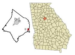 Location in Newton County and the state of Georgia | |
| Coordinates: 33°31′1″N 83°41′40″W | |
| Country | United States |
| State | Georgia |
| County | Newton |
| Area | |
| • Total | 1.60 sq mi (4.16 km2) |
| • Land | 1.59 sq mi (4.13 km2) |
| • Water | 0.01 sq mi (0.03 km2) |
| Elevation | 732 ft (223 m) |
| Population (2010) | |
| • Total | 696 |
| • Estimate (2019)[2] | 783 |
| • Density | 490.91/sq mi (189.55/km2) |
| Time zone | UTC-5 (Eastern (EST)) |
| • Summer (DST) | UTC-4 (EDT) |
| ZIP code | 30056 |
| Area code(s) | 770 |
| FIPS code | 13-54656[3] |
| GNIS feature ID | 0319570[4] |
| Website | http://newbornga.com |
History
After hearing a sermon by 19th-century preacher Samuel Porter Jones, the town adopted the name "Newborn", after the concept of born again in Evangelical Christianity.[5] The Georgia General Assembly incorporated Newborn as a town in 1894.[6]
Geography
Newborn is located at 33°31′1″N 83°41′40″W (33.516980, -83.694572).[7]
According to the United States Census Bureau, the town has a total area of 1.6 square miles (4.1 km2), all land.
Demographics
| Historical population | |||
|---|---|---|---|
| Census | Pop. | %± | |
| 1890 | 230 | — | |
| 1900 | 345 | 50.0% | |
| 1910 | 475 | 37.7% | |
| 1920 | 409 | −13.9% | |
| 1930 | 332 | −18.8% | |
| 1940 | 307 | −7.5% | |
| 1950 | 298 | −2.9% | |
| 1960 | 283 | −5.0% | |
| 1970 | 269 | −4.9% | |
| 1980 | 387 | 43.9% | |
| 1990 | 404 | 4.4% | |
| 2000 | 520 | 28.7% | |
| 2010 | 696 | 33.8% | |
| 2019 (est.) | 783 | [2] | 12.5% |
| U.S. Decennial Census[8] | |||
As of the census[3] of 2000, there were 520 people, 181 households, and 148 families living in the town. The population density was 325.6 people per square mile (125.5/km2). There were 187 housing units at an average density of 117.1 per square mile (45.1/km2). The racial makeup of the town was 71.35% White, 25.58% African American, 0.96% Native American, 1.35% from other races, and 0.77% from two or more races. Hispanic or Latino of any race were 2.88% of the population.
There were 181 households, out of which 42.5% had children under the age of 18 living with them, 57.5% were married couples living together, 18.8% had a female householder with no husband present, and 17.7% were non-families. 16.6% of all households were made up of individuals, and 8.3% had someone living alone who was 65 years of age or older. The average household size was 2.87 and the average family size was 3.17.
In the town, the population was spread out, with 28.8% under the age of 18, 9.0% from 18 to 24, 30.2% from 25 to 44, 23.8% from 45 to 64, and 8.1% who were 65 years of age or older. The median age was 32 years. For every 100 females, there were 94.8 males. For every 100 females age 18 and over, there were 85.9 males.
The median income for a household in the town was $37,692, and the median income for a family was $39,000. Males had a median income of $36,875 versus $24,904 for females. The per capita income for the town was $14,210. About 7.9% of families and 10.8% of the population were below the poverty line, including 10.5% of those under age 18 and 10.3% of those age 65 or over.
References
- "2019 U.S. Gazetteer Files". United States Census Bureau. Retrieved July 9, 2020.
- "Population and Housing Unit Estimates". United States Census Bureau. May 24, 2020. Retrieved May 27, 2020.
- "U.S. Census website". United States Census Bureau. Retrieved 2008-01-31.
- "US Board on Geographic Names". United States Geological Survey. 2007-10-25. Retrieved 2008-01-31.
- Krakow, Kenneth K. (1975). Georgia Place-Names: Their History and Origins (PDF). Macon, GA: Winship Press. p. 157. ISBN 0-915430-00-2.
- Acts of the General Assembly of the State of Georgia. Clark & Hines, State Printers. 1895. p. 174.
- "US Gazetteer files: 2010, 2000, and 1990". United States Census Bureau. 2011-02-12. Retrieved 2011-04-23.
- "Census of Population and Housing". Census.gov. Retrieved June 4, 2015.
Municipalities and communities of Newton County, Georgia, United States | ||
|---|---|---|
| Cities | 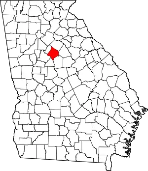 Map of Georgia highlighting Newton County | |
| Town | ||
| Unincorporated communities | ||
| Footnotes | ‡This populated place also has portions in an adjacent county or counties | |
| ||
