Ngao District
Ngao (Thai: งาว, pronounced [ŋāːw]) is a district (amphoe) of Lampang Province, northern Thailand.
Ngao
งาว | |
|---|---|
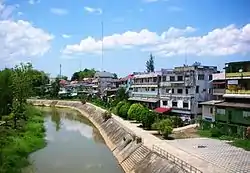 Ngao River flowing by Ngao town | |
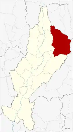 District location in Lampang Province | |
| Coordinates: 18°46′36″N 99°58′12″E | |
| Country | Thailand |
| Province | Lampang |
| Seat | Na Kae |
| Area | |
| • Total | 1,815.31 km2 (700.90 sq mi) |
| Population (2019) | |
| • Total | 54,723 |
| • Density | 32.4/km2 (84/sq mi) |
| Time zone | UTC+7 (ICT) |
| Postal code | 52110 |
| Geocode | 5205 |
Geography
Neighboring districts are (from the south clockwise): Mae Mo, Chae Hom and Wang Nuea of Lampang Province, Mueang Phayao and Dok Khamtai of Phayao Province, and Song of Phrae Province.
The Phi Pan Nam Mountains dominate the landscape of the district. A section of Tham Pha Thai National Park is in Ngao District.
History
Originally named Mueang Ngao, the district was renamed Ngao in 1938, as the prefix Mueang was then reserved for the capital districts of the provinces.[1]
Administration
Central administration
The district Ngao is subdivided into 10 subdistricts (Tambon), which are further subdivided into 85 administrative villages (Muban).
| No. | Name | Thai | Villages | Pop.[2] |
|---|---|---|---|---|
| 1. | Luang Nuea | หลวงเหนือ | 6 | 4,208 |
| 2. | Luang Tai | หลวงใต้ | 8 | 5,530 |
| 3. | Ban Pong | บ้านโป่ง | 12 | 6,757 |
| 4. | Ban Rong | บ้านร้อง | 13 | 6,297 |
| 5. | Pong Tao | ปงเตา | 13 | 7,292 |
| 6. | Na Kae | นาแก | 6 | 4,724 |
| 7. | Ban On | บ้านอ้อน | 8 | 4,523 |
| 8. | Ban Haeng | บ้านแหง | 8 | 6,219 |
| 9. | Ban Huat | บ้านหวด | 6 | 4,877 |
| 10. | Mae Tip | แม่ตีบ | 5 | 4,296 |
Local administration
There are 2 subdistrict municipalities (Thesaban Tambon) in the district:
- Luang Nuea (Thai: เทศบาลตำบลหลวงเหนือ) consisting of the complete subdistrict Luang Nuea.
- Luang Tai (Thai: เทศบาลตำบลหลวงใต้) consisting of the complete subdistrict Luang Tai.
There are 8 subdistrict administrative organizations (SAO) in the district:
- Ban Pong (Thai: องค์การบริหารส่วนตำบลบ้านโป่ง) consisting of the complete subdistrict Ban Pong.
- Ban Rong (Thai: องค์การบริหารส่วนตำบลบ้านร้อง) consisting of the complete subdistrict Ban Rong.
- Pong Tao (Thai: องค์การบริหารส่วนตำบลปงเตา) consisting of the complete subdistrict Pong Tao.
- Na Kae (Thai: องค์การบริหารส่วนตำบลนาแก) consisting of the complete subdistrict Na Kae.
- Ban On (Thai: องค์การบริหารส่วนตำบลบ้านอ้อน) consisting of the complete subdistrict Ban On.
- Ban Haeng (Thai: องค์การบริหารส่วนตำบลบ้านแหง) consisting of the complete subdistrict Ban Haeng.
- Ban Huat (Thai: องค์การบริหารส่วนตำบลบ้านหวด) consisting of the complete subdistrict Ban Huat.
- Mae Tip (Thai: องค์การบริหารส่วนตำบลแม่ตีบ) consisting of the complete subdistrict Mae Tip.
References
- พระราชกฤษฎีกาเปลี่ยนนามจังหวัด และอำเภอบางแห่ง พุทธศักราช ๒๔๘๑ (PDF). Royal Gazette (in Thai). 55 (ก): 658–666. November 14, 1938.
- "Population statistics 2019" (in Thai). Department of Provincial Administration. Retrieved 2020-11-22.
