Niantic, Illinois
Niantic is a village in Macon County, Illinois, United States whose population was 707 at the 2010 census. It is included in the Decatur, Illinois Metropolitan Statistical Area.
Niantic | |
|---|---|
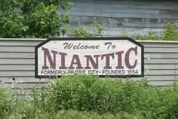 A sign welcoming travelers to Niantic, Illinois | |
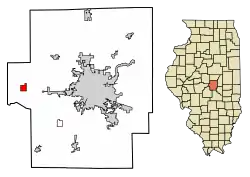 Location of Niantic in Macon County, Illinois | |
.svg.png.webp) Location of Illinois in the United States | |
| Coordinates: 39°51′18″N 89°9′56″W | |
| Country | United States |
| State | Illinois |
| County | Macon |
| Area | |
| • Total | 1.04 sq mi (2.69 km2) |
| • Land | 1.04 sq mi (2.69 km2) |
| • Water | 0.00 sq mi (0.00 km2) |
| Elevation | 601 ft (183 m) |
| Population (2010) | |
| • Total | 707 |
| • Estimate (2019)[2] | 655 |
| • Density | 630.41/sq mi (243.35/km2) |
| Time zone | UTC-6 (CST) |
| • Summer (DST) | UTC-5 (CDT) |
| ZIP Code(s) | 62551 |
| Area code(s) | 217 |
| FIPS code | 17-52961 |
| Wikimedia Commons | Niantic, Illinois |
History
Niantic was among the earliest settled townships in the county. In 1825, Joseph Strickling, a native of Ohio, first settled in what is now Niantic township. He erected the first log cabin in Niantic.
From 1825 to 1840, there were very few permanent settlers. The township's population varied on settlers setting up temporary homes on their way to the West Coast. The first schoolhouse was a log cabin built in 1847.
The Patawatomi Death Trail ran through Niantic in 1838.
Education
Niantic is home to Sangamon Valley High School, which is part of Sangamon Valley C.U.S.D. #9.
Geography
Niantic is located at 39°51′18″N 89°09′56″W.[3]
According to the 2010 census, Niantic has a total area of 1.07 square miles (2.77 km2), all land.[4]
Demographics
| Historical population | |||
|---|---|---|---|
| Census | Pop. | %± | |
| 1880 | 321 | — | |
| 1890 | 639 | 99.1% | |
| 1900 | 654 | 2.3% | |
| 1910 | 685 | 4.7% | |
| 1920 | 613 | −10.5% | |
| 1930 | 589 | −3.9% | |
| 1940 | 625 | 6.1% | |
| 1950 | 625 | 0.0% | |
| 1960 | 629 | 0.6% | |
| 1970 | 705 | 12.1% | |
| 1980 | 761 | 7.9% | |
| 1990 | 647 | −15.0% | |
| 2000 | 738 | 14.1% | |
| 2010 | 707 | −4.2% | |
| 2019 (est.) | 655 | [2] | −7.4% |
| U.S. Decennial Census[5] | |||
As of the census[6] of 2000, there were 738 people, 269 households, and 200 families residing in the village. The population density was 686.7 people per square mile (266.3/km2). There were 299 housing units at an average density of 278.2 per square mile (107.9/km2). The racial makeup of the village was 99.59% White, 0.14% Native American, and 0.27% from two or more races. Hispanic or Latino people of any race were 0.68% of the population.
There were 269 households, out of which 37.9% had children under the age of 18 living with them, 62.8% were married couples living together, 7.4% had a female householder with no husband present, and 25.3% were non-families. 21.6% of all households were made up of individuals, and 9.7% had someone living alone who was 65 years of age or older. The average household size was 2.74 and the average family size was 3.18.
In the village, the population was spread out, with 31.2% under the age of 18, 7.3% from 18 to 24, 28.7% from 25 to 44, 19.5% from 45 to 64, and 13.3% who were 65 years of age or older. The median age was 33 years. For every 100 females, there were 99.5 males. For every 100 females age 18 and over, there were 94.6 males.
The median income for a household in the village was $41,184, and the median income for a family was $42,500. Males had a median income of $33,750 versus $21,500 for females. The per capita income for the village was $19,448. About 5.7% of families and 7.8% of the population were below the poverty line, including 9.4% of those under age 18 and 9.2% of those age 65 or over.
Notable people
- Art Phelan, third baseman for the Chicago Cubs and Cincinnati Reds; born in Niantic
- John L. Rotz, jockey in National Museum of Racing and Hall of Fame; born in Niantic
Gallery
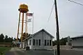 Niantic Illinois Village Hall and water tower
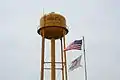 Niantic water tower
 Niantic Illinois Fire Station
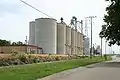 Niantic Illinois grain elevators
References
- "2019 U.S. Gazetteer Files". United States Census Bureau. Retrieved July 14, 2020.
- "Population and Housing Unit Estimates". United States Census Bureau. May 24, 2020. Retrieved May 27, 2020.
- "US Gazetteer files: 2010, 2000, and 1990". United States Census Bureau. 2011-02-12. Retrieved 2011-04-23.
- "G001 - Geographic Identifiers - 2010 Census Summary File 1". United States Census Bureau. Archived from the original on 2020-02-13. Retrieved 2015-12-25.
- "Census of Population and Housing". Census.gov. Retrieved June 4, 2015.
- "U.S. Census website". United States Census Bureau. Retrieved 2008-01-31.
Municipalities and communities of Macon County, Illinois, United States | ||
|---|---|---|
| Cities | Map of Illinois highlighting Macon County | |
| Villages | ||
| Townships | ||
| CDP | ||
| Other unincorporated communities |
| |
| Ghost towns |
| |
| ||