Nova Scotia Route 358
Route 358 is a collector road in the Canadian province of Nova Scotia.
| ||||
|---|---|---|---|---|
| Route information | ||||
| Maintained by Nova Scotia Department of Transportation and Infrastructure Renewal | ||||
| Length | 30 km[1] (19 mi) | |||
| Major junctions | ||||
| South end | ||||
| North end | Rogers Road in Scot's Bay | |||
| Highway system | ||||
| Provincial highways in Nova Scotia 100-series
| ||||
It is located in Kings County and connects Greenwich at Trunk 1 with Scot's Bay. Between Port Williams and Canard, the highway crosses the Canard River and the low fields of the riverbank in a wide curve, tracing the path of the Grand Dyke, built by the Acadians about 1750.[2]
Communities
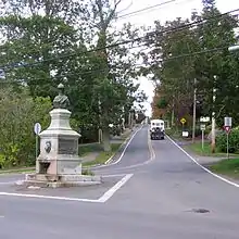
Route 358 in Canning
Parks
- Scots Bay Provincial Park
- Blomidon Provincial Park
- Cape Split Provincial Park Reserve
History
The section of the Collector Highway 358 from Canard to Canning was designated as part of the Trunk Highway 41.
References
- Atlantic Canada Back Road Atlas ISBN 978-1-55368-618-7 Page 66
- Marjory Whitelaw, The Wellington Dyke Nimbus Publishing (1997), page 24
This article is issued from Wikipedia. The text is licensed under Creative Commons - Attribution - Sharealike. Additional terms may apply for the media files.