Nowe
Nowe [ˈnɔvɛ] (German: Neuenburg in Westpreußen) is a town in Świecie County, Kuyavian-Pomeranian Voivodeship, Poland, with 6,270 inhabitants (2004).
Nowe | |
|---|---|
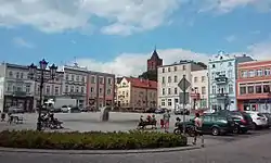 Marketplace | |
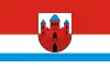 Flag 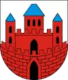 Coat of arms | |
 Nowe  Nowe | |
| Coordinates: 53°38′58″N 18°43′32″E | |
| Country | |
| Voivodeship | Kuyavian-Pomeranian |
| County | Świecie |
| Gmina | Gmina Nowe |
| Area | |
| • Total | 3.57 km2 (1.38 sq mi) |
| Population (2006) | |
| • Total | 6,252 |
| • Density | 1,800/km2 (4,500/sq mi) |
| Time zone | UTC+1 (CET) |
| • Summer (DST) | UTC+2 (CEST) |
| Postal code | 86-170 |
Geographical location
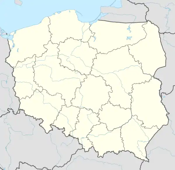
Nowe is located approximately 75 kilometers north-east of Bydgoszcz and 80 kilometers south of Gdańsk in an elevated position on the river Vistula. It is located in the historic region of Gdańsk Pomerania.
History
The medieval name of the town was Novo Castro, or Nowy Gród in Polish. The town was founded in 1185 by Sobieslaw I, Duke of Pomerania.[1] In 1266 the settlement is mentioned as a fortess place. In 1282 the Franciscan friars settled down here. It was part of the medieval Kingdom of Poland. In 1301 King Wenceslaus II of Poland granted the town to Piotr Swienca.[2]
In 1308 the town was invaded, destroyed and later annexed by the Teutonic Knights.[3] In 1350 it was granted new privileges, later confirmed by King Sigismund I the Old in 1528.[4] Poles recaptured the town after the Battle of Grunwald in 1410, however, after the 1411 peace treaty it fell back to the Teutonic Knights.[4]
In 1440 the town joined the Prussian Confederation, which opposed Teutonic rule,[5] and upon the request of which King Casimir IV Jagiellon re-incorporated the territory to the Kingdom of Poland in 1454. During the subsequent Thirteen Years' War it was captured by the Teutonic Knights in 1458, besieged by Poles in August 1464, and the Teutonic Knights capitulated in February 1465,[6] losing their last stronghold on the west bank of the Vistula. It was reintegrated with Poland, the castle became the seat of the local starosts[6] and the next year the Teutonic Knights renounced any claims to the town. In 1626 and 1655 Nowe was besieged by Sweden.[7]
In 1772, after the First Partition of Poland, the town was annexed by the Kingdom of Prussia and was subject to Germanisation policies, however, in the late 19th century it was still mainly populated by Poles.[8] Up to the end of World War I, as Neuenburg, it belonged to Kreis Schwetz in the administrative district of Regierungsbezirk Marienwerder in the Province of West Prussia of the German Reich. In 1920, after World War I the town became part of the re-established Republic of Poland.
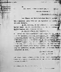
After the German Invasion of Poland it was annexed into the Third Reich, from 1939 to 1945. During the German occupation, Poles were subject to mass arrests and executions as part of the Intelligenzaktion Pommern.[9] The Germans established a prison in the local courthouse, in which around 200 Poles were imprisoned and tortured in September and October 1939, before being murdered in large massacres in the nearby village of Grupa.[9] Shortly before the end of World War II, Nowe was captured by the Red Army. After the end of the war the town became part of Poland once more.
.jpg.webp)
Sights
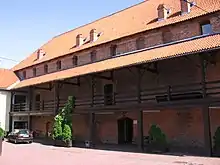
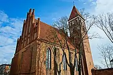
The landmarks of Nowe are the Old Town with the Rynek (market square) filled with colourful historic townhouses, the Gothic churches of Saint Matthew and Saint Maximilian Kolbe, and the medieval Nowe Castle, which today houses the Culture Centre.
References
- Johann Friedrich Goldbeck: Volständige Topographie des Königreichs Preußen. Part II: Topographie von West-Preußen. Marienwerder 1789, p. 65, paragraph 3.
- Słownik geograficzny Królestwa Polskiego i innych krajów słowiańskich, Tom VII, Warszawa, 1886, p. 215 (in Polish)
- Słownik geograficzny Królestwa Polskiego i innych krajów słowiańskich, Tom VII, Warszawa, 1886, p. 215-216
- Słownik geograficzny Królestwa Polskiego i innych krajów słowiańskich, Tom VII, Warszawa, 1886, p. 216
- Karol Górski, Związek Pruski i poddanie się Prus Polsce: zbiór tekstów źródłowych, Instytut Zachodni, Poznań, 1949, p. XXXVII (in Polish)
- Słownik geograficzny Królestwa Polskiego i innych krajów słowiańskich, Tom VII, Warszawa, 1886, p. 217
- Słownik geograficzny Królestwa Polskiego i innych krajów słowiańskich, Tom VII, Warszawa, 1886, p. 218
- Słownik geograficzny Królestwa Polskiego i innych krajów słowiańskich, Tom VII, Warszawa, 1886, p. 214
- Maria Wardzyńska, Był rok 1939. Operacja niemieckiej policji bezpieczeństwa w Polsce. Intelligenzaktion, IPN, Warszawa, 2009, p. 167 (in Polish)
- Der Große Brockhaus, 15th edition, Vol. 13, Leipzig 1932, p. 295.
- Michael Rademacher: Deutsche Verwaltungsgeschichte Provinz Westpreußen, Kreis Schwetz (2006).
- August Eduard Preuß: Preußische Landes- und Volkskunde, Königsberg 1835, pp. 386–387.
| Town and seat | | |
|---|---|---|
| Villages | ||
