Ntungamo
Ntungamo is a town in the Western Region of Uganda. It is the largest town in Ntungamo District and the site of the district headquarters.[2]
Ntungamo
Ntungamo Municipality | |
|---|---|
 Ntungamo Location in Uganda | |
| Coordinates: 00°52′55″S 30°15′55″E | |
| Country | |
| Region | Western Region of Uganda |
| Sub-region | Ankole sub-region |
| District | Ntungamo District |
| Elevation | 4,600 ft (1,400 m) |
| Population (2014 Census) | |
| • Total | 18,854.[1] |
Location
Ntungamo is about 65 kilometres (40 mi), by road, southwest of the city of Mbarara, the largest city in Uganda's Western Region.[3] This is approximately 78 kilometres (48 mi), by road, northeast of Kabale City, along the Mbarara–Ntungamo–Kabale–Katuna Road.[4] The coordinates of the town are 0°52'55.0"S, 30°15'55.0"E (Latitude:-0.881944; Longitude:30.265278).[5]
Overview
Ntungamo is a growing town, located on the Mbarara-Kabale highway. A tarmacked road branches off at Ntungamo to lead to Rukungiri. The town, as of November 2013, was grappling with rapid growth, sanitation, and water supply issues.[6]
Population
The 2002 national census put the population of the town at 13,320. In 2010, the Uganda Bureau of Statistics (UBOS) estimated the population at 16,100. In 2011, UBOS estimated the mid-year population at 16,400.[7] In 2014, the national population census conducted in August that year put the population at 18,854.[1]
Points of interest
The following additional points of interest lie within the town limits or near the town borders:[5]
1. The offices of Ntungamo Town Council
2. Ntungamo Central Market
3. Karegyeya Rock Shelter
4. Itojo Hospital, a 120-bed public hospital owned by the Uganda Ministry of Health, and administered by the Ntungamo District Local administration. It is located 22 kilometres (14 mi), northeast of Ntungamo, on the Mbarara-Kabale road 5. The Ntungamo-Rukungiri Road, an all-tarmac road, starting here and ending in Rukungiri, 51 kilometres (32 mi) to the northwest.[8]
6. The Mbarara–Ntungamo–Kabale–Katuna Road passes through the town in a general north to south direction.
Notable people
- Eriya Kategaya, politician and lawyer, born raised and buried here
- Janet Museveni, politician and wife of president Yoweri Museveni, was born here in 1948
- Yoweri Museveni, military general and politician. President of Uganda since 1986. He and his wife maintain a home in the town.[2]
References
- UBOS (29 November 2014). "The Population of The Regions of the Republic of Uganda And All Cities And Towns of More Than 15,000 Inhabitants". Citypopulation.de Quoting Uganda Bureau of Statistics (UBOS). Retrieved 28 February 2015.
- Western-uganda.net (2021). "About Ntungamo Town, Western Region, Uganda". Western-uganda.net. Retrieved 5 January 2021.
- Google (5 January 2021). "Distance Between Mbarara, Uganda And Ntungamo, Uganda" (Map). Google Maps. Google. Retrieved 5 January 2021.
- Google (5 January 2021). "Road Distance Between Kabale, Uganda And Ntungamo, Uganda" (Map). Google Maps. Google. Retrieved 5 January 2021.
- Google (5 January 2021). "Location of Ntungamo, Western Region, Uganda" (Map). Google Maps. Google. Retrieved 5 January 2021.
- Ssenkaaba, Stephen (8 November 2013). "Ntungamo's Growth Blind to Hygiene". New Vision. Retrieved 8 June 2014.
- UBOS. "Estimated Population of Ntungamo In 2002, 2010 And 2011" (PDF). Uganda Bureau of Statistics (UBOS). Archived from the original (PDF) on 2013-01-19. Retrieved 8 June 2014.
- Google (5 January 2021). "Road Distance Between Ntungamo, Uganda And Rukungiri, Uganda" (Map). Google Maps. Google. Retrieved 5 January 2021.
External links
Capital: Ntungamo | ||
| Towns and villages | 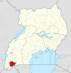 | |
| Economy | ||
| Health | ||
| Transport | ||
| Notable people | ||
