Ocheyedan River
The Ocheyedan River is a tributary of the Little Sioux River, 58 mi (93 km) long, in southwestern Minnesota and northwestern Iowa in the United States. Via the Little Sioux and Missouri Rivers, it is part of the watershed of the Mississippi River. The river has been channelized for much of its length.
| Ocheyedan River | |
|---|---|
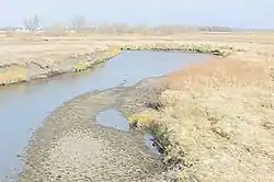 The Ocheyedan River near Spencer in Clay County, Iowa | |
| Location | |
| Country | US |
| State | Iowa, Minnesota |
| District | Clay County, Iowa, O'Brien County, Iowa, Osceola County, Iowa |
| Physical characteristics | |
| Source | |
| • coordinates | 43.547°N 95.638°W |
| Mouth | Missouri River |
• coordinates | 43.136°N 95.153°W |
| Discharge | |
| • location | Spencer, Iowa |
| • average | 259 cu/ft. per sec.[1] |
Course
The Ocheyedan River flows from Ocheda Lake in Nobles County, Minnesota, 3 mi (4.8 km) south of Worthington, and flows generally southeastwardly through Osceola, O'Brien and Clay Counties in Iowa. It joins the Little Sioux River at the town of Spencer.
In Osceola County, the river collects the short Little Ocheyedan River, which rises near Hawkeye Point (the highest elevation in Iowa) and flows southeastwardly.
See also
- List of Iowa rivers
- List of Minnesota rivers
Sources
- Columbia Gazetteer of North America entry
- DeLorme (1998). Iowa Atlas & Gazetteer. Yarmouth, Maine: DeLorme. ISBN 0-89933-214-5.
- DeLorme (1994). Minnesota Atlas & Gazetteer. Yarmouth, Maine: DeLorme. ISBN 0-89933-222-6.
- U.S. Geological Survey Geographic Names Information System: Ocheyedan River
- U.S. Geological Survey Geographic Names Information System: Little Ocheyedan River
This article is issued from Wikipedia. The text is licensed under Creative Commons - Attribution - Sharealike. Additional terms may apply for the media files.