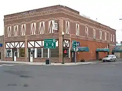
Odessa, Washington
Odessa is a town in Lincoln County, Washington, United States. The population was 910 at the 2010 census.
Odessa | |
|---|---|
| Odessa, Washington | |
 | |
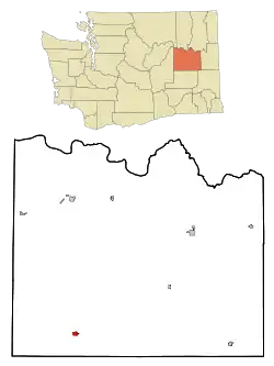 Location of Odessa, Washington | |
| Coordinates: 47°20′N 118°41′W | |
| Country | United States |
| State | Washington |
| County | Lincoln |
| Area | |
| • Total | 0.81 sq mi (2.10 km2) |
| • Land | 0.81 sq mi (2.10 km2) |
| • Water | 0.00 sq mi (0.00 km2) |
| Elevation | 1,549 ft (472 m) |
| Population | |
| • Total | 910 |
| • Estimate (2019)[3] | 894 |
| • Density | 1,100.99/sq mi (424.93/km2) |
| Time zone | UTC-8 (Pacific (PST)) |
| • Summer (DST) | UTC-7 (PDT) |
| ZIP codes | 99144, 99159 |
| Area code(s) | 509 |
| FIPS code | 53-50745[4] |
| GNIS feature ID | 1507143[5] |
| Website | Town of Odessa |
History
A post office called Odessa has been in operation since 1898.[6] The community was named after Odessa, in Ukraine.[7]
Odessa was officially incorporated on September 25, 1902.
Geography
Odessa is located at 47°20′N 118°41′W (47.3332, -118.6882).[8]
According to the United States Census Bureau, the town has a total area of 0.82 square miles (2.12 km2), all of it land.[9]
Climate
Odessa has a Cold semi-arid climate (BSk) according to the Köppen climate classification system.
| Climate data for Odessa | |||||||||||||
|---|---|---|---|---|---|---|---|---|---|---|---|---|---|
| Month | Jan | Feb | Mar | Apr | May | Jun | Jul | Aug | Sep | Oct | Nov | Dec | Year |
| Record high °F (°C) | 80 (27) |
68 (20) |
83 (28) |
93 (34) |
100 (38) |
110 (43) |
112 (44) |
112 (44) |
102 (39) |
91 (33) |
73 (23) |
74 (23) |
112 (44) |
| Average high °F (°C) | 35 (2) |
42.2 (5.7) |
53.3 (11.8) |
63.3 (17.4) |
72.1 (22.3) |
79.5 (26.4) |
88.6 (31.4) |
87.1 (30.6) |
77.8 (25.4) |
63.8 (17.7) |
46.4 (8.0) |
36.6 (2.6) |
62.1 (16.7) |
| Average low °F (°C) | 19.9 (−6.7) |
24.5 (−4.2) |
29.6 (−1.3) |
34.3 (1.3) |
40.7 (4.8) |
47.4 (8.6) |
52.4 (11.3) |
50.9 (10.5) |
43.1 (6.2) |
34.6 (1.4) |
27.7 (−2.4) |
22.1 (−5.5) |
35.6 (2.0) |
| Record low °F (°C) | −33 (−36) |
−27 (−33) |
4 (−16) |
10 (−12) |
20 (−7) |
15 (−9) |
32 (0) |
25 (−4) |
15 (−9) |
−2 (−19) |
−17 (−27) |
−24 (−31) |
−33 (−36) |
| Average precipitation inches (mm) | 1.26 (32) |
0.91 (23) |
0.88 (22) |
0.68 (17) |
0.85 (22) |
0.8 (20) |
0.38 (9.7) |
0.29 (7.4) |
0.51 (13) |
0.75 (19) |
1.38 (35) |
1.43 (36) |
10.14 (258) |
| Average snowfall inches (cm) | 5.7 (14) |
2.3 (5.8) |
0.8 (2.0) |
0.1 (0.25) |
0 (0) |
0 (0) |
0 (0) |
0 (0) |
0 (0) |
0.1 (0.25) |
1.9 (4.8) |
5.4 (14) |
16.2 (41) |
| Average precipitation days | 9 | 7 | 7 | 6 | 6 | 5 | 3 | 3 | 4 | 6 | 9 | 10 | 75 |
| Source: [10] | |||||||||||||
Demographics
| Historical population | |||
|---|---|---|---|
| Census | Pop. | %± | |
| 1910 | 885 | — | |
| 1920 | 1,050 | 18.6% | |
| 1930 | 830 | −21.0% | |
| 1940 | 816 | −1.7% | |
| 1950 | 1,127 | 38.1% | |
| 1960 | 1,231 | 9.2% | |
| 1970 | 1,074 | −12.8% | |
| 1980 | 1,009 | −6.1% | |
| 1990 | 935 | −7.3% | |
| 2000 | 957 | 2.4% | |
| 2010 | 910 | −4.9% | |
| 2019 (est.) | 894 | [3] | −1.8% |
| U.S. Decennial Census[11] | |||
2010 census
As of the census[2] of 2010, there were 910 people, 394 households, and 253 families living in the town. The population density was 1,109.8 inhabitants per square mile (428.5/km2). There were 460 housing units at an average density of 561.0 per square mile (216.6/km2). The racial makeup of the town was 95.5% White, 0.3% African American, 1.3% Native American, 0.2% Asian, 1.0% from other races, and 1.6% from two or more races. Hispanic or Latino of any race were 2.6% of the population.
There were 394 households, of which 23.9% had children under the age of 18 living with them, 50.5% were married couples living together, 8.4% had a female householder with no husband present, 5.3% had a male householder with no wife present, and 35.8% were non-families. 32.7% of all households were made up of individuals, and 17.7% had someone living alone who was 65 years of age or older. The average household size was 2.23 and the average family size was 2.78.
The median age in the town was 50.8 years. 21.9% of residents were under the age of 18; 4.8% were between the ages of 18 and 24; 15.6% were from 25 to 44; 31.3% were from 45 to 64; and 26.4% were 65 years of age or older. The gender makeup of the town was 47.1% male and 52.9% female.
2000 census
As of the census[4] of 2000, there were 957 people, 405 households, and 268 families living in the town. The population density was 1,170.9 people per square mile (450.6/km2). There were 472 housing units at an average density of 577.5 per square mile (222.2/km2). The racial makeup of the town was 97.39% White, 0.21% African American, 0.52% Native American, 0.94% from other races, and 0.94% from two or more races. Hispanic or Latino of any race were 1.25% of the population.
There were 405 households, out of which 26.7% had children under the age of 18 living with them, 56.0% were married couples living together, 6.9% had a female householder with no husband present, and 33.6% were non-families. 29.1% of all households were made up of individuals, and 17.3% had someone living alone who was 65 years of age or older. The average household size was 2.28 and the average family size was 2.83.
In the town, the population was spread out, with 23.7% under the age of 18, 4.4% from 18 to 24, 21.2% from 25 to 44, 23.5% from 45 to 64, and 27.2% who were 65 years of age or older. The median age was 46 years. For every 100 females, there were 93.7 males. For every 100 females age 18 and over, there were 88.1 males.
The median income for a household in the town was $34,038, and the median income for a family was $38,594. Males had a median income of $30,764 versus $20,357 for females. The per capita income for the town was $17,461. About 7.9% of families and 10.6% of the population were below the poverty line, including 14.8% of those under age 18 and 9.9% of those age 65 or over.
Special events
Each year the town hosts the Odessa Deutschesfest, which occurs on the third weekend in September. Several thousand guests travel from distant places to experience the German festival. Attractions include the Sausage Bowl (Odessa High School 8-man football), Quilt Display, Art Show, Horseshoe Tournament, Historisches Museum, Bed and Tricycle races, Flea Market, Parade featuring modern farm machinery, Jugend (Youth) Garten, German Biergarten, and food circus. Some of the foods featured at the event include traditional German sausage, kartoffel und kloese, reuben sandwiches, borscht soup, kuchen, apple strudel, hot potato salad, pfeffernüsse, cabbage rolls, and a variety of homemade pies. Polka music is provided by the Oom Pas and Mas, composed of lederhosen-wearing local musicians. The group is known for its performance of the Chicken Dance.
References
- "2019 U.S. Gazetteer Files". United States Census Bureau. Retrieved August 7, 2020.
- "U.S. Census website". United States Census Bureau. Retrieved 2012-12-19.
- "Population and Housing Unit Estimates". United States Census Bureau. May 24, 2020. Retrieved May 27, 2020.
- "U.S. Census website". United States Census Bureau. Retrieved 2008-01-31.
- "Odessa". Geographic Names Information System. United States Geological Survey.
- "Post Offices". Jim Forte Postal History. Retrieved 19 August 2016.
- Meany, Edmond S. (1923). Origin of Washington geographic names. Seattle: University of Washington Press. p. 195.
- "US Gazetteer files: 2010, 2000, and 1990". United States Census Bureau. 2011-02-12. Retrieved 2011-04-23.
- "US Gazetteer files 2010". United States Census Bureau. Archived from the original on January 12, 2012. Retrieved 2012-12-19.
- "ODESSA, WASHINGTON (456039)". Western Regional Climate Center. Retrieved November 18, 2015.
- United States Census Bureau. "Census of Population and Housing". Retrieved September 8, 2014.
External links
- Parry, Albert (Spring 1944). "US towns named Odessa". Russian Review. 3 (2): 36–40. doi:10.2307/125407.
- Town of Odessa
- Odessa Chamber of Commerce
- Odessa Public Library
- Odessa High School
- Odessa Heritage. Digitized historical resources from the Odessa Public Library and Odessa Historisches Museum
Municipalities and communities of Lincoln County, Washington, United States | ||
|---|---|---|
| Cities | 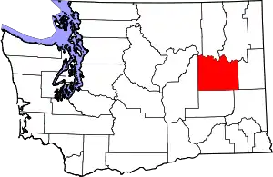 Map of Washington highlighting Lincoln County | |
| Towns | ||
| Unincorporated communities | ||
| Ghost town | ||
| ||
| Authority control |
|---|