Olaya Herrera
Olaya Herrera is a town and municipality in the Nariño Department, Colombia. Named after the former President of Colombia Enrique Olaya Herrera. Its municipal seat is known as Bocas de Satinga.
Olaya Herrera | |
|---|---|
Municipality and town | |
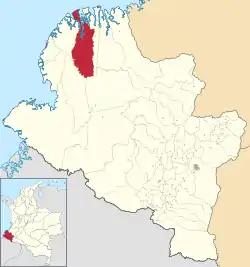 Location of the municipality and town of Olaya Herrera in the Nariño Department of Colombia. | |
| Coordinates: 2°20′49″N 78°19′32″W | |
| Country | |
| Department | Nariño Department |
| Population (2020 est.[1]) | |
| • Total | 33,132 |
| Time zone | UTC-5 (Colombia Standard Time) |
Climate
Olaya Herrera has a tropical rainforest climate (Af) with heavy to very heavy rainfall year-round.
| Climate data for Bocas de Satinga | |||||||||||||
|---|---|---|---|---|---|---|---|---|---|---|---|---|---|
| Month | Jan | Feb | Mar | Apr | May | Jun | Jul | Aug | Sep | Oct | Nov | Dec | Year |
| Average high °C (°F) | 28.6 (83.5) |
29.5 (85.1) |
29.9 (85.8) |
29.8 (85.6) |
29.5 (85.1) |
29.6 (85.3) |
29.4 (84.9) |
29.2 (84.6) |
29.0 (84.2) |
28.3 (82.9) |
28.4 (83.1) |
28.8 (83.8) |
29.2 (84.5) |
| Daily mean °C (°F) | 25.5 (77.9) |
25.9 (78.6) |
26.3 (79.3) |
26.3 (79.3) |
26.2 (79.2) |
26.1 (79.0) |
26.0 (78.8) |
26.0 (78.8) |
25.8 (78.4) |
25.5 (77.9) |
25.6 (78.1) |
25.6 (78.1) |
25.9 (78.6) |
| Average low °C (°F) | 22.5 (72.5) |
22.4 (72.3) |
22.7 (72.9) |
22.9 (73.2) |
23.0 (73.4) |
22.6 (72.7) |
22.6 (72.7) |
22.8 (73.0) |
22.6 (72.7) |
22.8 (73.0) |
22.8 (73.0) |
22.5 (72.5) |
22.7 (72.8) |
| Average rainfall mm (inches) | 330 (13.0) |
293 (11.5) |
257 (10.1) |
348 (13.7) |
502 (19.8) |
489 (19.3) |
320 (12.6) |
264 (10.4) |
346 (13.6) |
329 (13.0) |
254 (10.0) |
231 (9.1) |
3,963 (156.1) |
| Source: Climate-Data.org[2] | |||||||||||||
References
- "Resultados y proyecciones (2005-2020) del censo 2005". Retrieved 19 April 2020.
- "Climate: Bocas de Satinga". Climate-Data.org. Retrieved October 14, 2020.
This article is issued from Wikipedia. The text is licensed under Creative Commons - Attribution - Sharealike. Additional terms may apply for the media files.
