Olustee, Oklahoma
Olustee is a town in Jackson County, Oklahoma, United States. "Olustee" is said to be a Seminole word meaning "pond"[5] or from the Creek (Muscogee) language ue-lvste (/oy-lást-i/) meaning "black water", and being taken from the Battle of Olustee in Florida.[6] The population was 607 at the 2010 census.
Olustee, Oklahoma | |
|---|---|
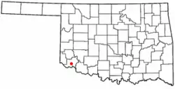 Location of Olustee, Oklahoma | |
| Coordinates: 34°32′49″N 99°25′23″W | |
| Country | United States |
| State | Oklahoma |
| County | Jackson |
| Area | |
| • Total | 0.82 sq mi (2.14 km2) |
| • Land | 0.82 sq mi (2.14 km2) |
| • Water | 0.00 sq mi (0.00 km2) |
| Elevation | 1,332 ft (406 m) |
| Population (2010) | |
| • Total | 607 |
| • Estimate (2019)[2] | 555 |
| • Density | 672.73/sq mi (259.72/km2) |
| Time zone | UTC-6 (Central (CST)) |
| • Summer (DST) | UTC-5 (CDT) |
| ZIP code | 73560 |
| Area code(s) | 580 |
| FIPS code | 40-55450[3] |
| GNIS feature ID | 1096265[4] |
Geography
Olustee is located at 34°32′49″N 99°25′23″W (34.546999, -99.423166).[7] It is 14 miles (23 km) southwest of Altus[5] along Oklahoma State Highway 6.[8]
According to the United States Census Bureau, the town has a total area of 0.8 square miles (2.1 km2), all land.
Demographics
| Historical population | |||
|---|---|---|---|
| Census | Pop. | %± | |
| 1910 | 850 | — | |
| 1920 | 665 | −21.8% | |
| 1930 | 651 | −2.1% | |
| 1940 | 248 | −61.9% | |
| 1950 | 455 | 83.5% | |
| 1960 | 463 | 1.8% | |
| 1970 | 819 | 76.9% | |
| 1980 | 721 | −12.0% | |
| 1990 | 701 | −2.8% | |
| 2000 | 680 | −3.0% | |
| 2010 | 607 | −10.7% | |
| 2019 (est.) | 555 | [2] | −8.6% |
| U.S. Decennial Census[9] | |||
As of the census[3] of 2000, there were 680 people, 250 households, and 185 families residing in the town. The population density was 823.8 people per square mile (316.3/km2). There were 280 housing units at an average density of 339.2 per square mile (130.3/km2). The racial makeup of the town was 70.15% White, 0.74% African American, 3.97% Native American, 0.59% Asian, 19.71% from other races, and 4.85% from two or more races. Hispanic or Latino of any race were 32.79% of the population.
There were 250 households, out of which 42.8% had children under the age of 18 living with them, 55.6% were married couples living together, 13.6% had a female householder with no husband present, and 26.0% were non-families. 23.6% of all households were made up of individuals, and 11.6% had someone living alone who was 65 years of age or older. The average household size was 2.72 and the average family size was 3.16.
In the town, the population was spread out, with 33.5% under the age of 18, 8.2% from 18 to 24, 24.3% from 25 to 44, 21.6% from 45 to 64, and 12.4% who were 65 years of age or older. The median age was 33 years. For every 100 females, there were 92.1 males. For every 100 females age 18 and over, there were 86.8 males.
The median income for a household in the town was $25,125, and the median income for a family was $28,375. Males had a median income of $24,500 versus $20,893 for females. The per capita income for the town was $10,189. About 19.5% of families and 24.7% of the population were below the poverty line, including 30.0% of those under age 18 and 28.0% of those age 65 or over.
References
- "2019 U.S. Gazetteer Files". United States Census Bureau. Retrieved July 28, 2020.
- "Population and Housing Unit Estimates". United States Census Bureau. May 24, 2020. Retrieved May 27, 2020.
- "U.S. Census website". United States Census Bureau. Retrieved 2008-01-31.
- "US Board on Geographic Names". United States Geological Survey. 2007-10-25. Retrieved 2008-01-31.
- Oden, Tal. Encyclopedia of Oklahoma History and Culture. "Olustee." Retrieved January 4, 2013.
- Jack B. Martin. "From Tallahassee To Tulsa: Creek Place-Names in the American South". College of William and Mary, 2002. Retrieved 15 February 2014.
- "US Gazetteer files: 2010, 2000, and 1990". United States Census Bureau. 2011-02-12. Retrieved 2011-04-23.
- "Olustee, Oklahoma". Google Maps. Retrieved August 15, 2020.
- "Census of Population and Housing". Census.gov. Retrieved June 4, 2015.
Municipalities and communities of Jackson County, Oklahoma, United States | ||
|---|---|---|
| City | 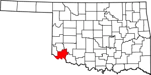 Jackson County map | |
| Towns | ||
| Unincorporated communities | ||
| Ghost towns | ||
| ||
| Authority control |
|
|---|
