Olyokma
The Olyokma (Russian: Олёкма, Olyokma, IPA: [ɐˈlʲɵkmə];[1] Yakut: Өлүөхүмэ, Ölüöxüme[1]) is a tributary of the Lena in eastern Siberia.
| Olyokma Yakut: Өлүөхүмэ | |
|---|---|
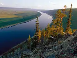 View of the river | |
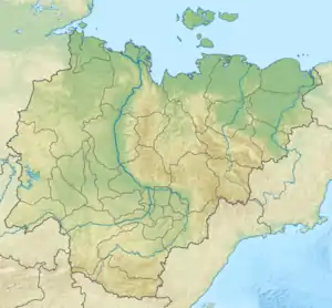 Location in the Sakha Republic, Russia | |
| Location | |
| Country | Yakutia, Russia |
| Physical characteristics | |
| Source | |
| • location | Muroy Range, Olyokma-Stanovik Highlands |
| • coordinates | 53°44′42″N 117°20′16″E |
| • elevation | 1,500 m (4,900 ft) |
| Mouth | |
• location | Lena |
• coordinates | 60°22′27″N 120°40′40″E |
• elevation | 115 m (377 ft) |
| Length | 1,436 km (892 mi) |
| Basin size | 210,000 km2 (81,000 sq mi) |
| Discharge | |
| • average | 1,990 m3/s (70,000 cu ft/s) |
| Basin features | |
| Progression | Lena→ Laptev Sea |
History
In the summer of 1631, Russian pioneer Pyotr Beketov entered the Olyokma during his first voyage down the Lena and in 1636 he founded the present-day city of Olyokminsk near the mouth of the river on the left bank of Lena.[2]
Yerofey Khabarov used this river's route to travel from the Lena to the Amur during his mid-17th century expeditions.[1]
Course
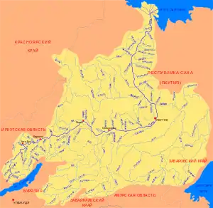
The river is 1,436 kilometres (892 mi) long, and has a drainage basin of 210,000 square kilometres (81,000 sq mi).[3] The Olyokma rises in the Muroy Range, Olyokma-Stanovik Highlands (Олёкминский Становик), west of Mogocha. It flows north through remote terrain before joining the Lena near Olyokminsk.[4]
To the west is the Vitim, to the south the Shilka and Amur, and to the east the upper Aldan. Its right tributary, the Tungir, leads to a portage to the Shilka. Other tributaries are the Nyukzha and the Chara.[2]
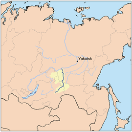 River location |
 Basin of the Lena |
See also
References
- "KNAB, the Place Names Database of EKI". Eki.ee. Retrieved 2013-01-01.
- Олёкма // Great Soviet Encyclopedia, in 30 vols. / Ch. ed. A.M. Prokhorov . - 3rd ed. - M., 1969-197
- Река Олёкма in the State Water Register of Russia (Russian)
- Russian State Water Register - Olyokma River
