Omeo Highway
The Omeo Highway[1] is a 157 kilometre (km) road in eastern Victoria, Australia, connecting north-east Victoria to Gippsland over parts of the Victorian Alps. The Highway is the first gazetted State highway in Victoria (1925).
Omeo Highway | |
|---|---|
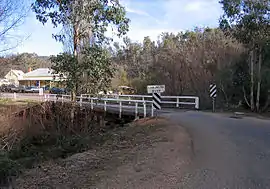 | |
Omeo Highway crossing the Cobungra River at Anglers Rest, Victoria | |
| General information | |
| Type | Highway |
| Length | 157 km (98 mi) |
| Route number(s) |
|
| Former route number |
|
| Major junctions | |
| North end | |
| for full list see major intersections | |
| South end | |
| Location(s) | |
| Major settlements | Eskdale, Mitta Mitta, Anglers Rest |
| Highway system | |
There are no substantial settlements between Mitta Mitta and Omeo, and therefore fuel is unavailable. There is no mobile phone communication from Mitta Mitta to south of Anglers' rest although there is an emergency roadside phone at the base of Mt Wills. There is some CB repeater coverage including Ch1 (Mitta). Monitor other traffic and log trucks on Ch 40.
Police and ambulance services are available at Mitta Mitta and Omeo.
Conditions in the mountains can change quickly and be harsh, particularly during winter. Snow is not uncommon in the winter season and may cause the road to be closed for short periods.
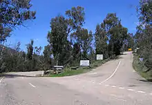
As probably one of the most impressive scenic routes in Australia, there are excellent views along most of the road, making it very popular with tourists. Due to winding nature of the road along the Omeo Highway, it is a common place for large groups of motorcycles to go riding. The Victorian Government completed the sealing of the road in March 2014 and the official opening of the completed highway took place at "The Walnuts" in May 2014.
There are some interesting stories of the highway that can be downloaded.[2]
Major intersections
| LGA | Location | km[3] | mi | Destinations | Notes |
|---|---|---|---|---|---|
| Towong | Tallangatta | 0 | 0.0 | Northern highway terminus | |
| Tallandoon | 27.0 | 16.8 | |||
| Mitta Mitta | 52.5 | 32.6 | |||
| East Gippsland | Glen Valley | 119 | 74 | Bogong High Plains Road – Falls Creek, Mount Beauty | |
| Omeo | 155 | 96 | |||
| 159 | 99 | Southern highway terminus | |||
| 1.000 mi = 1.609 km; 1.000 km = 0.621 mi | |||||
See also
- Highways in Australia
- Highways in Victoria
References
- "Map NE Victoria" (PDF). Vic Roads]. p. 16. Archived from the original (PDF) on 9 August 2008. Retrieved 9 February 2009.
- http://www.mitta.com.au/Omeo%20Highway%20Tales.pdf
- Google (26 June 2014). "Omeo Highway" (Map). Google Maps. Google. Retrieved 26 June 2014.
External links
![]() Media related to Omeo Highway at Wikimedia Commons
Media related to Omeo Highway at Wikimedia Commons