Opotoru River
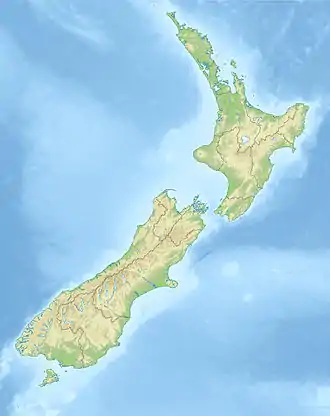
The Opotoru River is a river of the Waikato Region of New Zealand's North Island. It flows north, reaching the Raglan Harbour southwest of the town of Raglan.[2] There is no regular monitoring of pollution, but 38 kilometres (24 mi) (31.2%) of the river has been fenced to protect it from farm stock.[3]
| Opotoru River | |
|---|---|
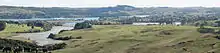
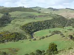 Opotoru River in the lower part of its valley | |
 | |
| Location | |
| Country | New Zealand |
| Physical characteristics | |
| Source | |
| • location | Karioi |
| • elevation | 756 m (2,480 ft) |
| Mouth | |
• location | Raglan Harbour |
• elevation | 0 m (0 ft) |
| Length | 14 km (9 mi) |
| Basin size | 36 km2 (14 sq mi)[1] |
Name
The Oct 1947 Lands and Survey one inch map shows the name 'Opotoru R' applied to the tidal creek of the harbour and 'Opotoru S' to the stretch through Te Mata. The 1971 2nd edition and current 1:50,000 maps (see http://www.topomap.co.nz/NZTopoMap/37544) show 'Opotoru River' for the lower part of the waterway, but 'Te Mata Stream' for the part up from the Te Hutewai Stream confluence. 'Te Mata Stream' appears to have been named 'Takapaunui Stream' in the 1910 postcards (see link below) and in the 1915 Bradbury's Illustrated Guide to The Raglan & Kawhia District.
Geology
The Geology of the Raglan-Kawhia Area[4] says, "The N-striking faults are evidenced by trends of the Tasman Sea coastline and probably by stream drainages such as that of the Opotoru River c 6 km E of Karioi summit." and "The base, consisting of interbedded conglomerate, sandstone, and locally siltstone, is strongly unconformable on Te Kuiti Group rocks south of Raglan at the Opotoru River estuary (R 14/751741)".
Chert is found beside a tributary at Te Mata and pebbles have been found downstream.[5]
History
Raglan County Hills and Sea[6] says, "On 11 January [1854] McLean purchased a small part of Te Mata at the SW corner of the Whaingaroa Block. The description of its boundaries, as recorded in the Deed of Sale, is worth quoting in part, if only for the quaintness of the wording: In the N the boundary was "the Government-cut line from the Opotoru Creek to the hole dug by C. W. Ligar Esquire; on the south side from the aforesaid hole to the root of the totara tree as left by William Naylor on making a canoe of the said tree, this root of the totara tree being close to the Opotoru Creek," which formed the W limit of the area. On 6 May a further section of Te Mata land was acquired, making a total of 630 acres. By 1858, 2130 acres of undulating forest land at Te Mata had been secured."
Natural history
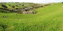
36% of the catchment is farmland and 50% forest.[7] Most of the forest is native bush on Mt Karioi, the rest mostly being scattered remnants of bush.[8]
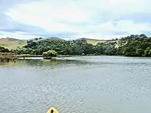
2004[9] and 2012 Regional Council vegetation surveys reported the river mouth and the saltmarsh, up to a small rapid in the River, as having mangroves (mānawa), manuka, mingimingi, cabbage trees (tī kōuka), remuremu, sea rush, oioi, saltmarsh ribbonwood (mākaka), flax, sea primrose, leptinella dioica, giant umbrella sedge (Toetoe upokotangata), tall fescue, coastal daisy and celery.[10]
See also
- List of rivers of New Zealand
- 1910 estuary postcard http://natlib.govt.nz/records/23162419
- 1910 Te Mata postcards http://natlib.govt.nz/records/22726677 and http://natlib.govt.nz/records/22874732
 compare this April 2010 photo with the estuary postcard photo of a century before - the 1907 road bridge is in the same position as the 1955 bridge.
References
- Mapping residence times in west coast estuaries of the Waikato region
- "Place name detail: Opotoru River". New Zealand Gazetteer. New Zealand Geographic Board. Retrieved 23 April 2010.
- Regional Council 2013 report on the work of Whaingaroa Harbour Care page 4
- Geology of the Raglan-Kawhia Area: Institute of Geological & Nuclear Sciences (N.Z.), Barry Clayton Waterhouse, P. J. White 1994 ISBN 0-478-08837-X
- Wilkes, Owen. "A SIGNIFICANT CHERT SOURCE AT RAGLAN, WAIKATO COAST". New Zealand Archaeological Association.
- https://books.google.com/books/about/Raglan_County_Hills_and_Sea.html?id=UssYAAAACAAJ&redir_esc=y (page 62)
- Mapping residence times in west coast estuaries of the Waikato region
- "New Zealand Topographic Map". NZ Topo Map. Retrieved 18 November 2017.
- Graeme, Meg (29 November 2004). "Estuarine Vegetation Survey – Raglan Harbour" (PDF). Environment Waikato.
- Graeme, Meg (2012). "Estuarine vegetation survey – Raglan (Whaingaroa) Harbour" (PDF). Waikato Regional Council.
