Orehovec, Šmarje pri Jelšah
Orehovec (pronounced [ɔˈɾeːxɔʋəts]) is a settlement in the Municipality of Šmarje pri Jelšah in eastern Slovenia. The area is part of the historical Styria region. The municipality is now included in the Savinja Statistical Region.[2]
Orehovec
Šent Janž pri Podčetrtku (until 1955) | |
|---|---|
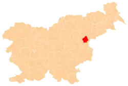
 Orehovec Location in Slovenia | |
| Coordinates: 46°10′42.75″N 15°31′40.13″E | |
| Country | |
| Traditional region | Styria |
| Statistical region | Savinja |
| Municipality | Šmarje pri Jelšah |
| Area | |
| • Total | 1.39 km2 (0.54 sq mi) |
| Elevation | 403.3 m (1,323.2 ft) |
| Population (2002) | |
| • Total | 66 |
| [1] | |
Name
The name of the settlement was changed from Šent Janž pri Podčetrtku (literally, 'Saint John near Podčetrtek') to Orehovec (literally, 'walnut-place') in 1955. The name was changed on the basis of the 1948 Law on Names of Settlements and Designations of Squares, Streets, and Buildings as part of efforts by Slovenia's postwar communist government to remove religious elements from toponyms.[3][4][5]
Church
The local church is dedicated to the Nativity of Saint John the Baptist and belongs to the Parish of Sveti Štefan pri Žusmu. It is a Late Gothic church that was extended in the 18th century.[6]
References
- Statistical Office of the Republic of Slovenia
- Šmarje pri Jelšah municipal site
- Spremembe naselij 1948–95. 1996. Database. Ljubljana: Geografski inštitut ZRC SAZU, DZS.
- Premk, F. 2004. Slovenska versko-krščanska terminologija v zemljepisnih imenih in spremembe za čas 1921–1967/68. Besedoslovne lastnosti slovenskega jezika: slovenska zemljepisna imena. Ljubljana: Slavistično društvo Slovenije, pp. 113–132.
- Urbanc, Mimi, & Matej Gabrovec. 2005. Krajevna imena: poligon za dokazovanje moči in odraz lokalne identitete. Geografski vestnik 77(2): 25–43.
- Slovenian Ministry of Culture register of national heritage reference number ešd 3439
External links