Orrum, North Carolina
Orrum is a town in Robeson County, North Carolina, United States. The population was 91 at the 2010 census.
Orrum, North Carolina | |
|---|---|
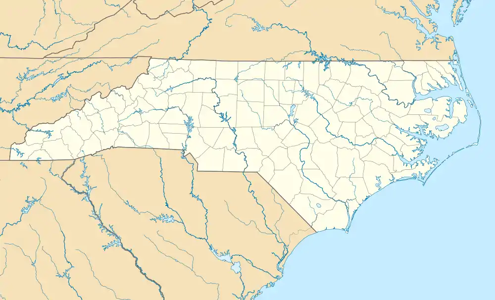 Orrum, North Carolina Location within the state of North Carolina | |
| Coordinates: 34°27′54″N 79°0′36″W | |
| Country | United States |
| State | North Carolina |
| County | Robeson |
| Area | |
| • Total | 0.48 sq mi (1.24 km2) |
| • Land | 0.48 sq mi (1.24 km2) |
| • Water | 0.00 sq mi (0.00 km2) |
| Elevation | 102 ft (31 m) |
| Population (2010) | |
| • Total | 91 |
| • Estimate (2019)[2] | 87 |
| • Density | 182.01/sq mi (70.24/km2) |
| Time zone | UTC-5 (Eastern (EST)) |
| • Summer (DST) | UTC-4 (EDT) |
| ZIP code | 28369 |
| Area code(s) | 910 |
| FIPS code | 37-49460[3] |
| GNIS feature ID | 1021756[4] |
History
The Williams-Powell House was listed on the National Register of Historic Places in 1984.[5]
Geography
Orrum is located at 34°27′54″N 79°0′36″W (34.465018, -79.010073).[6]
According to the United States Census Bureau, the town has a total area of 0.6 square miles (1.6 km2), all of it land.
Demographics
| Historical population | |||
|---|---|---|---|
| Census | Pop. | %± | |
| 1910 | 214 | — | |
| 1920 | 86 | −59.8% | |
| 1930 | 209 | 143.0% | |
| 1940 | 173 | −17.2% | |
| 1950 | 162 | −6.4% | |
| 1960 | 139 | −14.2% | |
| 1970 | 162 | 16.5% | |
| 1980 | 167 | 3.1% | |
| 1990 | 103 | −38.3% | |
| 2000 | 79 | −23.3% | |
| 2010 | 91 | 15.2% | |
| 2019 (est.) | 87 | [2] | −4.4% |
| U.S. Decennial Census[7] | |||
As of the census[3] of 2000, there were 79 people, 32 households, and 20 families residing in the town. The population density was 140.0 people per square mile (54.5/km2). There were 36 housing units at an average density of 63.8 per square mile (24.8/km2). The racial makeup of the town was 79.75% White, 15.19% African American, 2.53% Native American and 2.53% Pacific Islander.
There were 32 households, out of which 28.1% had children under the age of 18 living with them, 40.6% were married couples living together, 15.6% had a female householder with no husband present, and 34.4% were non-families. 31.3% of all households were made up of individuals, and 12.5% had someone living alone who was 65 years of age or older. The average household size was 2.28 and the average family size was 2.81.
In the town, the population was spread out, with 19.0% under the age of 18, 7.6% from 18 to 24, 26.6% from 25 to 44, 34.2% from 45 to 64, and 12.7% who were 65 years of age or older. The median age was 42 years. For every 100 females, there were 83.7 males. For every 100 females age 18 and over, there were 88.2 males.
The median income for a household in the town was $25,417, and the median income for a family was $35,000. Males had a median income of $27,917 versus $13,125 for females. The per capita income for the town was $12,095. There were 22.2% of families and 17.0% of the population living below the poverty line, including no under eighteens and 35.7% of those over 64.
References
- "2019 U.S. Gazetteer Files". United States Census Bureau. Retrieved July 27, 2020.
- "Population and Housing Unit Estimates". United States Census Bureau. May 24, 2020. Retrieved May 27, 2020.
- "U.S. Census website". United States Census Bureau. Retrieved 2008-01-31.
- "US Board on Geographic Names". United States Geological Survey. 2007-10-25. Retrieved 2008-01-31.
- "National Register Information System". National Register of Historic Places. National Park Service. July 9, 2010.
- "US Gazetteer files: 2010, 2000, and 1990". United States Census Bureau. 2011-02-12. Retrieved 2011-04-23.
- "Census of Population and Housing". Census.gov. Retrieved June 4, 2015.
Municipalities and communities of Robeson County, North Carolina, United States | ||
|---|---|---|
| City | 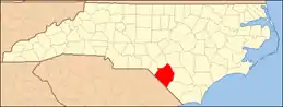 | |
| Towns | ||
| Townships | ||
| CDPs | ||
| Unincorporated communities | ||
| Footnotes | ‡This populated place also has portions in an adjacent county or counties | |
| ||