Osage Township, Bates County, Missouri
Osage Township is one of twenty-four townships in Bates County, Missouri, and is part of the Kansas City metropolitan area within the USA. As of the 2000 census, its population was 1,837.[1]
Osage Township | |
|---|---|
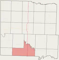 Location in Bates County | |
| Coordinates: 38°05′30″N 94°21′25″W | |
| Country | |
| State | |
| County | Bates |
| Area | |
| • Total | 44.86 sq mi (116.17 km2) |
| • Land | 44.73 sq mi (115.84 km2) |
| • Water | 0.13 sq mi (0.33 km2) 0.28% |
| Elevation | 781 ft (238 m) |
| Population (2000) | |
| • Total | 1,837 |
| • Density | 41.1/sq mi (15.9/km2) |
| Time zone | UTC-6 (CST) |
| • Summer (DST) | UTC-5 (CDT) |
| ZIP codes | 64730, 64779 |
| GNIS feature ID | 0766303 |
The township takes its name from the Osage River.[2]
Geography
According to the United States Census Bureau, Osage Township covers an area of 44.86 square miles (116.17 square kilometers); of this, 44.73 square miles (115.84 square kilometers, 99.72 percent) is land and 0.13 square miles (0.33 square kilometers, 0.28 percent) is water.
Cities, towns, villages
Adjacent townships
- Lone Oak Township (northeast)
- Prairie Township (east)
- Blue Mound Township, Vernon County (southeast)
- Metz Township, Vernon County (southwest)
- Howard Township (west)
- New Home Township (northwest)
Cemeteries
The township contains these two cemeteries: Fairview Rider and Greenlawn.
Major highways
Airports and landing strips
- Schooley Airport
School districts
- Rich Hill R-IV
Political districts
- Missouri's 4th congressional district
- State House District 125
- State Senate District 31
References
- United States Census Bureau 2008 TIGER/Line Shapefiles
- United States Board on Geographic Names (GNIS)
- United States National Atlas
- "U.S. Census website". Retrieved 2009-05-17.
- "Bates County Place Names, 1928-1945 (archived)". The State Historical Society of Missouri. Archived from the original on 24 June 2016. Retrieved 1 September 2016.
External links
Places adjacent to Osage Township, Bates County, Missouri | |
|---|---|
Municipalities and communities of Bates County, Missouri, United States | ||
|---|---|---|
| Cities | 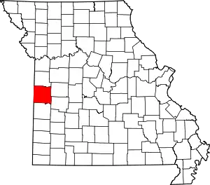 Map of Missouri highlighting Bates County | |
| Villages | ||
| Townships | ||
| Unincorporated communities | ||
| Ghost towns | ||
| Footnotes | ‡This populated place also has portions in an adjacent county or counties | |
| ||
This article is issued from Wikipedia. The text is licensed under Creative Commons - Attribution - Sharealike. Additional terms may apply for the media files.
