Otavi
Otavi is a town of 4,000 inhabitants in the Otjozondjupa Region of central Namibia. Situated 360km north of Windhoek, it is the district capital of the Otavi electoral constituency. Most of the area is dolomitic (Precambrian) and the district was in the past renowned for its mineral wealth. Most of the deposits have now been exhausted.
Otavi
Otjitavi | |
|---|---|
Town | |
.jpg.webp) Aerial view of Otavi (2018) | |
 Seal | |
| Nickname(s): otavio | |
| Motto(s): Volhard en Oorwin | |
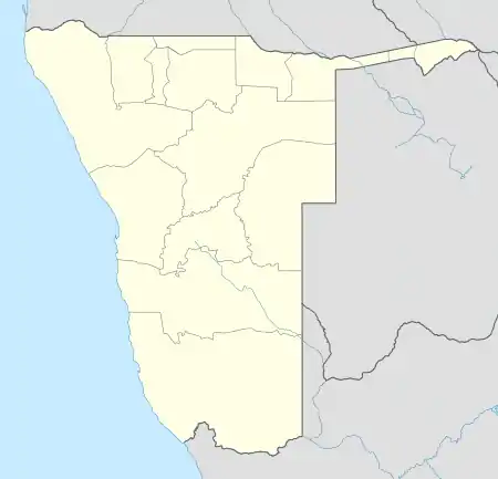 Otavi Location in Namibia | |
| Coordinates: 19°39′S 17°20′E | |
| Country | |
| Region | Otjozondjupa Region |
| Constituency | Otavi Constituency |
| Population (2011)[1] | |
| • Total | 5,242 |
| Time zone | UTC+2 (SAST) |
| Climate | BSh |
Elefantenberg (elephant mountain), a mountain 1624 meters above sea level, is located about 7 km south of Otavi.[2]
Otavi Triangle
The towns of Otavi, Tsumeb (to the north) and Grootfontein (to the northeast) define an area known as the "Otavi Triangle", also known as the Otavi Mountainland. This geographical region is sometimes referred to as the "Golden Triangle", or as the "maize Triangle", owing to the cultivation of maize in the area.[3] The three towns that define the triangle are roughly 60 km from each other.
History
On July 1, 1915, the German Army was defeated at Otavi by South African troops; on June 9 they surrendered nearby and signed the Khorab Peace Treaty. There is a memorial to this event a few miles outside of Otavi.
Economy
Much of the town's economy relies on the two grocery stores, a mill, two banks, two gas stations, and many surrounding game/cattle farms, as well as a handful of other small business. The owners of most of these businesses are Afrikaners (white Africans of Boer, ultimately Dutch, heritage) or Germans.
Due to financial mismanagement, Otavi lost its town status in 2004 and was downgraded to "village". After revenue picked up again, town status was reinstated in November 2010. With the foundation of the Ohorongo Cement factory and a gold mine to be opened soon, business and employment is supposed to pick up significantly.[4] A steel manufacturing plant it's also being developed. The project will cost $201 million and it's expected to produce 100 000 tons of steel.[5]
.jpg.webp)
Politics
Otavi is governed by a town council that currently has seven seats.[6]
The 2015 local authority election was won by SWAPO which gained six seats and 957 votes. The remaining seat went to the Democratic Turnhalle Alliance (DTA) which gained 79 votes.[7]
Education
Previously the German Regierungsschule Otavi (Government School Otavi) was in the city.[8]
See also
References
- "Table 4.2.2 Urban population by Census years (2001 and 2011)" (PDF). Namibia 2011 - Population and Housing Census Main Report. Namibia Statistics Agency. p. 39. Retrieved 24 August 2016.
- Mapcarta
- FAO/WFP CROP, LIVESTOCK AND FOOD SECURITY ASSESSMENT MISSION TO NAMIBIA
- ǃHoaës, Irene (19 November 2010). "Otavi making a U-turn". New Era. Archived from the original on 19 February 2013.
- "Otavi steel manufacturing plant to boost construction industry in Namibia". Construction Review Online. 2018-12-02. Retrieved 2020-11-30.
- "Know Your Local Authority". Election Watch (3). Institute for Public Policy Research. 2015. p. 4.
- "Local elections results". Electoral Commission of Namibia. 28 November 2015. p. 7. Archived from the original on 10 December 2015.
- "Deutscher Bundestag 4. Wahlperiode Drucksache IV/3672" (Archive). Bundestag (West Germany). 23 June 1965. Retrieved on 12 March 2016. p. 32/51.
| Authority control |
|---|
