Otter Tail River
The Otter Tail River (Ojibwe: Nigigwaanowe-ziibi) is a 192-mile-long (309 km)[1] river in the west-central portion of the U.S. state of Minnesota. It begins in Clearwater County, 40 miles (64 km) southwest of Bemidji. It then flows through a number of lakes and cities in Minnesota, including Elbow Lake, Many Point Lake, Chippewa Lake, Height of Land Lake, Frazee, the Pine lakes, Rush Lake, Otter Tail Lake and Ottertail, West Lost Lake, Fergus Falls, and Orwell Lake.

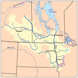
At its mouth, it joins with the Bois de Sioux River to form the Red River between Breckenridge, Minnesota and Wahpeton, North Dakota.[2] The Red River is the Minnesota–North Dakota boundary from this point onward to the Canada–United States border. Waters of the Red River watershed ultimately flow north into Hudson Bay.
Between 1909 and 1925, the privately owned Otter Tail Power Company built five dams on the Otter Tail River. They are Dayton Hollow (1909), Hoot Lake (1914), Pisgah (1918), Central / Wright (built 1871, rebuilt 1922), and Taplin Gorge (1925).
References
- U.S. Geological Survey. National Hydrography Dataset high-resolution flowline data. The National Map, accessed June 8, 2011
- Wahpeton, Minn.-N. Dak., 7.5 Minute Topographic Quadrangle, USGS, 1964 (1979 rev.)