Ottertail, Minnesota
Ottertail is a city in Otter Tail County, Minnesota, United States. The population was 572 at the 2010 census.[6]
Ottertail | |
|---|---|
 Looking southwest along Main Street (State Hwy. 108) | |
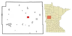 Location of Ottertail, Minnesota | |
| Coordinates: 46°25′19″N 95°33′58″W | |
| Country | United States |
| State | Minnesota |
| County | Otter Tail |
| Area | |
| • Total | 5.96 sq mi (15.44 km2) |
| • Land | 4.27 sq mi (11.07 km2) |
| • Water | 1.69 sq mi (4.37 km2) |
| Elevation | 1,352 ft (412 m) |
| Population | |
| • Total | 572 |
| • Estimate (2019)[3] | 648 |
| • Density | 151.65/sq mi (58.55/km2) |
| Time zone | UTC-6 (Central (CST)) |
| • Summer (DST) | UTC-5 (CDT) |
| ZIP code | 56571 |
| Area code(s) | 218 |
| FIPS code | 27-49210[4] |
| GNIS feature ID | 0649060[5] |
Geography
According to the United States Census Bureau, the city has a total area of 5.10 square miles (13.21 km2), of which 4.28 square miles (11.09 km2) is land and 0.82 square miles (2.12 km2) is water.[7]
Minnesota State Highways 78 and 108 are two of the main routes in the community.
History
Ottertail was platted in 1903, and named for nearby Otter Tail Lake.[8]
Demographics
| Historical population | |||
|---|---|---|---|
| Census | Pop. | %± | |
| 1910 | 176 | — | |
| 1920 | 223 | 26.7% | |
| 1930 | 221 | −0.9% | |
| 1940 | 254 | 14.9% | |
| 1950 | 237 | −6.7% | |
| 1960 | 164 | −30.8% | |
| 1970 | 180 | 9.8% | |
| 1980 | 239 | 32.8% | |
| 1990 | 313 | 31.0% | |
| 2000 | 451 | 44.1% | |
| 2010 | 572 | 26.8% | |
| 2019 (est.) | 648 | [3] | 13.3% |
| U.S. Decennial Census[9] | |||
2010 census
As of the census[2] of 2010, there were 572 people, 245 households, and 171 families living in the city. The population density was 133.6 inhabitants per square mile (51.6/km2). There were 401 housing units at an average density of 93.7 per square mile (36.2/km2). The racial makeup of the city was 99.0% White, 0.2% Native American, and 0.9% from two or more races. Hispanic or Latino of any race were 0.9% of the population.
There were 245 households, of which 22.0% had children under the age of 18 living with them, 57.1% were married couples living together, 9.4% had a female householder with no husband present, 3.3% had a male householder with no wife present, and 30.2% were non-families. 24.9% of all households were made up of individuals, and 8.6% had someone living alone who was 65 years of age or older. The average household size was 2.33 and the average family size was 2.75.
The median age in the city was 47.7 years. 18.2% of residents were under the age of 18; 5.4% were between the ages of 18 and 24; 21.4% were from 25 to 44; 35.2% were from 45 to 64; and 19.6% were 65 years of age or older. The gender makeup of the city was 51.2% male and 48.8% female.
2000 census
As of the census of 2000,[4] there were 451 people, 190 households, and 133 families living in the city. The population density was 102.7 people per square mile (39.7/km2). There were 323 housing units at an average density of 73.6 per square mile (28.4/km2). The racial makeup of the city was 99.56% White and 0.44% Native American. 42.8% were of German, 23.7% Norwegian and 7.7% Swedish ancestry.
There were 190 households, out of which 27.9% had children under the age of 18 living with them, 63.2% were married couples living together, 3.7% had a female householder with no husband present, and 29.5% were non-families. 24.2% of all households were made up of individuals, and 9.5% had someone living alone who was 65 years of age or older. The average household size was 2.37 and the average family size was 2.82.
In the city, the population was spread out, with 21.1% under the age of 18, 7.3% from 18 to 24, 24.2% from 25 to 44, 32.6% from 45 to 64, and 14.9% who were 65 years of age or older. The median age was 43 years. For every 100 females, there were 115.8 males. For every 100 females age 18 and over, there were 105.8 males.
The median income for a household in the city was $32,188, and the median income for a family was $43,750. Males had a median income of $23,750 versus $18,438 for females. The per capita income for the city was $18,612. About 10.2% of families and 12.7% of the population were below the poverty line, including 21.8% of those under age 18 and 4.1% of those age 65 or over.
References
- "2019 U.S. Gazetteer Files". United States Census Bureau. Retrieved July 26, 2020.
- "U.S. Census website". United States Census Bureau. Retrieved 2012-11-13.
- "Population and Housing Unit Estimates". United States Census Bureau. May 24, 2020. Retrieved May 27, 2020.
- "U.S. Census website". United States Census Bureau. Retrieved 2008-01-31.
- "US Board on Geographic Names". United States Geological Survey. 2007-10-25. Retrieved 2008-01-31.
- "2010 Census Redistricting Data (Public Law 94-171) Summary File". American FactFinder. U.S. Census Bureau, 2010 Census. Retrieved 23 April 2011.
- "US Gazetteer files 2010". United States Census Bureau. Archived from the original on 2012-07-02. Retrieved 2012-11-13.
- Upham, Warren (1920). Minnesota Geographic Names: Their Origin and Historic Significance. Minnesota Historical Society. p. 397.
- "Census of Population and Housing". Census.gov. Retrieved June 4, 2015.
Municipalities and communities of Otter Tail County, Minnesota, United States | ||
|---|---|---|
| Cities |  Map of Minnesota highlighting Otter Tail County | |
| Townships |
| |
| Unincorporated communities | ||
| Indian reservation | ||
| Ghost towns | ||
| Footnotes | ‡This populated place also has portions in an adjacent county or counties | |
| ||