Ouésso
Ouésso is a town in the northern Republic of the Congo, lying on the Sangha River and surrounded by rainforest. It is linked by ferry with Brazzaville and is known for the pygmy people who live nearby. It is the capital of the Sangha Region.
Ouésso | |
|---|---|
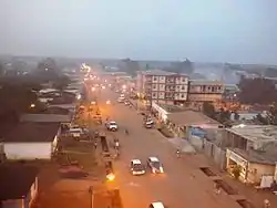 Ouésso at night (2015) | |
 Seal | |
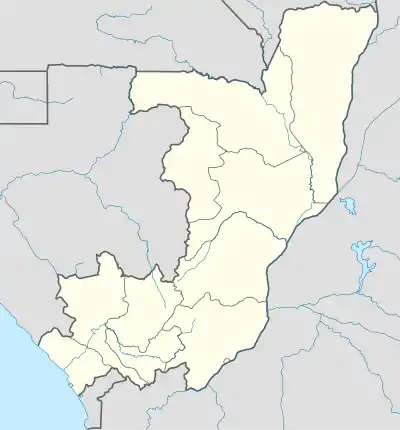 Ouésso Location in the Republic of the Congo | |
| Coordinates: 1°36′49″N 16°03′06″E | |
| Country | |
| Region | Sangha Region |
| District | Ouésso District |
| City | Ville de Ouésso |
| Area | |
| • Total | 5 km2 (2 sq mi) |
| Elevation | 340 m (1,120 ft) |
| Population (2012) | |
| • Total | 31,062 |
| • Density | 6,200/km2 (16,000/sq mi) |
It is served by Ouésso Airport.
Climate
Ouésso has a tropical monsoon climate (Köppen climate classification Am).
| Climate data for Ouesso | |||||||||||||
|---|---|---|---|---|---|---|---|---|---|---|---|---|---|
| Month | Jan | Feb | Mar | Apr | May | Jun | Jul | Aug | Sep | Oct | Nov | Dec | Year |
| Average high °C (°F) | 31 (88) |
32 (89) |
32 (90) |
33 (91) |
31 (88) |
30 (86) |
29 (85) |
29 (85) |
30 (86) |
31 (87) |
31 (87) |
30 (86) |
31 (87) |
| Average low °C (°F) | 21 (69) |
21 (69) |
22 (71) |
22 (71) |
22 (71) |
21 (70) |
21 (69) |
21 (69) |
21 (69) |
21 (69) |
21 (69) |
20 (68) |
21 (70) |
| Average precipitation mm (inches) | 56 (2.2) |
79 (3.1) |
150 (5.9) |
130 (5) |
150 (6) |
120 (4.6) |
79 (3.1) |
150 (6.1) |
220 (8.7) |
230 (8.9) |
150 (6) |
84 (3.3) |
1,600 (62.8) |
| Source: Weatherbase [1] | |||||||||||||
Timeline
2007
In April 2007, a Korean consortium proposed to build a railway to Ouésso from Brazzaville, in exchange for a concession to harvest timber.[2]
References
- "Weatherbase: Historical Weather for Ouesso, Republic of Congo". Weatherbase. 2011. Retrieved on November 24, 2011.
- Ouésso railway
This article is issued from Wikipedia. The text is licensed under Creative Commons - Attribution - Sharealike. Additional terms may apply for the media files.