Outline of Sikkim
The following outline is provided as an overview of and topical guide to Sikkim:

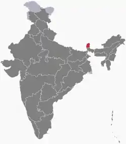
Location of Sikkim
Sikkim – landlocked state of India, the last to give up its monarchy and fully integrate into India, in 1975. With 607,688 inhabitants as of the 2011 census, Sikkim is the least populous state in India and the second-smallest state after Goa in total area, covering approximately 7,096 km2 (2,740 sq mi). Sikkim is nonetheless geographically diverse due to its location in the Himalayas; the climate ranges from subtropical to high alpine, and Kangchenjunga, the world's third-highest peak, is located on Sikkim's border with Nepal.

Seal of Sikkim
General reference
Names
- Common English name: Sikkim
- Official English name(s): Sikkim
- Nicknames
- Su Khyim, Denjong, Beyul Demazong, Nye-mae-el, Indrakil
- Adjectivals
- Denonyms
- Abbreviations and name codes
- ISO 3166-2 code: IND-SK
- Vehicle registration code: SK
Rankings (amongst India's states)
- by population: 29th
- by area (2011 census): 28th
- by crime rate (2015):
- by gross domestic product (GDP) (2014): 28th
- by Human Development Index (HDI):
- by life expectancy at birth:
- by literacy rate:
Geography of Sikkim
- Sikkim is: an Indian state
- Population of Sikkim:
- Area of Sikkim:
- Atlas of Sikkim
Location of Sikkim
- Sikkim is situated within the following regions:
- Time zone: Indian Standard Time (UTC+05:30)
Districts of Sikkim
Municipalities of Sikkim
Municipalities of Sikkim
- Capital of Sikkim: Capital of Sikkim
- Cities of Sikkim
Demography of Sikkim
Government and politics of Sikkim
- Form of government: Indian state government (parliamentary system of representative democracy)
- Capital of Sikkim: Capital of Sikkim
- Elections in Sikkim
Union government in Sikkim
Branches of the government of Sikkim
Executive branch of the government of Sikkim
- Head of state: Governor of Sikkim
- Head of government: Chief Minister of Sikkim
Legislative branch of the government of Sikkim
Law and order in Sikkim
- Law enforcement in Sikkim
History of Sikkim
Culture of Sikkim
- Cuisine of Sikkim
- Languages of Sikkim
- Monuments in Sikkim
- World Heritage Sites in Sikkim
Art in Sikkim
Sports in Sikkim
Sports in Sikkim
- Cricket in Sikkim
- Football in Sikkim
Symbols of Sikkim
- State mammal: Red panda
- State bird: Blood pheasant
- State flower: Noble orchid
- State seal: Seal of Sikkim
- State tree: Rhododendron
Economy and infrastructure of Sikkim
Health in Sikkim
Health in Sikkim
See also
References
External links
- Official website of the Government of Sikkim
- "Buddhist Monasteries of Sikkim". Sikkim.nic.in.
- Outline of Sikkim at Curlie
 Geographic data related to Sikkim at OpenStreetMap
- Sikkim
- SIKKIM ORGANIC MISSION
This article is issued from Wikipedia. The text is licensed under Creative Commons - Attribution - Sharealike. Additional terms may apply for the media files.