Overton Hill
Overton Hill is a 571 ft (174 m) hill at the southern edge of the Marlborough Downs in Wiltshire, England. It lies just west of the village of West Overton and about 4 miles (6 km) west from the town of Marlborough. The A4 road passes close to the north, and to the south is the River Kennet.
| Overton Hill | |
|---|---|
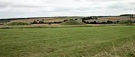 Round tumuli on Overton Hill | |
| Highest point | |
| Elevation | 174 m (571 ft) |
| Coordinates | 51°24′36″N 1°49′54″W |
| Geography | |
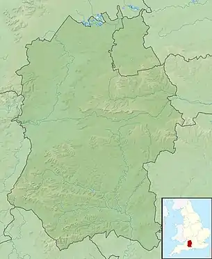 Overton Hill Overton Hill shown within Wiltshire | |
| Location | Wiltshire, England |
| OS grid | SU118679 |
| Topo map | OS Explorer 157 |
The hill is notable for being the start point of the Ridgeway National Trail, which follows an ancient trackway. There are several round barrows (burial mounds) on it, and it is the site of an Iron Age wooden circle known as The Sanctuary, indicating human activity for thousands of years.[1] The hill is part of the Avebury section of the Stonehenge and Avebury World Heritage Site.
References
- Historic England. "The Sanctuary, Overton Hill (1014563)". National Heritage List for England. Retrieved 5 December 2020.
This article is issued from Wikipedia. The text is licensed under Creative Commons - Attribution - Sharealike. Additional terms may apply for the media files.