Paillon
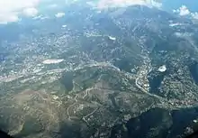
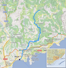
The Paillon (Nissard Occitan: Palhon) is a coastal river of the Alpes-Maritimes that flows into the Mediterranean Sea in Nice, near the old district. It is 35.8 km (22.2 mi) long.[1] Its drainage basin is 258 km2 (100 sq mi).[2] Its source is north of Lucéram. It flows generally south, through L'Escarène, Peillon, Drap (where it meets its main tributary Paillon de Contes), La Trinité, and finally Nice.
| Paillon | |
|---|---|
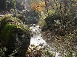 The Paillon in Contes | |
 | |
| Location | |
| Country | France |
| Physical characteristics | |
| Mouth | Mediterranean Sea |
• coordinates | 43.6945°N 7.2679°E |
| Length | 36 km (22 mi) |
| Basin size | 258 km2 (100 sq mi) |
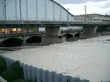
The region of the Paillon and the Paillon de Contes is called the pays des Paillons. The river is covered in its last few kilometers in the city of Nice, with the Guillaume Apollinaire High School and the Palais des Congrès Acropolis over the river.
It is a typical Mediterranean river, with low water level throughout the year and violent floods during autumn and sometimes during spring.
References
- Sandre. "Fiche cours d'eau - Le Paillon (Y65-0400)".
- Bassin versant : Paillon (Le), Observatoire Régional Eau et Milieux Aquatiques en PACA
