Pampierstad
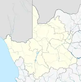
Pampierstad is a town in Frances Baard District Municipality in the Northern Cape province of South Africa.
Pampierstad | |
|---|---|
 Pampierstad  Pampierstad | |
| Coordinates: 27.776°S 24.690°E | |
| Country | South Africa |
| Province | Northern Cape |
| District | Frances Baard |
| Municipality | Phokwane |
| Area | |
| • Total | 10.39 km2 (4.01 sq mi) |
| Population (2011)[1] | |
| • Total | 21,707 |
| • Density | 2,100/km2 (5,400/sq mi) |
| Racial makeup (2011) | |
| • Black African | 98.9% |
| • Coloured | 0.5% |
| • Indian/Asian | 0.3% |
| • Other | 0.3% |
| First languages (2011) | |
| • Tswana | 83.3% |
| • English | 4.7% |
| • Xhosa | 4.0% |
| • Afrikaans | 1.9% |
| • Other | 6.0% |
| Time zone | UTC+2 (SAST) |
| Postal code (street) | 8566 |
| PO box | 8566 |
| Area code | 053 |
The town lies in the northern part of the Vaalharts irrigation scheme and 14 km from Hartswater. Most residents are Tswana speaking.
Education
Pampierstad consist of 6 Primary schools, 2 Secondaries and 2 High schools
1. Pabalelo 2. Bontleng 3. Gaoshupe Makodi 4. Mooki Lobelo 5. Simon Medupe 6. Kgono
Secondaries 1. Olehile Manchwe 2. Reitlamile
High Schools 1. Kgomotso 2. Pampierstad High
References
- "Main Place Pampierstad". Census 2011.
People of Pampierstad majority were forcefully moved from Jan Kempdorp location and others from Hartswater Thagadiepelajang in the early 60's.
This article is issued from Wikipedia. The text is licensed under Creative Commons - Attribution - Sharealike. Additional terms may apply for the media files.
.svg.png.webp)