Panguru
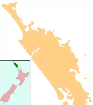
Panguru is a community in the northern Hokianga harbour, in Northland, New Zealand. The Whakarapa Stream flows from the Panguru Range in the Warawara Forest to the west, through Panguru and into the Hokianga.[1][2]
Panguru | |
|---|---|
 Panguru | |
| Coordinates: 35°22′40″S 173°22′56″E | |
| Country | New Zealand |
| Region | Northland Region |
| District | Far North District |
Demographics
| Year | Pop. | ±% p.a. |
|---|---|---|
| 2006 | 813 | — |
| 2013 | 744 | −1.26% |
| 2018 | 795 | +1.33% |
| Source: [3] | ||
The statistical area of Hokianga North, which at 345.93 square km is much larger than Panguru, covers the western side of the area between Hokianga Harbour and Whangape Harbour, including the locality of Matihetihe Hokianga North had a population of 795 at the 2018 New Zealand census, an increase of 51 people (6.9%) since the 2013 census, and a decrease of 18 people (-2.2%) since the 2006 census. There were 294 households. There were 399 males and 396 females, giving a sex ratio of 1.01 males per female. Of the total population, 201 people (25.3%) were aged up to 15 years, 120 (15.1%) were 15 to 29, 312 (39.2%) were 30 to 64, and 159 (20.0%) were 65 or older. Figures may not add up to the total due to rounding.
Ethnicities were 25.3% European/Pākehā, 86.0% Māori, 7.5% Pacific peoples, 0.8% Asian, and 0.4% other ethnicities. People may identify with more than one ethnicity.
The percentage of people born overseas was 3.8, compared with 27.1% nationally.
Although some people objected to giving their religion, 16.2% had no religion, 73.6% were Christian, and 4.2% had other religions.
Of those at least 15 years old, 48 (8.1%) people had a bachelor or higher degree, and 168 (28.3%) people had no formal qualifications. The median income was $17,900. The employment status of those at least 15 was that 150 (25.3%) people were employed full-time, 93 (15.7%) were part-time, and 54 (9.1%) were unemployed.[3]
History and culture
Panguru began as a Catholic settlement.[4]
There are three marae in the area connected to Te Rarawa hapū:
- Ngāti Manawa or Te Waiariki Marae and Te Rarawa meeting house are affiliated with Ngāti Manawa, Te Kai Tutae and Te Waiariki.
- Waipuna Marae and Te Puna I Te Ao Marama meeting house are affiliated with Te Kai Tutae and Te Waiariki.
- Waihou or Waimirirangi Marae and Te Puna I te Ora meeting house are affiliated with Ngāti Te Rēinga.[5][6]
Education
Te Kura Taumata o Panguru is a coeducational composite (years 1-15) school[7] with a roll of 95 students as of March 2020.[8]
It was the smallest high school in New Zealand at the time of its establishment in 1964.[9]
Notable people
- Dame Whina Cooper, respected Māori elder
- Adam Blair, Rugby League Player
Notes
- Peter Dowling (editor) (2004). Reed New Zealand Atlas. Reed Books. pp. map 3. ISBN 0-7900-0952-8.CS1 maint: extra text: authors list (link)
- Roger Smith, GeographX (2005). The Geographic Atlas of New Zealand. Robbie Burton. pp. map 22. ISBN 1-877333-20-4.
- "Statistical area 1 dataset for 2018 Census". Statistics New Zealand. March 2020. Hokianga North (101600). 2018 Census place summary: Hokianga North
- "Hokianga district". Te Ara: The Encyclopedia of New Zealand.
- "Māori Maps". maorimaps.com. Te Potiki National Trust.
- "Te Kāhui Māngai directory". tkm.govt.nz. Te Puni Kōkiri.
- Education Counts: Te Kura Taumata o Panguru
- "New Zealand Schools Directory". New Zealand Ministry of Education. Retrieved 26 April 2020.
- "Te Kura Taumata O Panguru".