Parachinar
Parachinar or Pāṛačinār (Pashto: پاړه چنار; Urdu: پاڑه چنار) is a small town which is the capital of Kurram District in the province of Khyber Pakhtunkhwa, Pakistan.[3] Parachinar is situated on a neck of Pakistani territory west of Peshawar, that juts into the Logar and Nangarhar provinces of Afghanistan. With a distance of 110 kilometres (68 mi) from the Afghan capital Kabul, Parachinar is the closest point in Pakistan to Kabul. It is one of two urban areas in Kurram District, the other one being Sadda, and has shrank considerably in population over the past few decades, becoming the least populous urbanized area in Kohat Division. .
Parachinar
| |
|---|---|
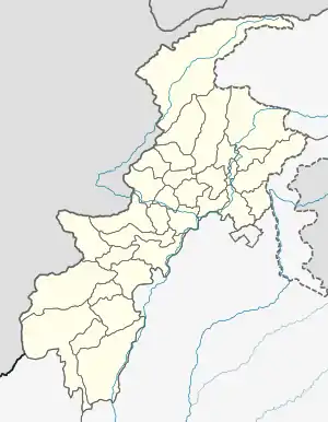 Parachinar  Parachinar  Parachinar .svg.png.webp) Parachinar | |
| Coordinates: 33°54′N 70°6′E | |
| Country | |
| Province | |
| Division | Kohat |
| District | Kurram |
| Tehsil | Upper Kurram |
| Elevation | 1,705 m (5,594 ft) |
| Population | |
| • Town | 115,502 |
| • Estimate () | 115,502 |
| • Rank | 9th, Kohat Division |
| Time zone | UTC+5 (PST) |
History
The famous British soldier and historian CM Enriquez has written the reason for the city of Para Chinar in his famous book The Pathan Borderland page 117. Enriquez writes that Malik Pare was a reputable Malik of the Pare Khel branch of the Hamza Khel tribe of the Turi (Pashtun Tribe) and they planted this poplar tree 200 years ago, and this whole desert also belongs to them. In terms of distribution, the ancient poplar tree and the surrounding land belonged to the Parakhel tribe. This ownership is still authentic in official records or deeds of property. Parakhel tribesmen used to cultivate wheat in this desert area. During the wheat harvest, tents were pitched here, and in the shade of this poplar tree, jirgas, consultations were performed. You also read detailed Urdu article on Parachinar City name in Urdu language. The name Parachinar is derived as a result of social meetings conducted under a large chinar tree[4]. The remains of that tree are still there at a place now encompassed by the headquarters of Kurram Agency As this poplar tree was located right between the British established offices and the Kurram militia and people from remote areas of the Kurram Valley often came and gathered here, it became known as ParaChinar instead of Totkai Bazar, and thus Totkai Bazaar Para Chinar Was called and The poplar tree that gave the city the name Chinar was planted 200 years ago by Malik Pare, a reputed Malik of the Pare Khel branch of the Hamza Khel tribe, and the entire desert belongs to them, as per Enriquez’s، C M (1910). The Pathan Borderland on page 117 and official records also testifies to this.
Durand Line Agreement
In 1893, during the rule of Ameer Abdur Rahman (Barakzai Dynasty) of Afghanistan, a Royal Commission for demarcating a Boundary between Afghanistan and the territory of British governed India negotiated terms, agreeing to the Durand line. Two parties camped at Parachinar, now part of FATA, Pakistan, which is near Khost, Afghanistan.
From the British side the camp was attended by Sir Mortimer Durand and Sahibzada Abdul Qayyum, Assistant Political Agent, Khyber Agency. The Afghanistan interest was represented by Sahibzada Abdul Latif and the Governor Khost Sardar Shireendil Khan, representing King Amir Abdur Rahman Khan.[5]
2007 Kurram Agency conflict
On April 6, 2007, a gunman of Sunni sect fired upon a Friday prayer held by Shia in Parachinar, leaving more than 40 people dead and more than 150 people wounded.[6] Violent clashes in the region occurred in the following week until a ceasefire was reached on April 12, 2007.[7]
Climate
Parachinar has a moderate humid subtropical climate (Köppen climate classification Cfa). Although the city's southeasterly aspect relative to the valley in which it is situated allows it to receive on occasions significant monsoonal rainfall, the most frequent source of rain is western depressions and related thunderstorms. During the winter, snowfall is common, and frosts occur on most mornings. Snow closes the Peiwar Pass, located on the Paktia border just over 20 km west of Parachinar, for up to five months per year.
| Climate data for Parachinar | |||||||||||||
|---|---|---|---|---|---|---|---|---|---|---|---|---|---|
| Month | Jan | Feb | Mar | Apr | May | Jun | Jul | Aug | Sep | Oct | Nov | Dec | Year |
| Record high °C (°F) | 20.6 (69.1) |
20.2 (68.4) |
29.0 (84.2) |
31.7 (89.1) |
37.4 (99.3) |
38.6 (101.5) |
36.4 (97.5) |
34.6 (94.3) |
36.2 (97.2) |
32.2 (90.0) |
26.3 (79.3) |
23.0 (73.4) |
38.6 (101.5) |
| Average high °C (°F) | 9.9 (49.8) |
10.4 (50.7) |
14.9 (58.8) |
21.3 (70.3) |
26.6 (79.9) |
30.7 (87.3) |
29.6 (85.3) |
28.4 (83.1) |
27.1 (80.8) |
23.2 (73.8) |
18.2 (64.8) |
12.7 (54.9) |
21.1 (70.0) |
| Daily mean °C (°F) | 4.2 (39.6) |
4.8 (40.6) |
9.6 (49.3) |
15.6 (60.1) |
20.3 (68.5) |
24.5 (76.1) |
24.5 (76.1) |
23.5 (74.3) |
21.3 (70.3) |
16.7 (62.1) |
11.5 (52.7) |
6.7 (44.1) |
15.3 (59.5) |
| Average low °C (°F) | −1.6 (29.1) |
−0.8 (30.6) |
4.2 (39.6) |
9.9 (49.8) |
14.1 (57.4) |
18.3 (64.9) |
19.5 (67.1) |
18.5 (65.3) |
15.6 (60.1) |
10.2 (50.4) |
5.0 (41.0) |
0.7 (33.3) |
9.47 (49.05) |
| Record low °C (°F) | −15 (5) |
−11.2 (11.8) |
−6.6 (20.1) |
1.7 (35.1) |
5.2 (41.4) |
8.0 (46.4) |
13.3 (55.9) |
12.8 (55.0) |
6.1 (43.0) |
3.4 (38.1) |
−2.0 (28.4) |
−7.2 (19.0) |
−15 (5) |
| Average precipitation mm (inches) | 44.9 (1.77) |
73.3 (2.89) |
127.3 (5.01) |
87.6 (3.45) |
65.8 (2.59) |
44.8 (1.76) |
107.1 (4.22) |
102.2 (4.02) |
55.1 (2.17) |
22.4 (0.88) |
17.4 (0.69) |
33.8 (1.33) |
781.7 (30.78) |
| Mean monthly sunshine hours | 214.5 | 198.8 | 209.4 | 233.5 | 292.1 | 297.3 | 285.7 | 280.6 | 270.2 | 284.3 | 260.1 | 199.2 | 3,025.7 |
| Source: NOAA (1971-1990) [9] | |||||||||||||
Demographics
| Year | Pop. | ±% p.a. |
|---|---|---|
| 1961 | 22,953 | — |
| 1972 | 34,000 | +3.64% |
| 1998 | 88,042 | +3.73% |
| 2017 | 115,502 | +1.44% |
| Source: [10][2] | ||
The population of Parachinar is predominantly Shia Muslim.[11] It is a big city of about 115,500 which has seen itself increase considerably in population despite political strife caused by the Afghanistan Wars.
Education
FATA University plans to open a sub-campus at Parachinar.[12]
Transportation
The Thall-Parachinar road is the main road connecting Parachinar to the rest of the country.[13]
Parachinar has an airport but currently it is non functional. In the past there was a flight service between Peshawar and Parachinar.[14][15]
See also
References
- "پارا چنار شہر کی وجہ تسمیہ". urdu.nayadaur.tv. 06-2020. Retrieved 3 January 2021.
- "POPULATION AND HOUSEHOLD DETAIL FROM BLOCK TO DISTRICT LEVEL FATA (KURRAM AGENCY)" (PDF). KURRAM_AGENCY_BLOCKWISE.pdf. Pakistan Bureau of Statistics. 3 January 2018. Archived from the original (PDF) on 23 June 2020. Retrieved 23 June 2020.
- "Suspected suicide blast in Parachinar; 15 killed". Samaa TV. Pakistan. March 31, 2017. Retrieved April 11, 2018.
- Enriquez’s, C M. The Pathan Borderland. p. 117. ISBN 8171410626. Retrieved 3 January 2021.
- Ahmad, Sahibzada Zahoor (Speaker) (July 13, 2003). "100 Years of the Martyrdom of Sahibzada Abdul Latif of Khost, Afghanistan (14th July 1903 to 14th July 2003)". Hazrat Sahibzada Abdul Latif Shaheed (MP3) (Audio) (in Urdu). Lahore Ahmadiyya Movement in Islam.
- "Deadly clashes rage in Pakistan". BBC News. April 7, 2007. Retrieved April 10, 2018.
- "Jirga negotiates truce in Kurram Agency: Forces from across border blamed for unrest". Dawn. Karachi, Pakistan: Pakistan Herald Publications. April 13, 2007. Retrieved April 10, 2018.
- Khan, M. Ilyas (January 26, 2017). "The little boy killed at the market". BBC News. Retrieved April 10, 2018.
- "Parachinar Climate Normals 1971-1990". National Oceanic and Atmospheric Administration. Retrieved January 16, 2012.
- "TABLE-1: AREA & POPULATION OF ADMINISTRATIVE UNITS BY RURAL/URBAN: 1951-1998 CENSUSES" (PDF). Administrative Units.pdf. Pakistan Bureau of Statistics. Archived (PDF) from the original on 20 June 2020. Retrieved 20 June 2020.
- Sirmed, Marvi (April 2, 2017). "What makes Parachinar hotbed of terrorism". Daily Times. Lahore, Pakistan. Retrieved April 10, 2018.
- Mir, Rukhshan (July 25, 2017). "FATA University To Establish Sub Campus At Bajaur Agency". UrduPoint. Retrieved April 11, 2018.
- Mashal, Mujib (June 25, 2011). "A community under siege in tribal Pakistan". Al Jazeera. Doha, Qatar. Retrieved April 11, 2018.
- Ali, Zulfiqar (January 17, 2008). "Airfield in Wana, Miramshah upgraded". Dawn. Karachi, Pakistan: Pakistan Herald Publications. Retrieved April 11, 2018.
- Ashraf, Syed Irfan (November 9, 2011). "The Kurram blockade". Dawn. Karachi, Pakistan: Pakistan Herald Publications. Retrieved April 11, 2018.
| Wikimedia Commons has media related to Parachinar. |