Partapur, Rajasthan
Partapur is a municipality in Banswara district in the Indian state of Rajasthan.it is a fastest growing town in vagad reigeon and second largest town in banswara district
Partapur (Rajasthan) | |
|---|---|
Rokadiya Empire | |
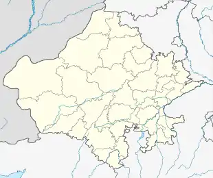 Partapur (Rajasthan) Location in Rajasthan, India  Partapur (Rajasthan) Partapur (Rajasthan) (India) | |
| Coordinates: 23.6°N 74.17°E | |
| Country | |
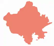
| State | Rajasthan |
| District | Banswara |
| Elevation | 164 m (538 ft) |
| Population (2011) | |
| • Total | 15,968 |
| Languages | |
| • Official | Hindi |
| Time zone | UTC+5:30 (IST) |
| ISO 3166 code | RJ-IN |
| Vehicle registration | RJ- |
Geography
Partapur is located at 23.6°N 74.17°E.[1] It has an average elevation of 164 metres (538 feet).
About
Partapur is the second largest town after banswara in Banswara district which is a part of wagad area in rajasthan.Wagari is the local dialect of people staying in Partapur and surrounding areas. The Partapur has now turned into a municipality after merger of nearby villages like Garhi, Nawagoun, Dhani, Bedwa, four Mosques. And also, Galiakot and Banswara are the two nearby religious places for the Bohras. and another two river sangam of Mahi and Chap rivers in nearest village Chaupasag.
Demographics
As of 2011 India census,[2] Partapur had a population of 15,968. Males constitute 53% of the population and females 47%. Partapur has an average literacy rate of 70%, higher than the national average of 59.5%: male literacy is 77%, and female literacy is 63%. In Partapur, 14% of the population is under 6 years of age.
Transport
Nearest International Airport - Ahmedabad 240 km.
Nearest Airport - Udaipur 135 km.
Nearest Railway station - Ratlam 100 km.
Partapur is 130 km away from Udaipur. One can get a bus for it from Ratlam from where it is at a distance of 100 km. Area code for telephone is 0091-2963 Zip Code - 327024
References
- Falling Rain Genomics, Inc - Partapur
- "Census of India 2001: Data from the 2001 Census, including cities, villages and towns (Provisional)". Census Commission of India. Archived from the original on 16 June 2004. Retrieved 1 November 2008.
| Outline |
|  | |||||||||||||
|---|---|---|---|---|---|---|---|---|---|---|---|---|---|---|---|
| Governance |
| ||||||||||||||
| Divisions and districts |
| ||||||||||||||
| Major cities | |||||||||||||||
| Related templates |
| ||||||||||||||