Paunküla Reservoir
Paunküla Reservoir is located in Kiruvere Village, Kose Parish, Harju County, Estonia, near Ardu.
| Paunküla reservoir | |
|---|---|
 | |
| Location | Kiruvere Village, Kose Parish, Harju County, Estonia |
| Coordinates | 59.1156°N 25.3525°E |
| Type | Reservoir |
| Part of | Tallinn water supply system |
| Primary inflows | Paunküla Stream, Palgissaare Stream, Sae-Paunküla Canal |
| Primary outflows | Pirita River |
| Catchment area | 90.1 km2 (34.8 sq mi) |
| Basin countries | Estonia |
| Managing agency | Tallinna Vesi |
| Built | 1960 |
| First flooded | 1960 |
| Max. length | 3.9 km (2.4 mi) |
| Max. width | 1.8 km (1.1 mi) |
| Surface area | 420.2 ha (1,038 acres) |
| Average depth | 3.4 m (11 ft) |
| Max. depth | 8.7 m (29 ft) |
| Water volume | 10,100 m3 (360,000 cu ft) |
| Shore length1 | 25.5 km (15.8 mi) |
| Surface elevation | 72.5 m (238 ft) |
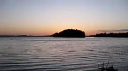
| Islands | 10+ |
| Settlements | Ardu |
| 1 Shore length is not a well-defined measure. | |
The reservoir is part of the Tallinn water supply system and is connected to upstream Jägala river via Sae-Paunküla Canal.[1]
Pirita river runs isolated along the southern shore of the reservoir in a ditch and is only connected to the reservoir at the north-eastern end of the reservoir.[2]
The area of the reservoir is 420 ha (1,000 acres), average depth is 3.4 m (11 ft) and maximum depth is 8.7 m (29 ft). The reservoir's water is changed 6 times every year.[3]
History
The reservoir was first flooded in 1960.[2] The reservoir reached its current size in 1979.[4]
- Photos from 1979 reconstruction
.jpg.webp)
.jpg.webp)
.jpg.webp)
.jpg.webp)
.jpg.webp)
References
- EE, Eesti entsüklopeedia. [Encyclopedia of Estonia] A-Ü. Tallinn: Valgus. 2003. p. 206. ISBN 9985701410.
- "Paunküla veehoidla". www.eestigiid.ee (in Estonian). Retrieved 2021-02-05.
- "Paunküla veehoidla". keskkonnaportaal.ee (in Estonian). Retrieved 2021-02-04.
- "Veekogu: Paunküla veehoidla VEE2031910". infoleht.keskkonnainfo.ee (in Estonian). Retrieved 2021-02-05.
See also
- Soodla Reservoir
- Raudoja Reservoir
- Aavoja Reservoir
- Kaunissaare Reservoir
- Vaskjala Reservoir
- Lake Ülemiste
- List of lakes of Estonia
This article is issued from Wikipedia. The text is licensed under Creative Commons - Attribution - Sharealike. Additional terms may apply for the media files.
