Peray
Peray is a commune in the Sarthe department in the region of Pays de la Loire in north-western France.
Peray | |
|---|---|
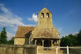 The church of Saint Jouin, in Peray | |
Location of Peray 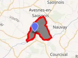
| |
 Peray  Peray | |
| Coordinates: 48°14′55″N 0°21′52″E | |
| Country | France |
| Region | Pays de la Loire |
| Department | Sarthe |
| Arrondissement | Mamers |
| Canton | Mamers |
| Intercommunality | Maine Saosnois |
| Government | |
| • Mayor (2020–2026) | Jean-Luc Godimus |
| Area 1 | 2.45 km2 (0.95 sq mi) |
| Population (2017-01-01)[1] | 62 |
| • Density | 25/km2 (66/sq mi) |
| Demonym(s) | Peréen, Peréenne Perayen, Perayenne |
| Time zone | UTC+01:00 (CET) |
| • Summer (DST) | UTC+02:00 (CEST) |
| INSEE/Postal code | 72233 /72260 |
| Elevation | 62–96 m (203–315 ft) |
| 1 French Land Register data, which excludes lakes, ponds, glaciers > 1 km2 (0.386 sq mi or 247 acres) and river estuaries. | |
World War II
After the liberation of the area by Allied Forces in August 1944, engineers of the Ninth Air Force IX Engineering Command began construction of a combat Advanced Landing Ground outside of the town. Declared operational on 2 September, the airfield was designated as "A-44", it was used by several combat units until November 1944 when the units moved into Central France. Afterward, the airfield was closed.[2][3]
See also
References
- "Populations légales 2017". INSEE. Retrieved 6 January 2020.
- Johnson, David C. (1988), U.S. Army Air Forces Continental Airfields (ETO), D-Day to V-E Day; Research Division, USAF Historical Research Center, Maxwell AFB, Alabama.
- Maurer, Maurer. Air Force Combat Units of World War II. Maxwell AFB, Alabama: Office of Air Force History, 1983. ISBN 0-89201-092-4.
| Wikimedia Commons has media related to Peray. |
| Authority control |
|---|
This article is issued from Wikipedia. The text is licensed under Creative Commons - Attribution - Sharealike. Additional terms may apply for the media files.
